
Is unfortunately closed.
adventure
All posts tagged adventure
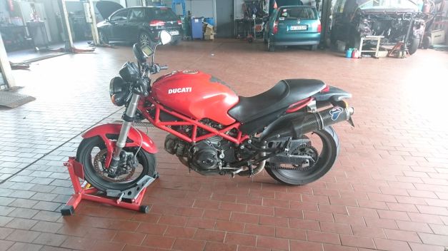
Days 12 & 13 we did some riding between Menton – Monaco – Nizza. The Ducati got new chains and sprockets in Nizza and when we got the bike from Ducati Alpes Maritimes service it was only 10km’s when the rear brake caliper was loose!! They didn’t tighten the bolts at all! But ok, we could ride the Monster back to the Hotel and next day we started riding back north!
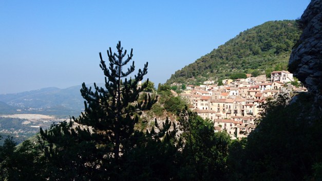
Day 14 started with very narrow mountain road from Menton towards the small village Peille. It is a beautiful old mountain village in the steep mountain wall!
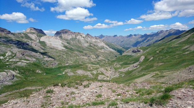
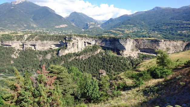
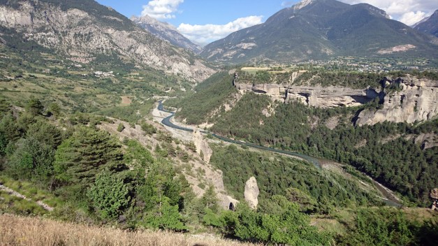
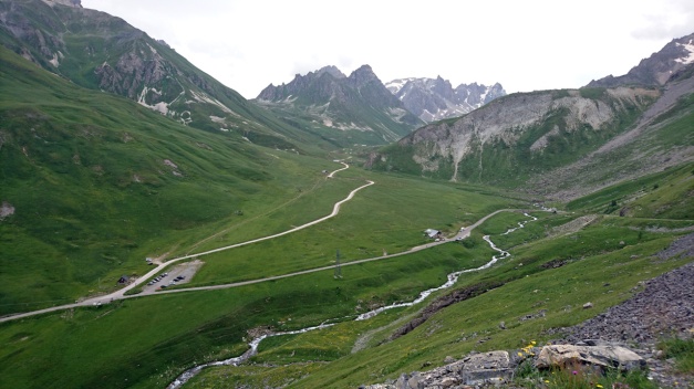
Then after few more nice mountain roads it was all about Col de la Bonette and Cime de la Bonette! Cime de la Bonette is the highest possible paved road (without dead end) in Europe! At first the road north from Saint-Sauveur-sur-Tinée is very nice and fast ride! It has mellow bends and fast corners until Saint-Étienne-de-Tinée. This video starts about 2 km’s before this village!
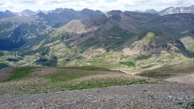
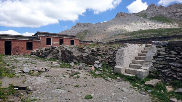
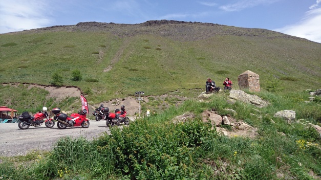
Few km’s more and the road is more narrow and the corners get tighter. In 11:10 is the first hairpin… And then starts the real climbing!! I deside to stop for awhile in the place called Camp des fourches

Here is few old and abandoned houses (I think they’re related to Napoleon?) But then the climbing continues…
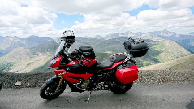
This video goes all the way to the top of Europe (2802 meters!)
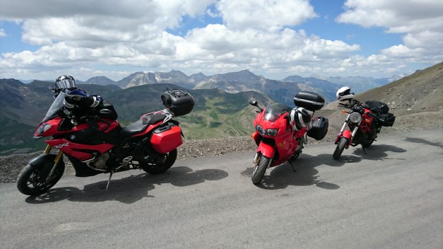
And then some photos!
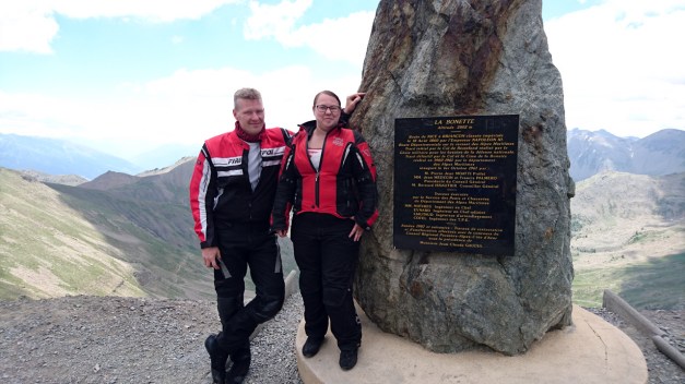
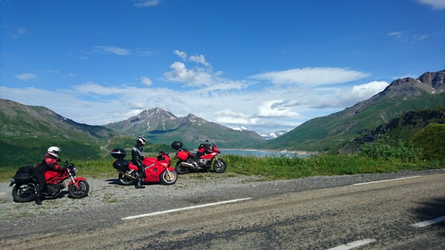
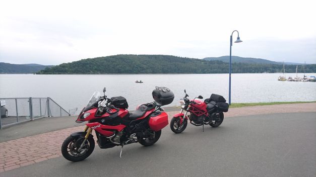
Timo & Maria, my fellowriders in this tour! (Timo with Honda and Maria with Ducati)
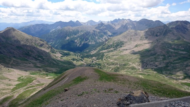
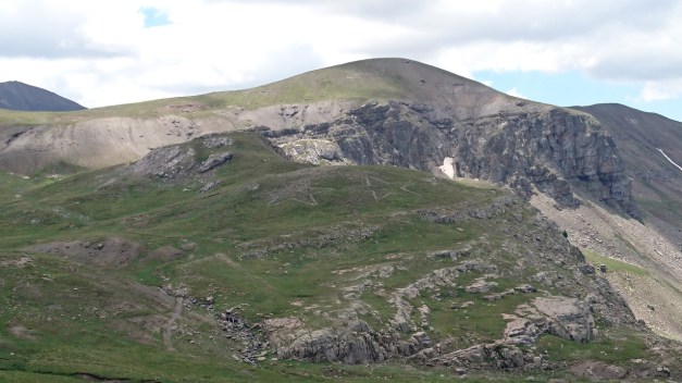
After spending some nice time in heights starts the ride down from Bonette. It is still an endless amount of hairpins and spectacular views. But there’s an interesting old abandoned fortress-looking building quite near… So I stop there.
We went in to see what was it all about?
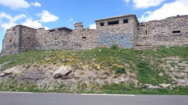
There was some “drawings” in the mountain-wall too, made of stones!
“My God, it’s full of stars!”
Then we also climbed Col de Vars but at the moment I feel like I don’t remember it at all! It must be because Bonette was so beautiful, magnificent and spectacular so I remember it much better!
But here’s a video from Col de vars:
Right after Vars, we entered the village Eygliers where we had our next accomodation. The only problem was how to find it?? I try to call them but they didn’t speak any English. It was very hot day, Maria and Timo were a littele bit frustrated and they rode to the village to ask if somebody knew where it was. And I found a lady who did speak good English and I asked her… And she told me that the place right in front of me!!
After the shower and changing the clothes Me and Maria desided to take a look of the fortress nearby. We didn’t know anything about it when we went there…
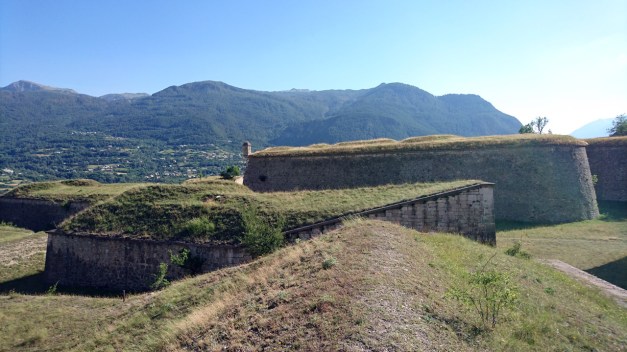
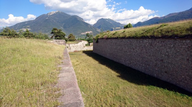
There was walls everywhere! It was almost like a labyrinth. It was also a very nice view to the other side of the valley!
The fortress is Mont-Dauphin, a small village with walls protecting it. It was built in late 17th century by the request of King Ludvig XIV. The fortress is 58 hectares and there’s about 150 people living in the village.
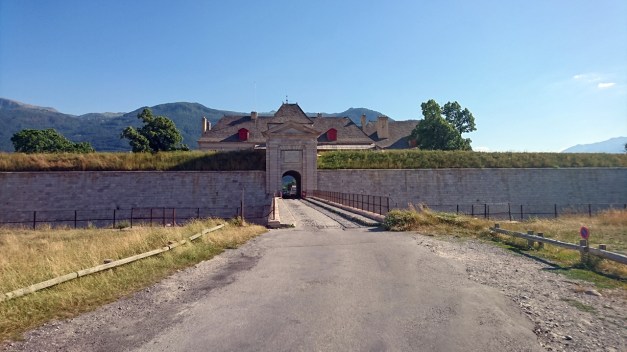
This is the gate to the village from the outside.

And from the inside.
Finally after spending some time in Mont-Dauphin it was 7pm! And usually you can’t get any food before 7pm!!! I think that’s totally crazy! We are hungry after riding all day!!
This was the route for the day 14!
Ride from the magnificent Chalet Sul Lago back to France was much nicer than the day before when we arrived.
Mt Cenis
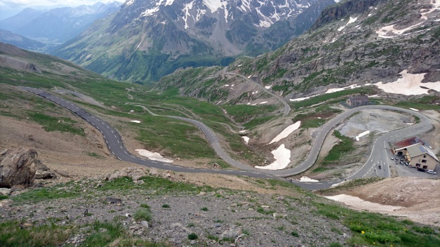
In France we started riding the endless amount of hairpin corners and mountain passes! First we had Col du Télégraphe then Col du Galibier, Col d’Izoard and finally Col de Vars.
Here’s video climbing up the Col du Télégraphe from the north:
This climb ends in Valloire village and from the southside of Valloire starts the climb to Col du Galibier which is one of my favorites! It has a short tunnel on the top, but to reach even higher you have to take the alternative route and finally reach the 2645 meters.
Here’s video from the Col du Galibier
Col d’Izoard is more south and it starts from Cervières village (If you ride from north to south). The view on the summit is a little bit different than in many other mountain pass, the mountain walls are mostly gravel and stones! It is a barren sight!
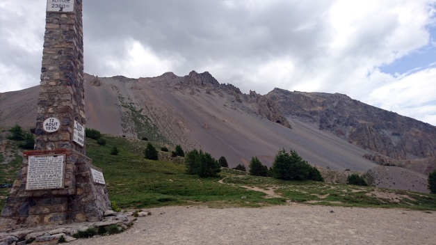
Col d’Izoard is 2360 meters high!
Finally we had Col de Vars (2109m) where we had some ice cream!
We had the accommodation in the middle of Barcelonnette city. Here’s the route for the day 10.
This was the day when we finally entered the Alps and the route that I planned this whole trip (Route des Grandes Alpes). But before we actually got to ride the endless hairpin corners… we visited the Les Gorges du Pont du Diable.
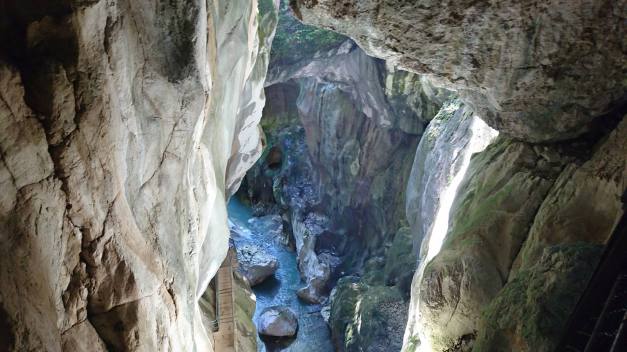
This is a place where the river has been “digging” the limestone for millions of years. It’s not a cave but almost… The hole is 40 meters deep. It costs 6,10€ to take a 40 minutes tour with a guide and it really is worth every penny!!
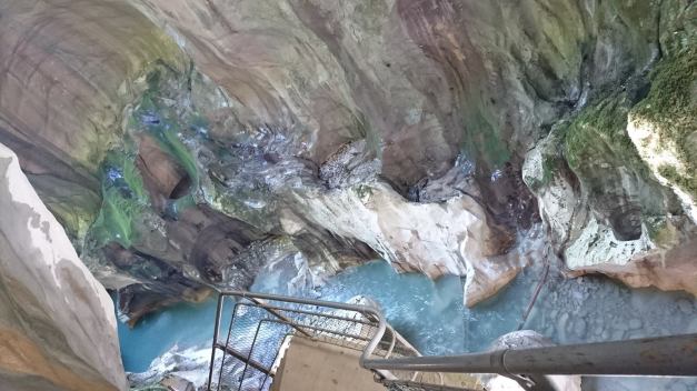
It is amazing place! And it’s only 20 minutes from Thonon Les Bains.
Then the first climb we took was Col de la Colombiere which is 1614 meters high mountain pass near Cluses. Then we climbed Col des Aravis, it’s still not very high but it offers one of the best views to Mt. Blanc!
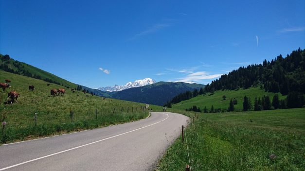
You can see the highest mountain in Europe from many places if you’re driving south of Col des Aravis.
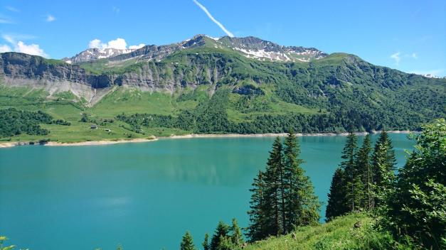
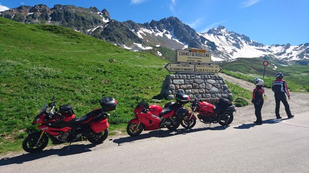
Then we had Cormet de Roselend, which is almost 2000 meters (1968 meters), this offered already very spectacular views from the top!! Especially the Lake Roselend with the clear turquoise water is really worth to make a break and admire the view!
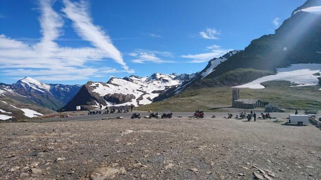
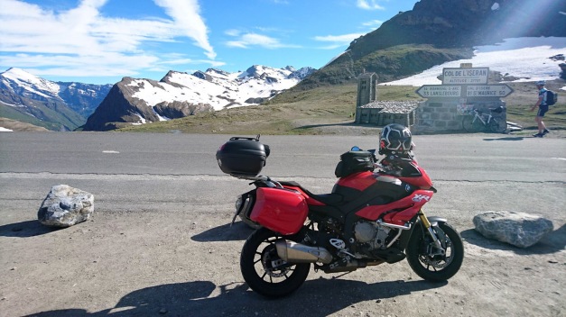
And finally we had the highest mountain pass in Europe in the afternoon: Col d’Iseran (2764 meters). The summit is still a lonely place! There’s no restaurant or no souvenir-shop just an old chapel made of stone… and I think they don’t even use that anymore!
There’s still old meters in the sign… It has been checked few years ago that the real hight is few meters lower!
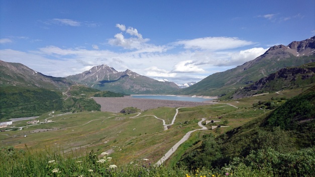
When we rode down to Val d’Isere it started to get cloudy. We had one more climb to make since we had our accommodation in Italy (Moncenisio). We did see a little bit of of the Lake Mt Cenis, but after we crossed the border we had no visibility anymore! We’re riding in the clouds! And the road to the amazing Chalet Sul Lago was extremely narrow with the branches of the trees coming very low… it felt like a scene from a horror movie!! And finally when we found the place… it had a very pleasant surprise for us!
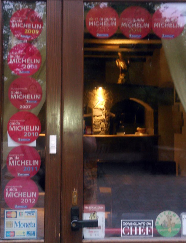
No, it is not a Michelin restaurant with any stars… But it is mentioned in the Michelin quite many times (as you can see!) -And yes the food was good!
Here is the route for the day 9.
After breakfast it was time to start riding again. My Tomtom Rider 410 showed us the way to the nearest gas station in Weil am Rhein… but what I didn’t remember in that point that in highway in Switzerland you’ll need the Vignette! And the nearest Shell was AFTER the border checkpoint in autobahn/ highway with only possible direction to Switzerland… Oops! (We decided that we are not going to buy the expensive Vignette -we would rather ride the small roads in Switzerland area).
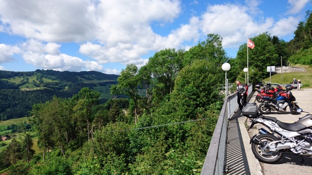
After a short discussion with customs officer we were able to make nice move to the other side of the customs area and ride back to Germany… and soon after that ride through the city of Basel. That took about 1 hour! In the southside of Basel we actually got our first real mountain hairpin corners when we climbed to Passwang Pass (elevation 1204 meters). And we had the first break in the “summit cafeteria” (http://www.alpenblick-passwang.ch/).
The view to valley was amazing.
Then we had Grenchenberg! What an amazing ride it was! The road is so narrow (climb from the north) that it is simply impossible to overtake a car. And I was so kind that I stopped and wait for the other 2 riders… and we had to drive behind a car for a long time.
Just before the summit there was a place with lots of cars, tents and people… I don’t know if there was a some kind of special meeting or a camp(?) but it looked very strange! (In video 09:00). We had a nice break in the summit restaurant.
The southside road of Grenchenberg is not that narrow, there are even some busses driving… Then we entered Bern.
I was actually quite scared about riding through Bern! But it was Sunday early afternoon and there was not that much traffic. We did see the city center terminal of Bern and it was quite easy to ride through. From Bern we choose the road beside (and under) the highway to west as we headed to Lake Geneva. In the way we got some pretty nice views to the Lake of Gruyère (a reservoir).
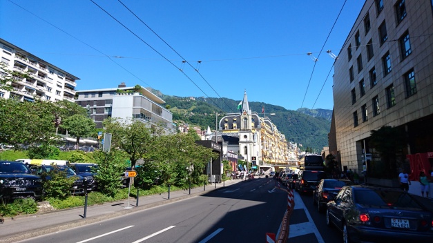
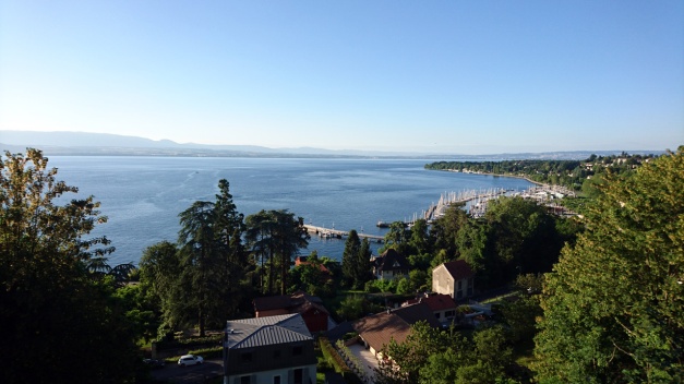
Also the view to the Lake Geneva was amazing! I had planned the route to the beach Boulevard of Vevey, Clarens and Montreux… And that was a big mistake! There was annual Jazz Festival of Montreux going on… it took about 2 hours to ride that boulevard! (But we learned to do some nice splitting!) We did see the tents! And we heard some music! So I guess we can say that we were at the festival!
Finally after a long day we arrived in Thonon-Les-baines. It’s a city in French side of the Lake Geneva.
The route for this day was like this.
We got 1 more rider to make this tour with us! He’s Timo and he rides Honda VFR 800, and it’s red too!
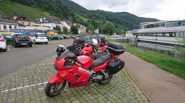
This days route was called “Lets get the real good look at River Mosel!” -And yes we did!
The route was like this! And we’re following the River Mosel all the way from Koblenz to Trier and then to Luxemburg… It was more than 230 km’s of River Mosel and those grapevine or wine bushes on the both sides of the river! I think that’s enough… Luckily we did ride something else too! In the last part of the route we had nice ride in Eppenbrunn!
And then finally the GPS found a route that it is even hard to find from the map!!!
This must be the MAIN ROAD from Germany to France!
We had accommodation in Obersteinbach, France. It was nice and “bohemian” just in the right way!
This was from Edersee to Bendorf (near Koblenz) like this. There was a risk of rain so we didn’t ride the whole tour Lake – Edersee. That area is very much recommended with nice roads all around!
In the half-way of this day we noticed that the Ducati’s chains are very loose! Luckily we found a car and motorcycle garage where they tightened the chains right away!
 As we got closer to Koblenz there was a very nice road with multiple tight corners!
I let the Ducati ride first.
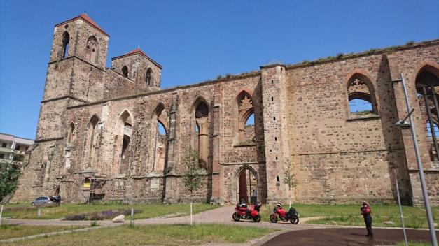
At first we rode through small roads to Beelitz-Heilstätten abandoned hospital. This is where A.Hitler had his testicles fixed (contoversal?) We checked few smaller buildings in the area. Little bit later we arrived in Zerbst/Anhalt -city and first we’re impressed by the middle-aged gate, but then we saw 2 high towers nearby. It was the ruins of old St. Nicolai church. It was such a beautiful place!
Soon after this city we crossed the river Elbe with Reaction ferry
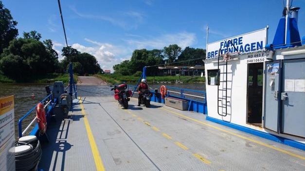
So there’s no engine in this Ferry but still it takes you to the other side!
When our route took us to Harz-mountains it had been raining a little. So we had to ride the nice corners with wet road. Luckily at the end of the day we had some nice corners near Edersee area and it was dry there!
Here’s the route we took.
Made few mistakes! Planned a long route with 2 times crossing the Russian border… Ooops! But I’ll tell you later about it.
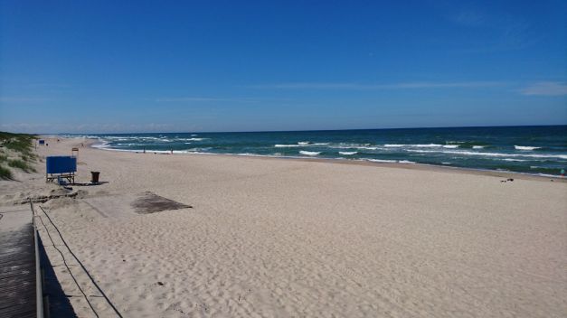
First there was a ride from Plinkses to Klaipeda harbour, and from there we took a ferry to Curonian Spit. Ferry costs 3,35€. And after we arrived the spit there was a roadtoll (5€/ bike). And we also had to pay the toll again in Russian side (that was a little bit more than 4€). The road in Curonian Spit is beautiful, it even has some corners and uphills-downhills.
We stopped in one beach to take some pictures of the Baltic ocean. We also stopped in Nida to buy something from the shop.
After Nida it was time for the first border check-Ins! These first check-Ins took about 1h 30mins! Then we’re in Russia!!
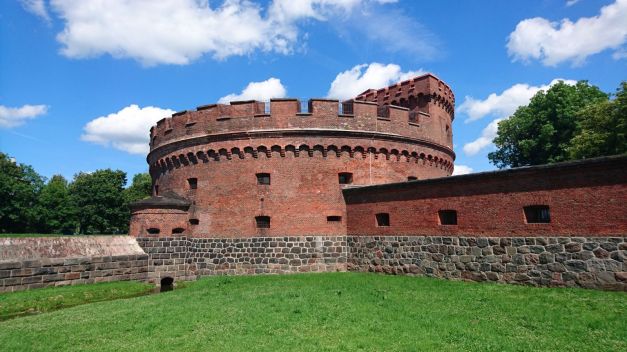
This is Amber museum in the center of Kaliningrad.
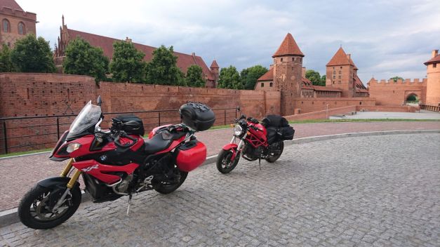
And this is the worlds biggest castle in Malbork Poland.
But before we could ride in Poland we had to cross the border again! The Russian side of the border was ok, (quite fast) but then the Poland side of the border-check was with a very long line!!! We had to wait more than 2 hours!!! What a catastrophe! We were so late in our accommodation! It was 9,30 pm and we started 8.30 am and there in the middle we moved from timezone to another…. so it was more than 14 hours of ride!!!
Note to myself:
– If you’re about to ride Curonian Spit, you better have 1 whole day to do it!
– If you’re about to cross the Russian border twice a day, don’t ever think it’d take 2-3 hours! It will take more!
You can follow this trip in facebook (https://www.facebook.com/PVTourinki/), mostly in Finnish.
In instagram (https://www.instagram.com/gozamite/) and in moottoripyora.org forum (http://www.moottoripyora.org/keskustelu/showthread.php/289047-Parlez-Vous-TouRinki), only in Finnish!
And as you can guess the trip is called “Parlez-Vous TouRinki”!
