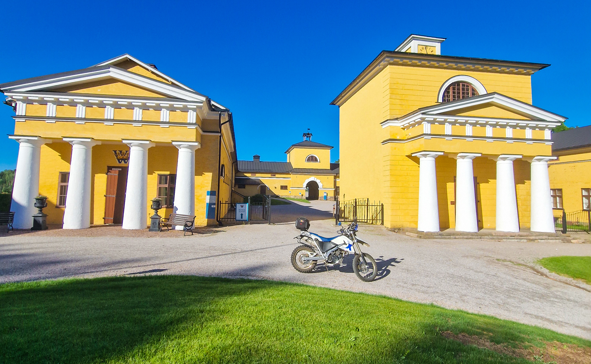
And suddenly Sweden looks the same… Almost like Finland!
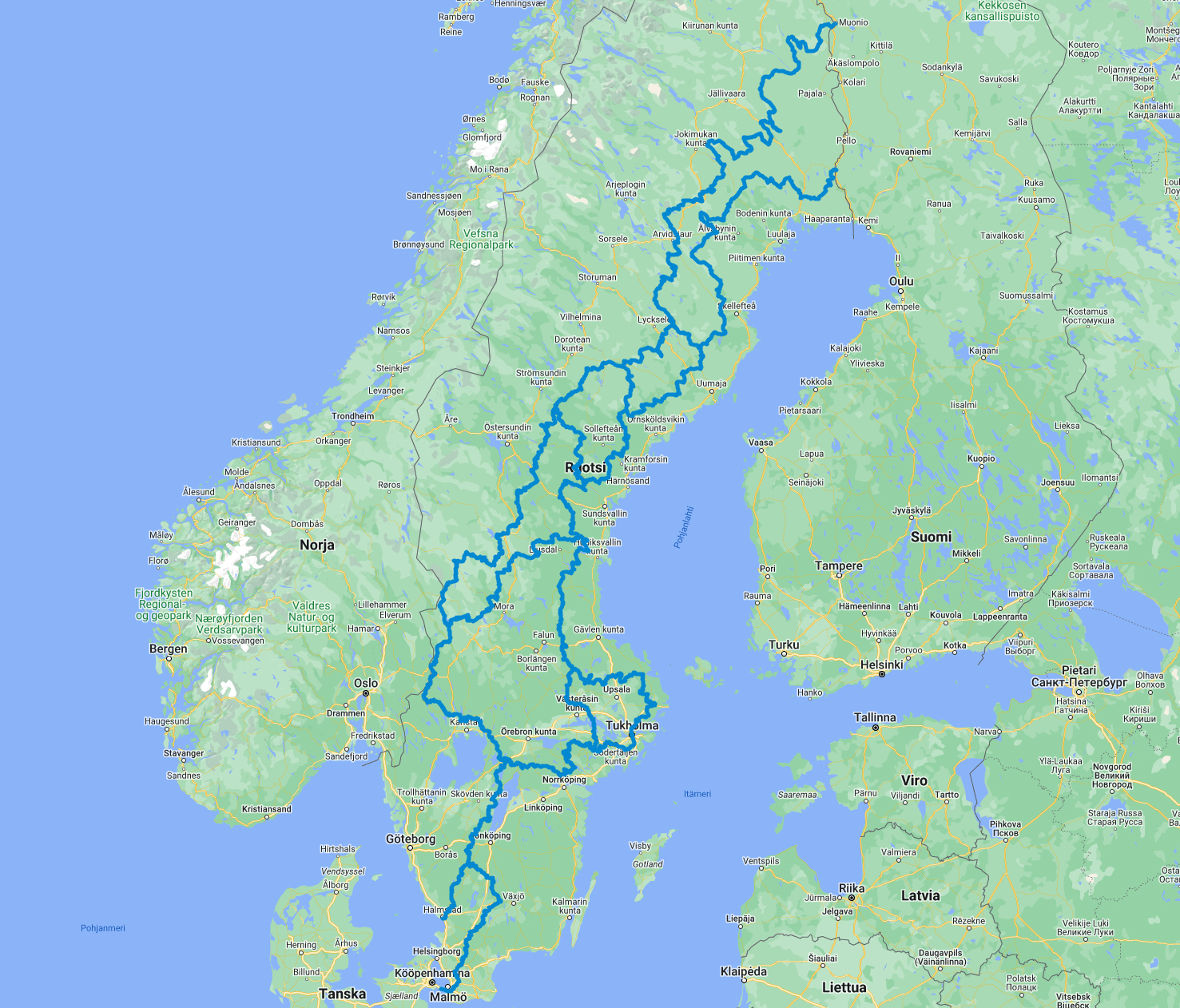
14 different sections, Total of 6800 kilometers! Nice work Linesman Jonas Bergh!
Download the latest GPX file from: https://transeurotrail.org/sweden/

And suddenly Sweden looks the same… Almost like Finland!
14 different sections, Total of 6800 kilometers! Nice work Linesman Jonas Bergh!
Download the latest GPX file from: https://transeurotrail.org/sweden/
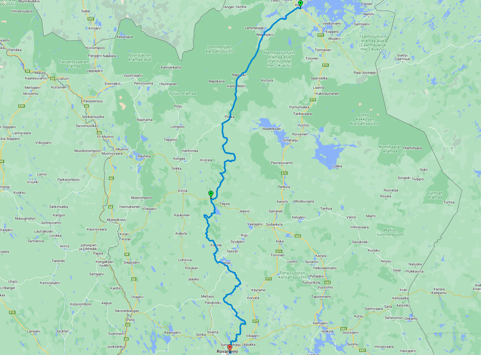
After a great night sleep in Inari Uruniemi camping (30€ only!) I was more than ready to start exploring new possible section for TransEuroTrail Finland.
First I had to ride the section 7 until it’s starting point which was still more than 100km away behind Pokka village. And it was paved road all the way there.
Actually before the “starting point” of section 7 I turned away from the paved road and all the fun started!
I soon joined with section 1 and was riding 27km together with the “main section”! And that was maybe the best road/ track that I had on this day!
Then I had route ahead of me that I knew nothing about. I planned the route to make it a section of it’s own but at some point I realised that it could be a continuation of an already existing section 7!
So all this new route would be just a new beginning part of that section. And after the update the section 7 is now 770km long!
So I was riding all the way down to Rovaniemi and it was almost 500km of riding!
Here’s the video of that day:
The route for the day 5 looks like this:
The weather forecast was saying that it will rain today but we desided to go anyway. And the plan was to ride north first to Enontekiö, then to Kautokeino (Norway) and from there we took the “Old Postroad” to Alta.
In Hetta (Enontekiö) we filled the tanks and in Norway border we took few pictures. For my friend Lauri it was his first time out from Finland with the motorcycle!
After 3 hours of riding we reached Kautokeino and we enjoyed lunch in Pit Stop Café & Restaurant. It was simple grillfood with very reasonable price. Here we got few drops of rain but other than that we had pretty nice weather all day!
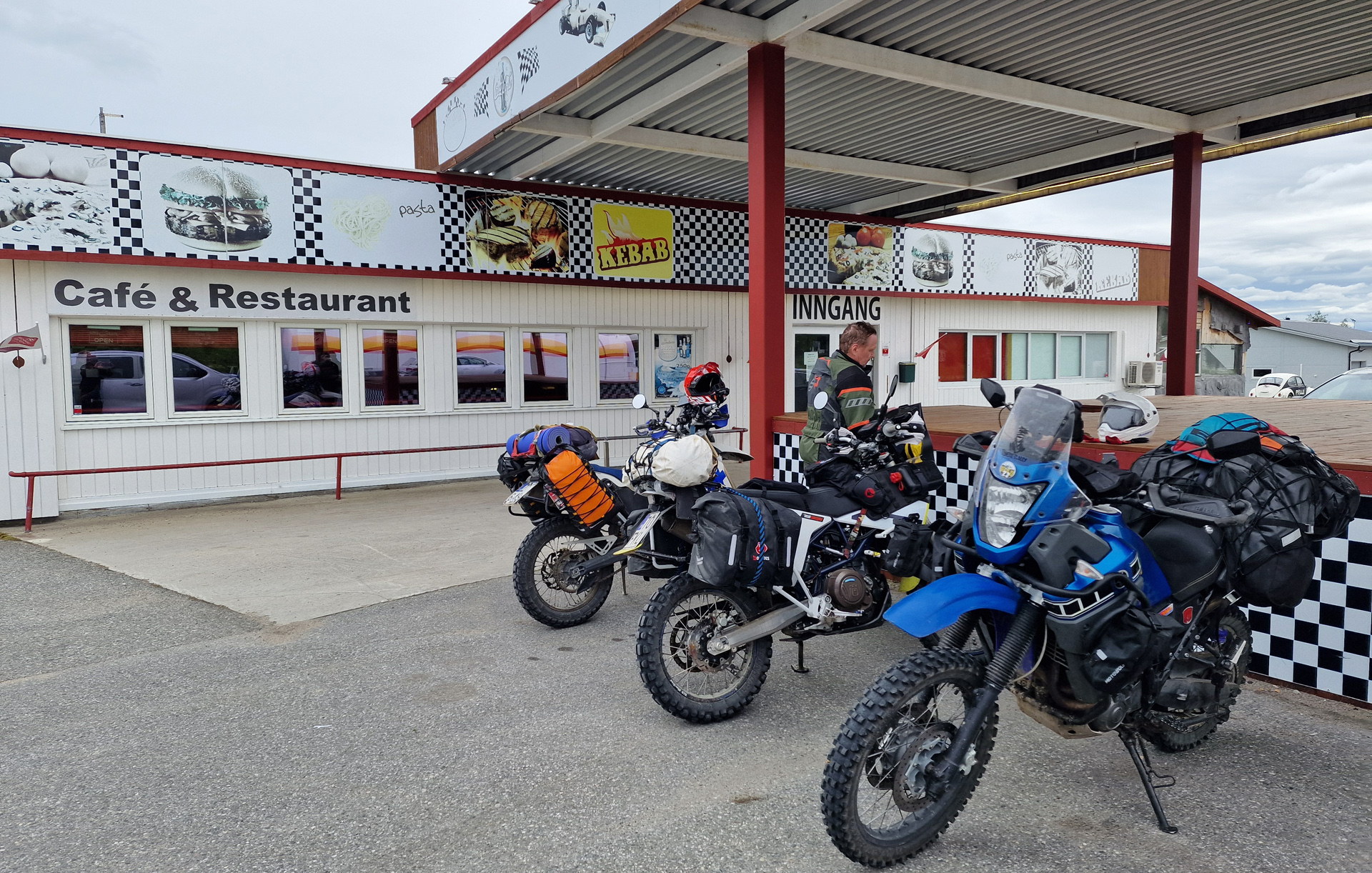
Then 15km north from Kautokeino starts the challenge!
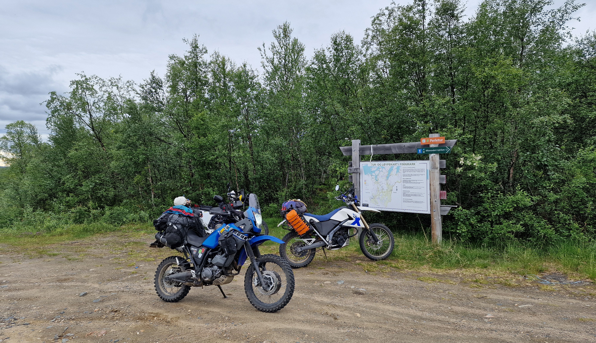
The Alta Old Post Road is very well known route for adventure riders! It had been my dream for many years and now I was here!
The south part is about 60km and it is the more challenging one. There’s actually no really hard parts but after 10-15 km of riding started the puddles and more rocky parts. I started to count how many big puddles there was but after 30 (something) I got confused in the calculations.

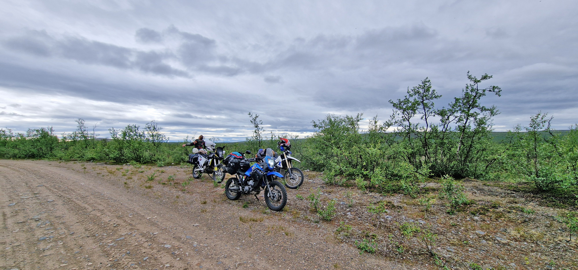
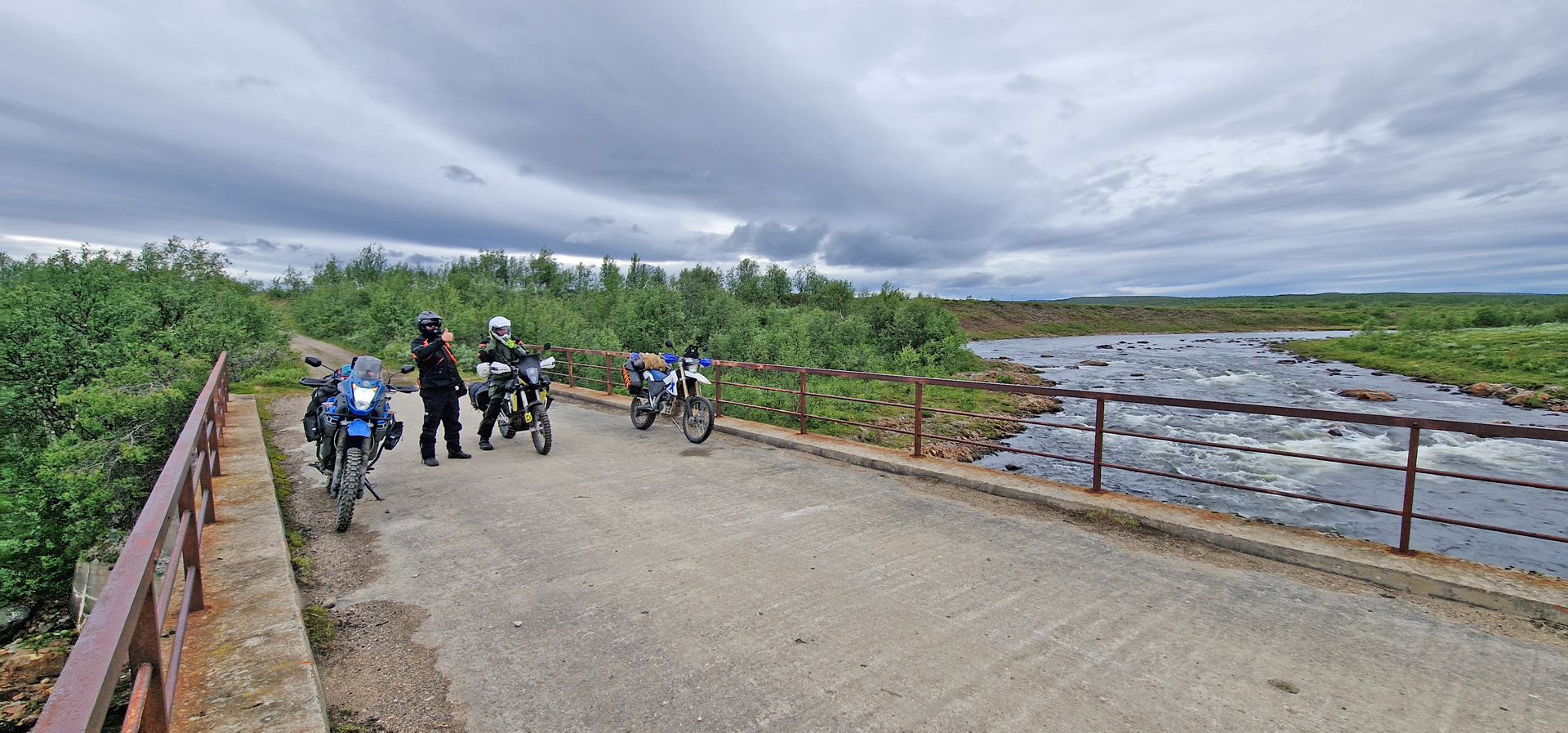
The last picture is from Mázejohka old bridge and it’s definitely on of the best-preserved bridges on the route! But soon after this comes the place where one Norwegian couple crashed badly few years ago.
The north part of the Old Post Road is almost like a normal road. You can drive there nicely with a normal car or with street motorcycle. And the scenery there is simply amazing!
The route for today was about 300km and it looked like this:
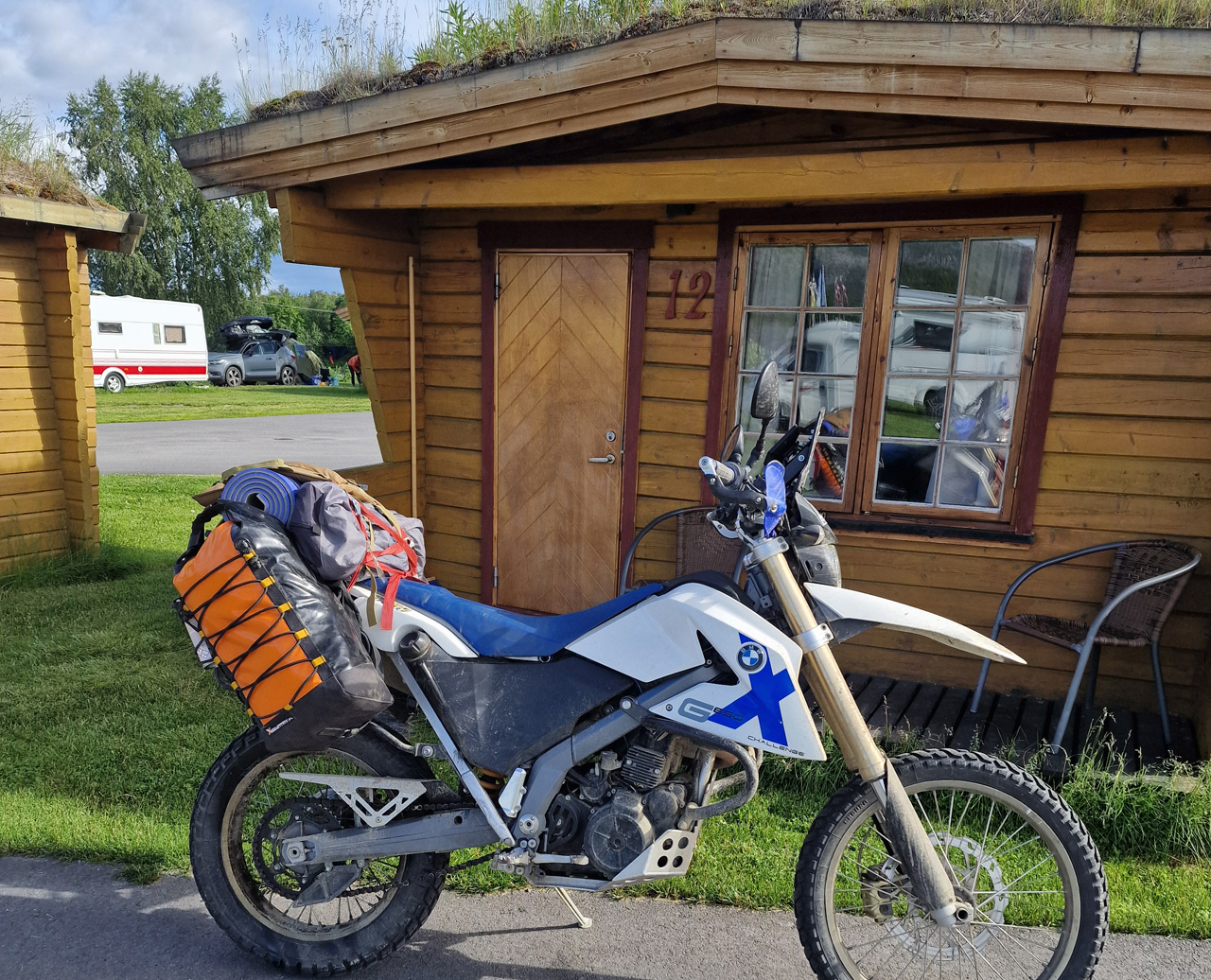
My friends Eero & Lauri took a different direction from Alta so after this day I was riding alone again. I found very nice cabin from Strand Camping with 51€.
The 30 minutes video of the day you can watch here:
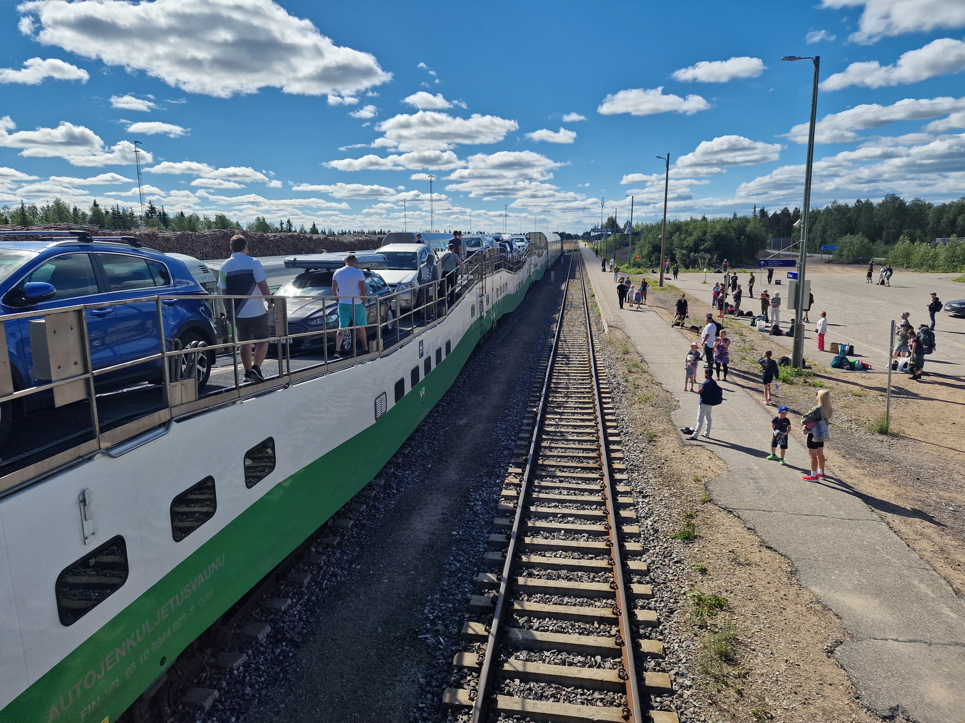
The train from Helsinki arrived to Kolari station around 11. About 1 hour later I got my bike out from the car-carrier train.
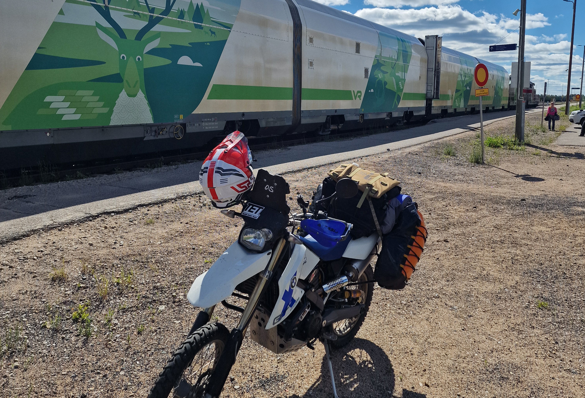
First thing I did I wanted to find a better place to change to my actual riding gear. That I did in the parking area of one restaurant that wasn’t open yet. There was also gas station just beside and I filled my tank. Then I started riding!
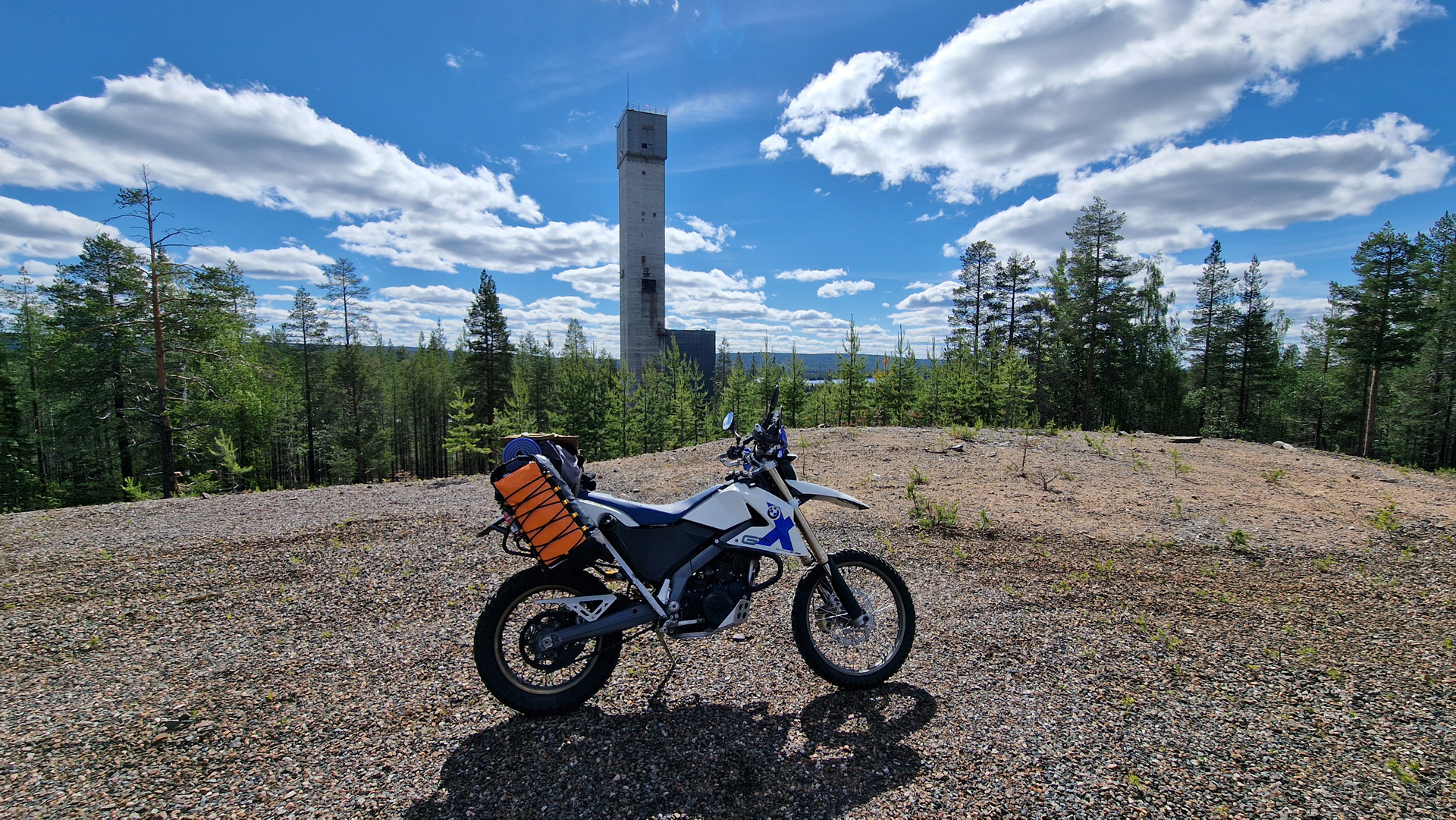
Pretty soon I arrived to the gate of an old mine. It was Rautuvaara that stopped working as a mine in 1988!
Big disappointment was the possibilities for eating in Muonio on Sunday afternoon!
SEO Muonio right beside the main road has Rolls hamburger restaurant. But I didn’t want anything from there. Other than that there was no option! Harriniva resort has restaurant but the kitchen opens only at 5pm! SO I decided to ride straight to my accommodation and they promised to make some food for me! (What a great service!)
Here is the route I did on the first day:

From Kolari to Muonio I was riding TransEuroTrail Finland Section 3. Here’s the video I made of that day:
Big recommendation for the place I stayed for the night!!
It was Old School of Kihlanki village and I found the place from booking.com. Check from the end of the video… I was amazed especially how helpful and friendly the hosts were!
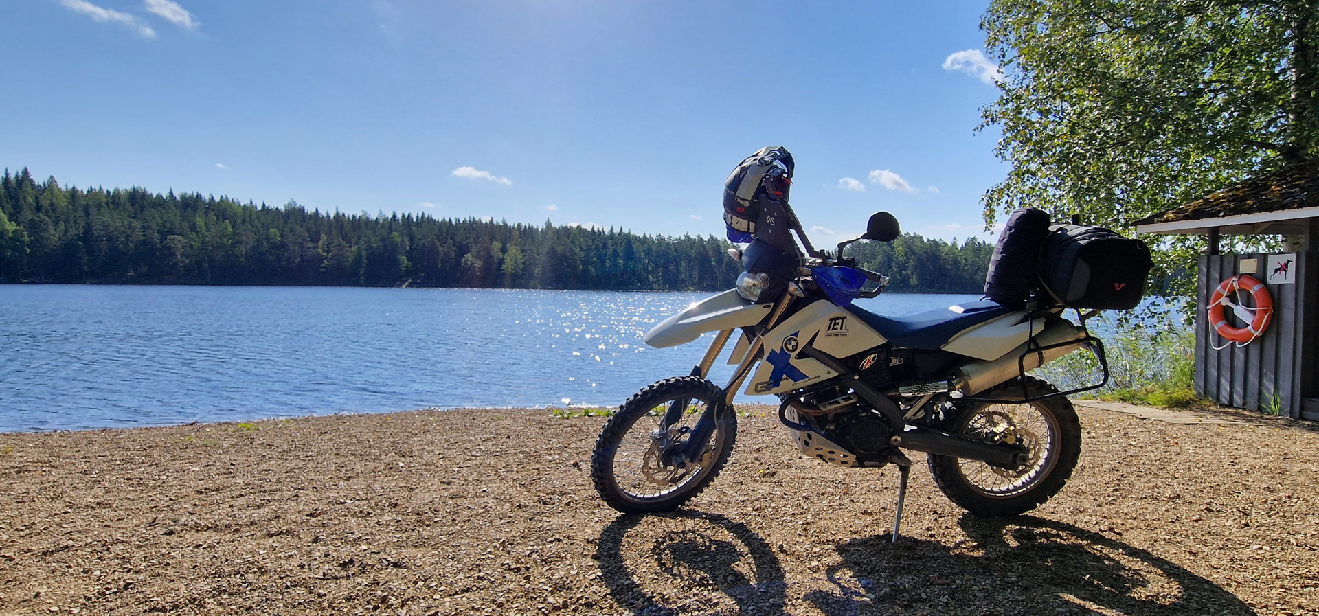
My bike seems to work nicely!! I did already a trip to Himos and back.
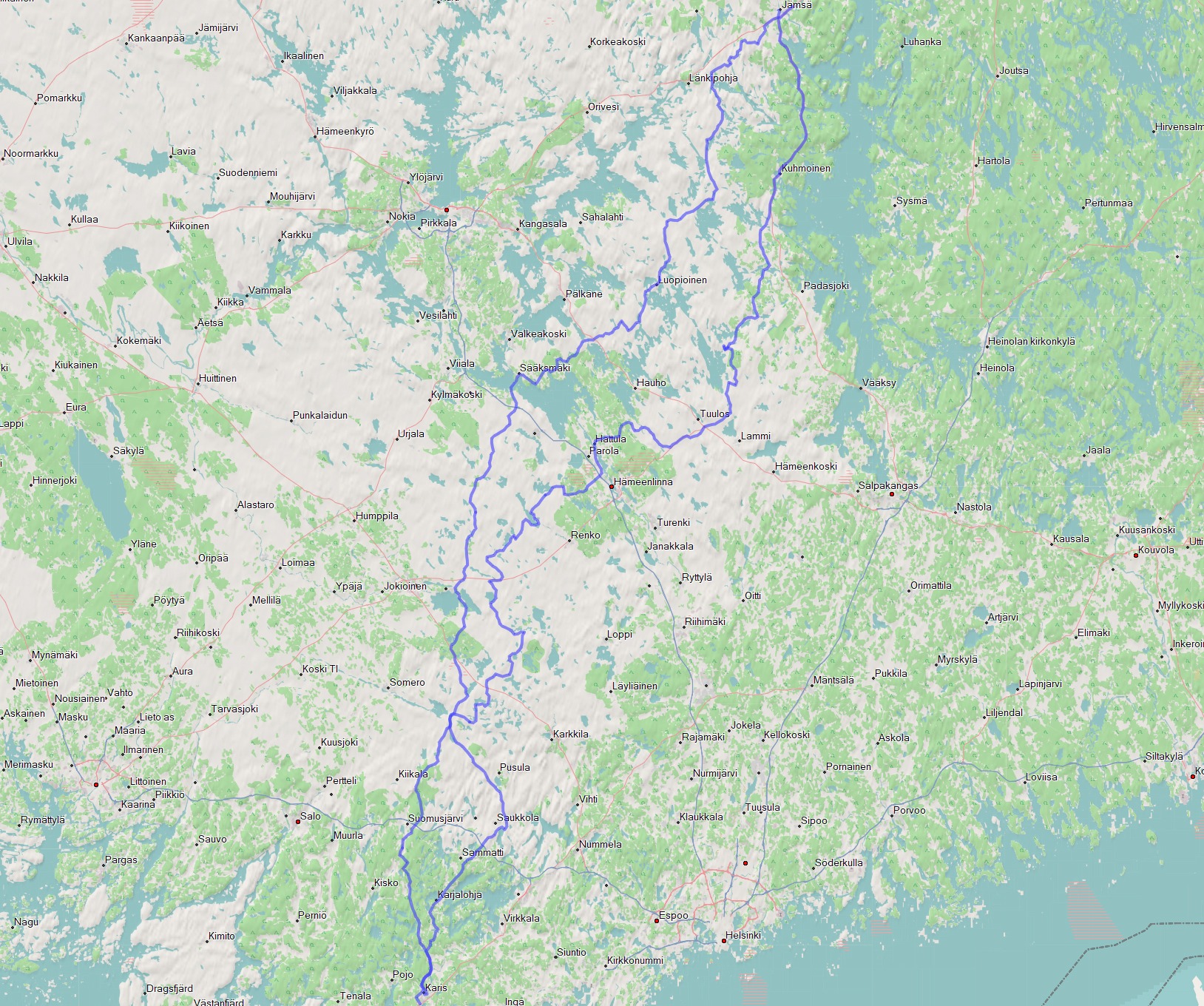
The right side (365km) was the trip from my home to Himos and I was following TET Section 1 from Somero to Evo. That was super nice ride!
Then returning home I took the left route and it was only about 310km but it had also more than 50% of paved roads…
Then yesterday I changed the tires for my bike. Now I have Heidenau K60 and those are more like 50/50 tires but they also should last quite a lot of kilometers. Since in 3 days I’m leaving to my summer adventure trip… First I’m taking the train from Helsinki to Kolari and that will be 921km and it will last 14 hours!
Today I took a proper testride for my new tires. I checked one POI from TET Finland Section 5.
I was adding this place to the list of POI’s on last update and now I can say that it’s very nice place but there was no firewood and that’s a pity! Here’s a video from today’s ride:
So next sunday will be my first day far away north of Finland!
You can follow my trip here.
It was the same ride on 1st of May when these problems started! It felt like the power was cutting/ stalling very shortly. And sometimes bike even did stall and it was difficult to get running again!
My bike went to Biketeam Raisio and first they found that idle actuator was not working as it should. They changed the new one and checked the error codes and it looked better.
But after I got bike back home I couldn’t ride it more than 30km! All the problems were back or they were even worse!
Bike went back to Biketeam and now with some serious investigations!
“The engine running problems continues. Error codes comes from:
000230 electric fuel pump
000335 Crankshaft sensor
000561 DME voltage supply, terminal 30
Cleaned a badly oxidized ground wire under the voltage regulator, after this the idle running improved considerably. Was running for 30 min. with some throttle every now and then without stalling. The error codes did return.
Measured petrol pressure at about 3bar, so OK! Ignition coils measured, are OK! Gas valve housing cleaned, Wire harness inspected and found no significant abrasions/wear but when the harness is moved with hand the injector nozzle activates and sprays gas into the intake manifold (!). The harness was peeled over a distance of about 30cm and found a point where the wires were badly worn and the plus wire was connecting with other wires, fixed! After this, the bike was test ridden a couple of times with no problems and no error codes came back. The repair was deemed successful.”
I feel a strong sense of gratitude and I deeply respect Biketeam for what they have done! They spent incredible amount of time/ hours to find the problem and they finally did! I really hope that my bike will work now… At least this summer!
On 4th of June I was riding by bike back home! Everything was working and bike felt smooth!


Empty shopping mall Zsar
This shopping mall was opened in November 2018. Already in december 2020 it was in debt restructuring and in october 2022 the company went bankrupt. Now this amazing building is standing empty just beside the TET Track in the beginning of the section 4. The POI is called “Zsar shopping Mall (empty)”

Kruununpuisto landscape
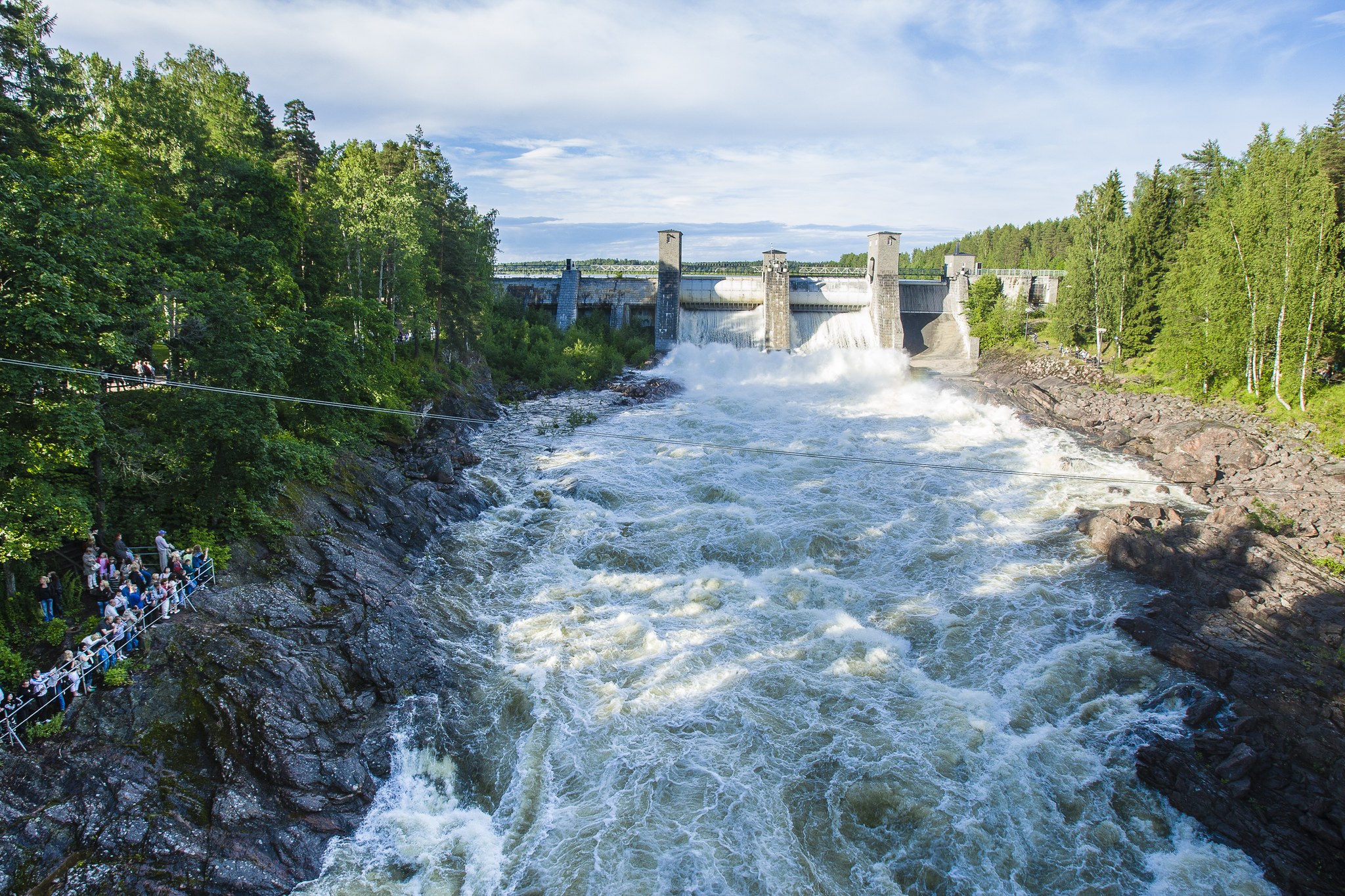
Finland’s first nature reserve Kruununpuisto-park in Imatra is established in 1842. In the same island are the best views of the dam and the old banks of the river/ rapids. The POI in the TET gpx is called “Oldest nature preserve in Finland” or “Imatra Dam”. This park is just beside the TET track.
Parikkala Sculpture park
Freak statues! Some even think they are scary… Entrance fee is 7€. The POI in TET gpx is called “Parikkala sculpture park” and it’s just beside the TET track.
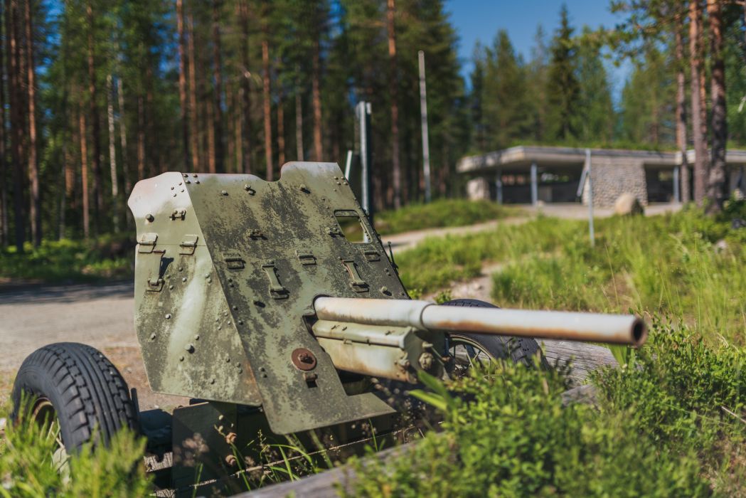
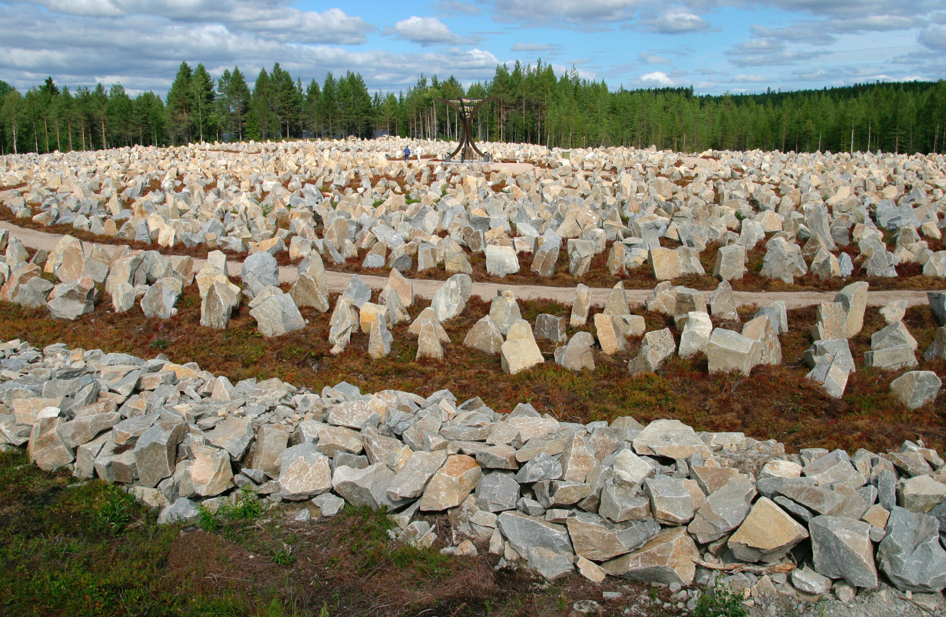
Öykköistenvaara Battle Zone
This is a perfect place to learn a little about the battles of the Second World War on the Finnish front line. You are free to walk around the area that was built by local volunteers. The POI in TET gpx is called “Öykköistenvaara Battle Zone”.
Most Eastern point of continental EU
This would be the most eastern point of the Continental EU. You are now 60km east from St. Petersburg. If you want to go further east in EU you need to visit Cyprus. The POI in TET gpx is called “Most Eastern point of EU”. The TET track takes you as far as you can ride. Then there is still a short hiking trail to the shore of the lake from where you can see the actual point.

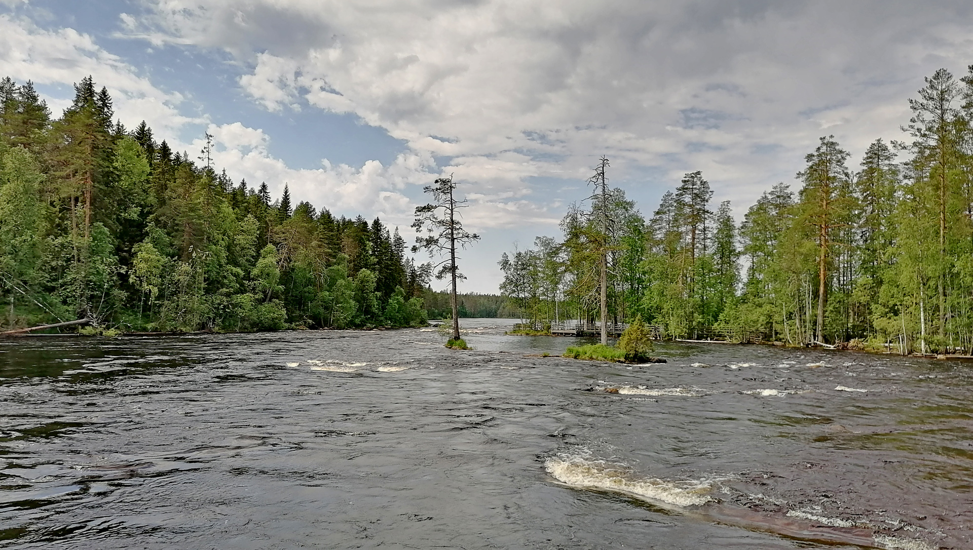
Neitikoski/ Ruunaa rapids
Ruunaa is a huge area for hiking, fishing or rafting. In the TET gpx file there is one suspension bridge POI but the main place to visit would be the Ruunaa outdoor center and the Neitikoski rapids close to this place. You need to ride 4,5km east from the track and the POI is called “Ruunaa rapids”. You can leave your bike to the parking area beside the outdoor center or somewhere close. The trail to the Neitikoski is very near and easy to find.
Saab museum
The Uusikaupunki car factory produced Saabs for many years. So it is only natural that Saab has its own museum there. But nowadays there’s many other Car brands too! The POI in the TET is called “Saab museum”

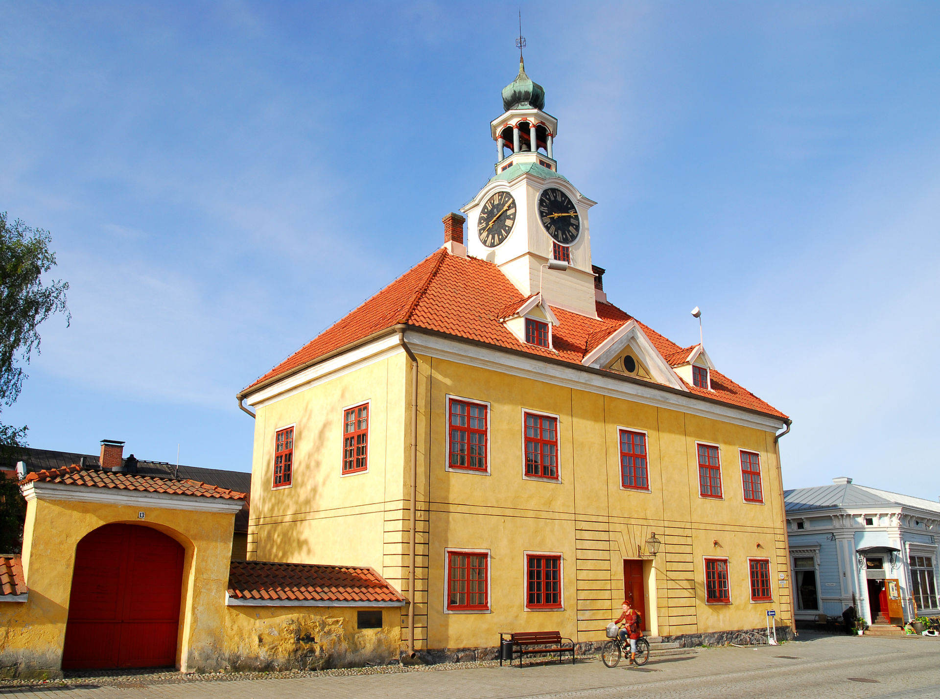
Old Rauma
The Old town of rauma is a Unesco World Heritage Site since 1991. The old part of the city consists of around 600 wooden houses which are used both for residential and commercial purposes. You will find some interesting shops, restaurants and cafeterias here.
TET route makes a loop through the market square but it’s recommended to ride around the narrow streets of the Old town and maybe check the old stone church too. The old town hall was built in 1776 (unfortunately this building/ museum is closed until 2026).
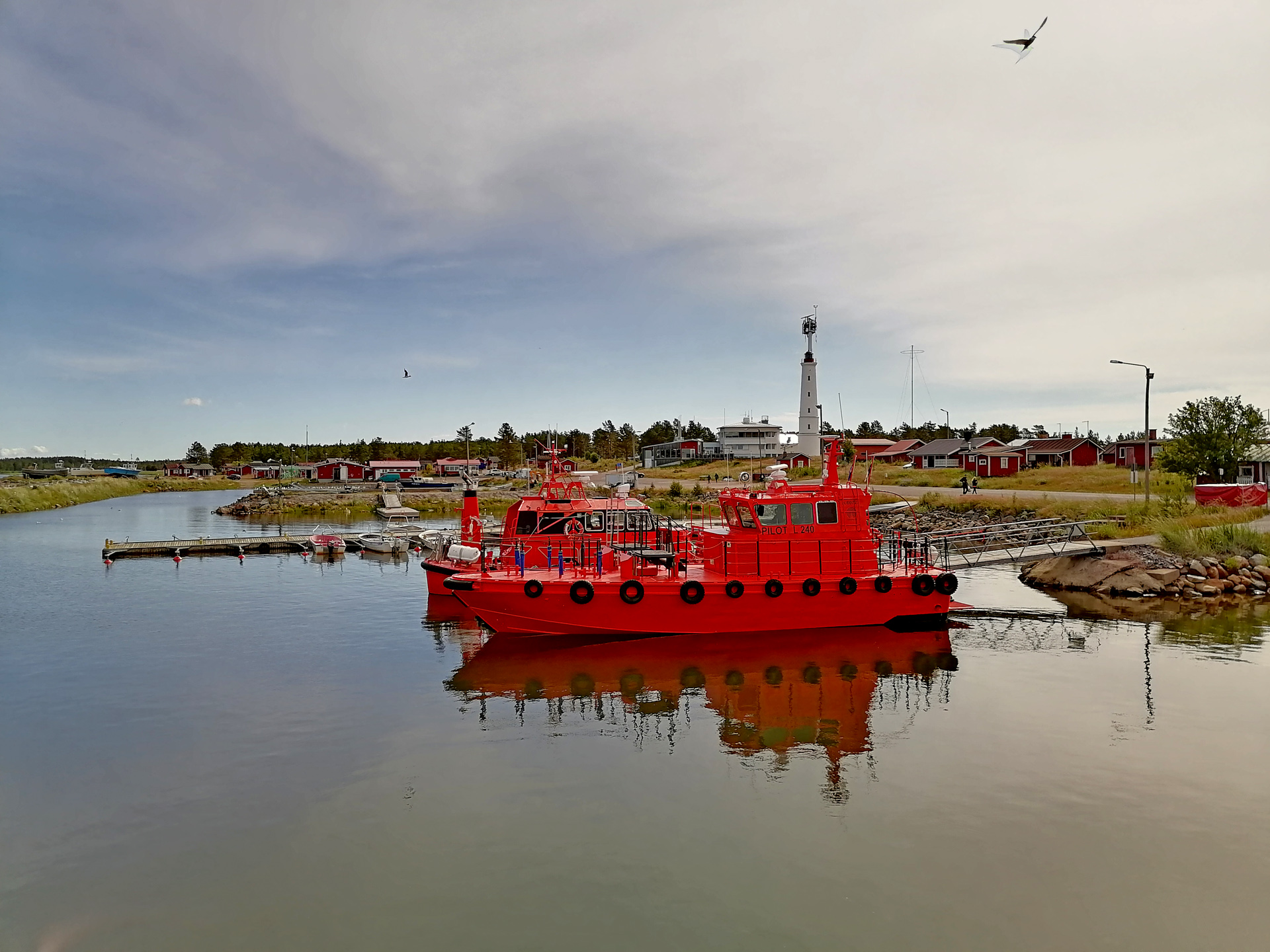
Kallo lighthouse
8m tall lighthouse of Kallo was built in 1903. There’s something special about this small lighthouse and the place where it’s located! The POI in the TET gpx has the same name.

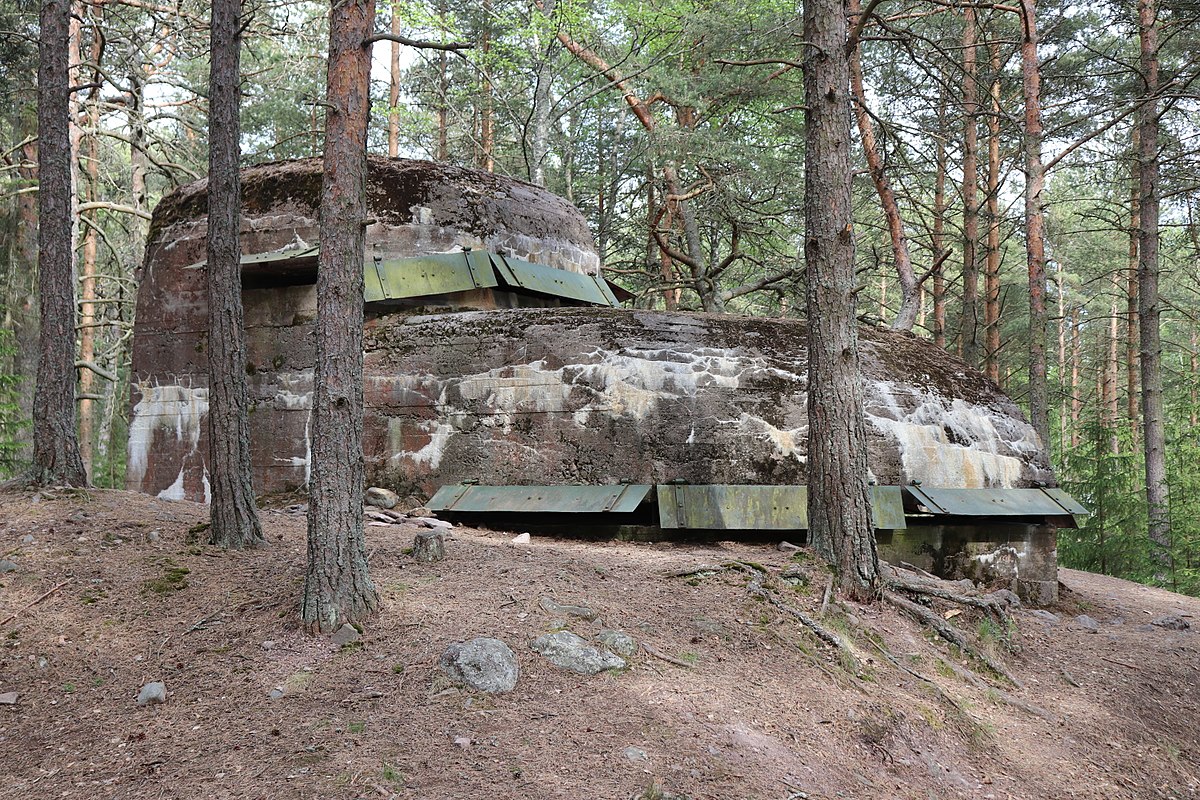
Reposaari fortress park
This island and its coastline you can see from Kallo lighthouse. But you need to ride 15km to reach the Reposaari island! The POI in TET gpx is called “Fortress park”. There you will find a wide range of fortifications from the Second World War. And there is also an observation tower about 10m high with very nice views to the sea!
Vattaja sand dunes
The Vattaja dune area is a valuable landscape also by European standards. Vattaja is Europe’s largest coastal dune area in the boreal region, and with 15 kilometres of shoreline, it is also one of the longest sandy beaches in the Nordic countries.
TET route would probably go through here but there are some military areas too so it’s not possible to make a nice route through the area. Now you need to ride about 35km north from TET track to reach Vattaja area. The POI in the TET gpx is called “Vattaja Beach & Dunes”
If you don’t visit Vattaja dunes you can still check Yyteri or Kalajoki beaches near TET Section 3!

Hailuoto/ Marjaniemi
Hailuoto is The third biggest island in Finland. You can visit the island by ferry and in the future throught the bridge. The most western point of Hailuoto is called Marjaniemi and it offers nice sand beaches, a lighthouse and a small fishing village. The POI in the TET gpx is called “Hailuoto Marjaniemi”. You need to ride more than 60km west from the TET track (but 7km of this is in the ferry!)
Aavasaksa hilltop
One of the first tourist attractions of Finland was the top of the hill of Aavasaksa. There is many things to see: Struve Geodetic Arc and The Imperial lodge that was built in 1883. But the best idea about the place you will have by hiking around the trail called The Scenic path of Aavasaksa.
There is 2 POI’s in the TET gpx: “The Imperial Lodge” and “Aavasaksa Viewpoint terrace”. The Aavasaksa hilltop is about 3,5km noth from the TET track.
Arctic Circle in Pello
The cafeteria & Restaurant Tuomaan tupa is a crossing point of the Arctic Circle. North from here you can experience the midnight sun and the further north you go the longer the period of the midnight sun is!
The POI in the TET gpx is called “Arctic Circle Pello”. You need to ride 2,8km north from the TET track.

Tyrvää medieval church
About 100km’s after the section 2 start you will ride through Sastamala city. This church is 3km after the city. POI in TET gpx-file has the same name. You need to ride about 1km away from the track to enter the place. The church is located on an island and it’s very beautiful place! Maybe churches is not your thing? But I recommend this place anyway -especially in the evening/ sunset it can be extremely beautiful.

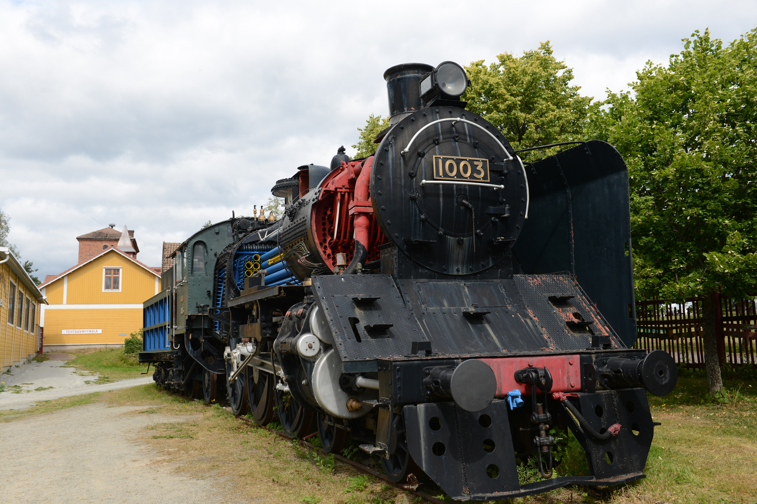
Haapamäki Steam Locomotive Park
About 335km from the start of Section 2 You will enter Haapamäki city where this place is located. The POI is called “Steamtrain park”. It claims to be the biggest Steam locomotive park in the world!
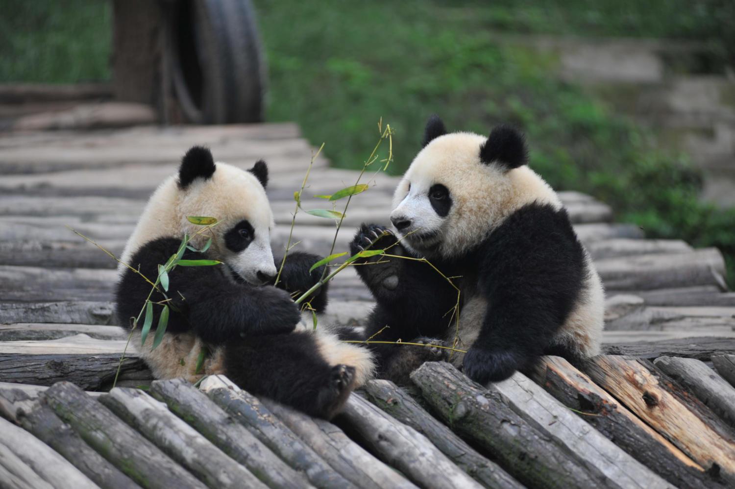
Ähtäri Zoo
They don’t have Pandas anymore!! POI has the same name. If you want to visit I think it will be at least 3 hours. Ticket to the Zoo is for 1 day (21-23€).
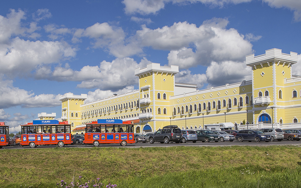
Tuuri Shopping Mall
28km west from Ähtäri Zoo there is the biggest shopping mall of Finland. The story begins in 1976 when the small grocery store started in Tuuri village.
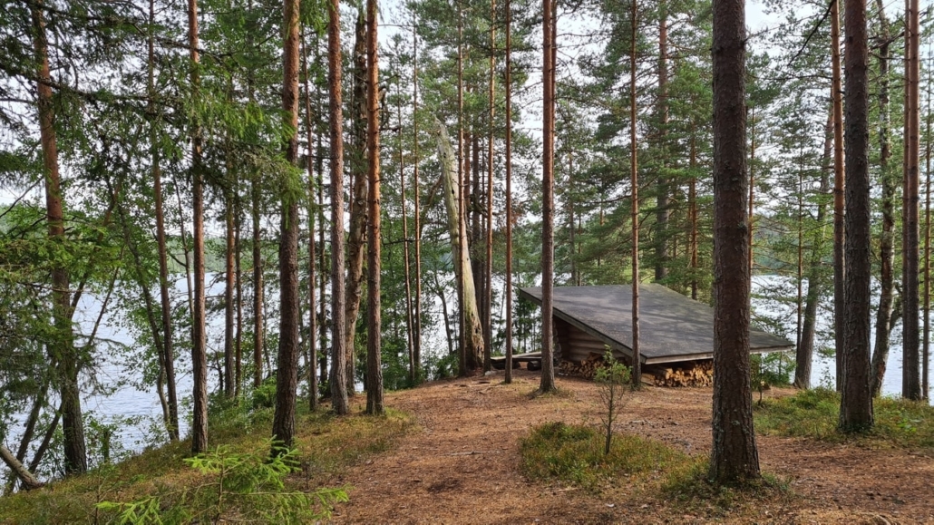
Hepoköngös Waterfall
This waterfall is in Puolanka about 15km west from the TET track. It’s one of the most famous waterfalls in Finland!

Iso Valkee
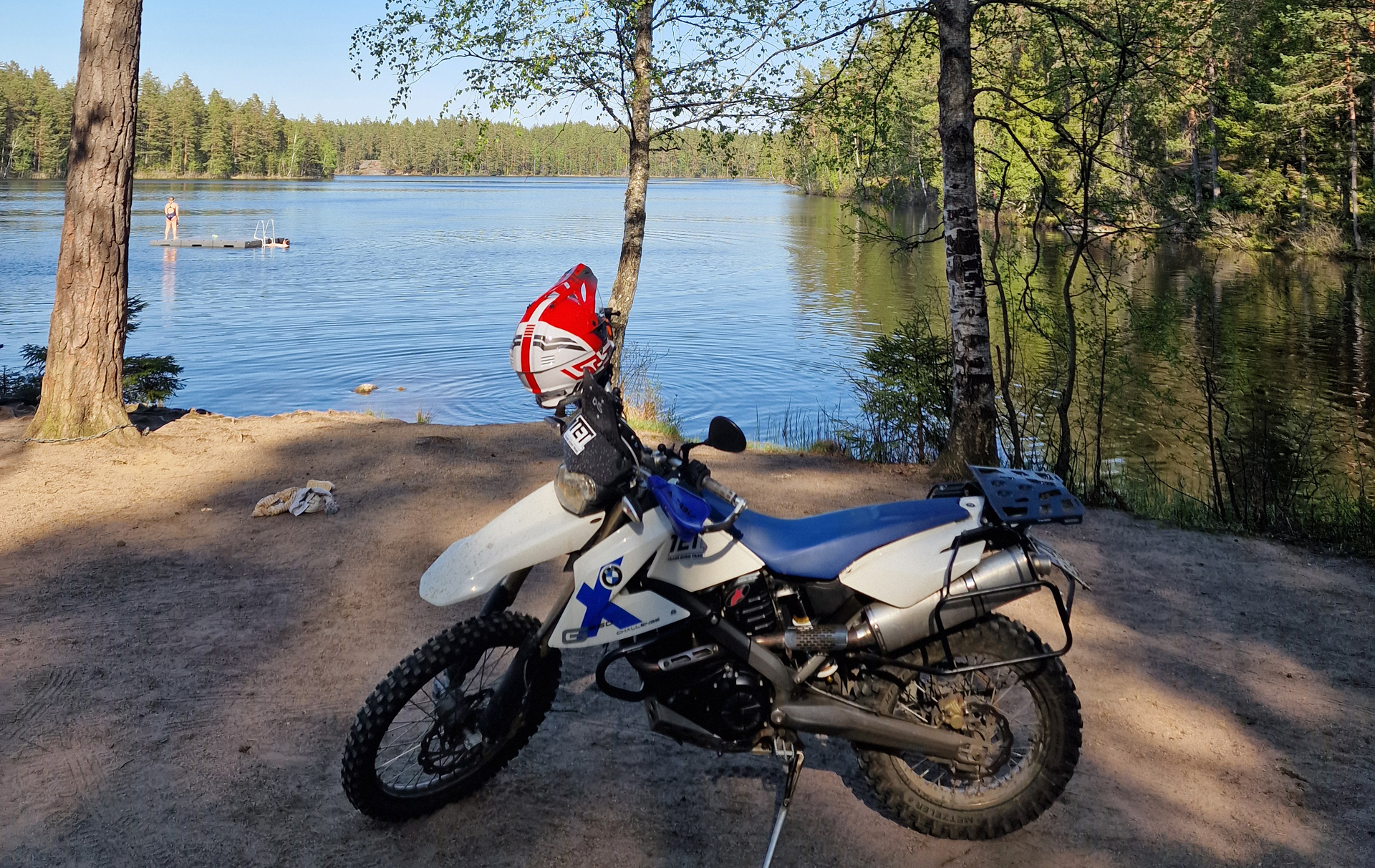
You started from Helsinki 159km ago and you have been enjoying “Kiikala” area already 30km’s and now you have POI in your TET gpx called “Iso Valkee very nice place”. This is a small beach, camping area and Lean-To shelter by a very beautiful lake! The lake has very clear water and sand bottom so it’s a nice place for a swim. Or grilling some sousages and have a break.
It’s ok to put your tent here and do wild camping. Remember: Don’t make fire if there is forest fire warning!
Aulanko in Hämeenlinna
You need to leave TET route just when you enter the main road 57 in Hattula/ Hämeenlinna. You need to ride 8km to south-east to reach the Aulanko area and there turn to left to Aulanko lookout tower.
(Route here). Even if the tower itself is not open the place has amazing views to the lake and the tower itself looks quite unique. It’s 117 years old tower and the place is one of the national landscapes of Finland. The POI in TET gpx is called “Aulanko National view”.

Niemisjärvi lake in Evo area
You have been riding in Evo area already few km’s and the TET route makes a turn to the right to go around this lake. I recommend to ride straight to the place and have a short break there. With lean-to shelters, grilling places and a beautiful small beach it’s quite special place. You’re not allowed to ride over the bridge but you can park your bike before the bridge.
POI is called “Niemisjärvi camping area”.
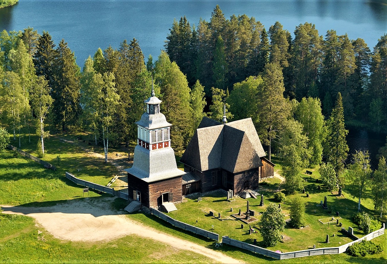
Old church of Petäjävesi
You can see this wooden church from The TET route but we really recommend you to go and check this 250 years old wooden church. You can see the POI in TET gpx, it’s called “Old Church of Petäjävesi”.
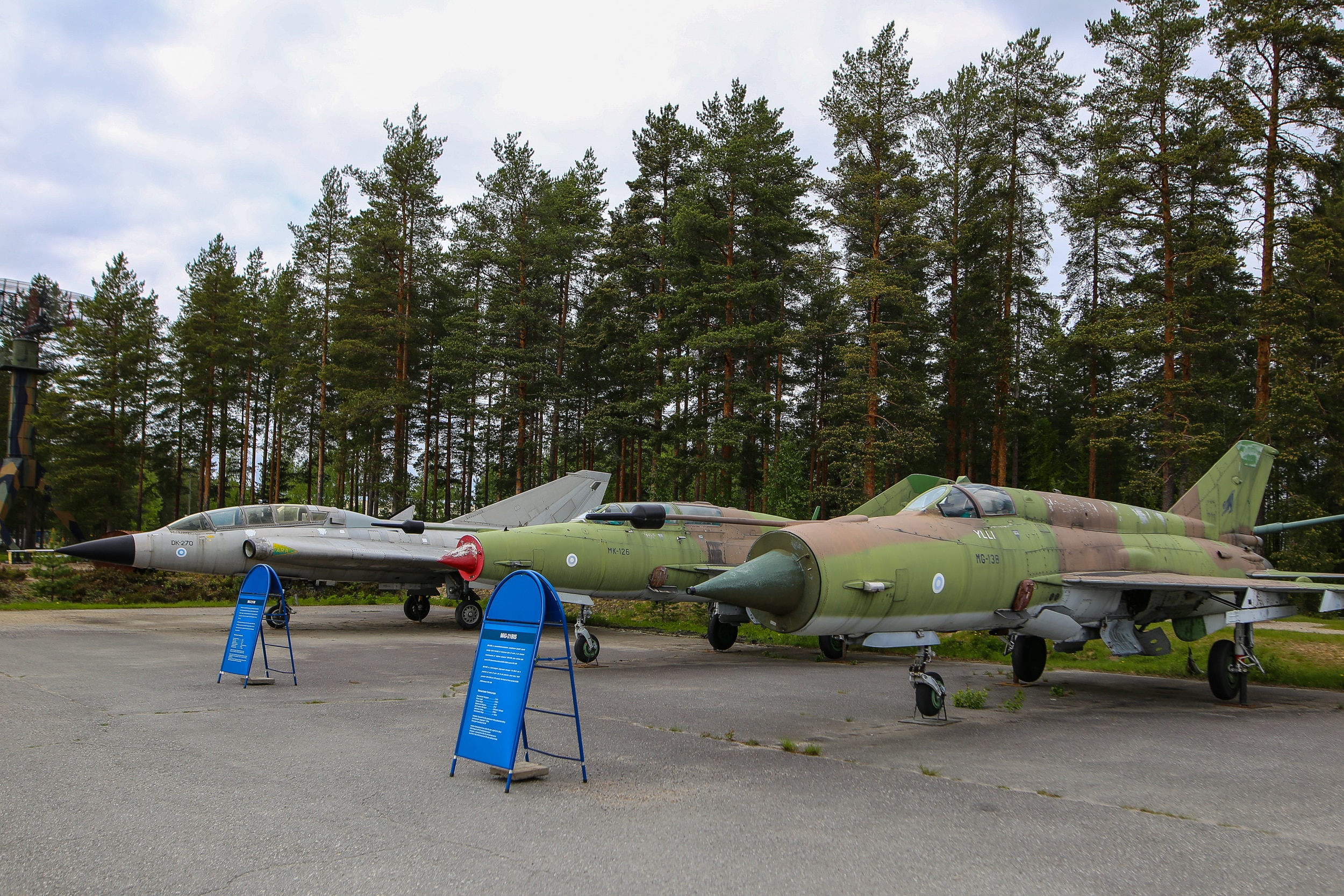
Finnish Air Force Museum
You can see the planes and the museum from the route but if you are interested about this kind of stuff it is ofcourse recommended to go in!
Google maps location
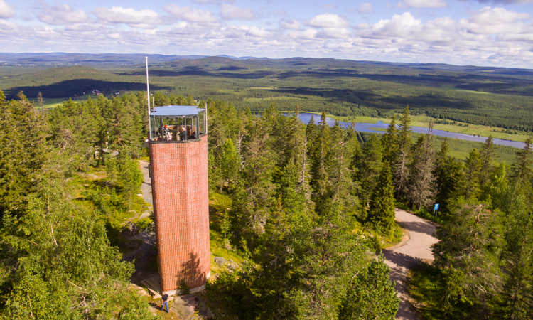
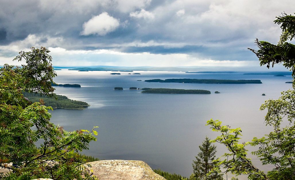
Koli National landscape
If you want to visit Koli National park and the “famous view from the top of Koli” You need to ride about 20km away from the route near Juuka. And in Koli you need to leave your bike to the parking area and take the railcar to the top. From there it is about 1km hike to the lookout spot.
POI is called “Koli hill top”.
Raate road
The route goes across Raate road in Suomussalmi. You will probably see some tanks or something about the war while riding but it’s very much recommended to ride to the beginning of Raate Road. That is about 15km’s from the actual TET route to the museum area. Maybe visit the Raatteen portti museum or at least read about the Battle of Raate Road and check the Winter War Monument.
POI’s are called “Raatteen portti” and “Winter War Monument”.
Kiutaköngäs rapids
The POI in TET gpx is called “Kiutaköngäs Rapids/ Waterfall”. If you ride 3 km north from the track you will find Oulanka National park (One of the gates to the park) and if you leave your bike to the parking area you will have about 1km hike to the famous rapids in the National park.

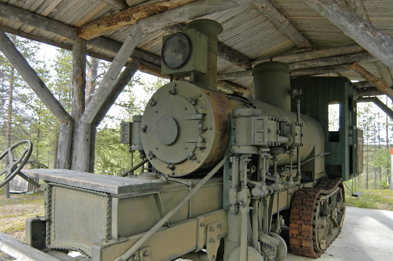
Samperi’s locomotive
About 4km east from the track you can find POI called “Tulppion majat” and just on the north side of that area there is a strange machine standing in the shelter. It’s a steam locomotive to be used in transporting logs from the forest closer to the road.