
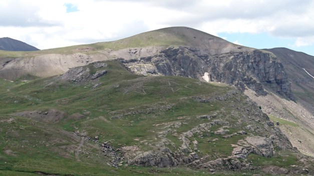
This day was riding from Lörrach to Aystetten like this. The weather forecast didn’t promise too much (but the rain) but actually it was like the first half of the day there was no rain and then the rest… yes it was raining. And now it was only me and Maria.
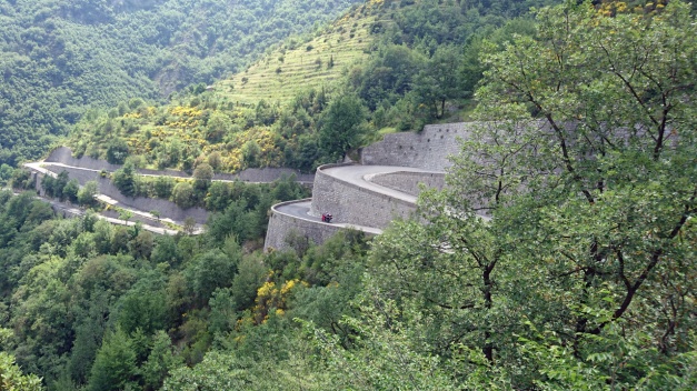
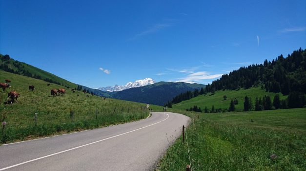
Pretty soon after we started from Lörrach we found the Wehra valley and the road L148. What an amazing road it was!! It’s like from a fairytale…

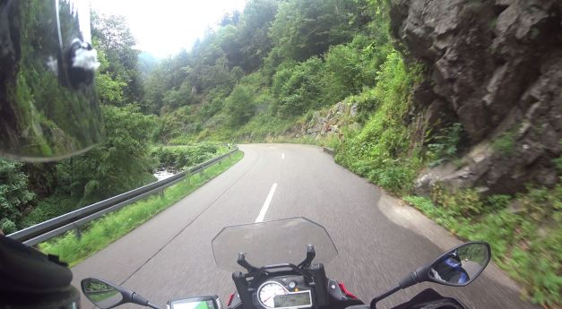
Some might say that the corners are not too tight here… But I don’t think you can ride like a crazy! Some of them are pretty tight and with no visibility at all!
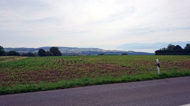
On the north side of Bannwald Wehratal the landscape was still very nice all around and the road was interesting and not boring at all!
This area has a lot of nature and forestpaths to visit and see very beautiful areas of Germany!
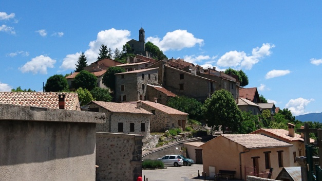
As we continued to east we didn’t know what to expect. So what we found next was a total surprise for both of us!
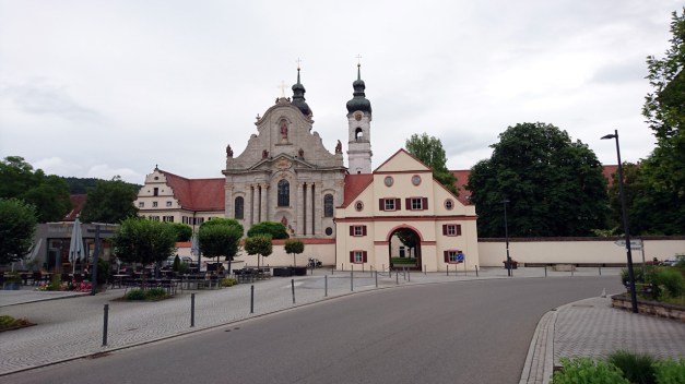
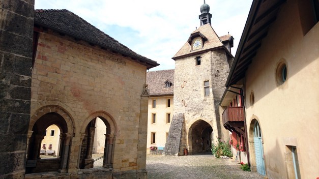
It was just a small city (called Zwiefalten) among many others and I stopped there to have a break. Then we noticed a very big building on the other side of the square and we started to walk closer. Then we thought “Let’s go inside…” -And there was the surprise!
I’ve never ever seen anything like this before!
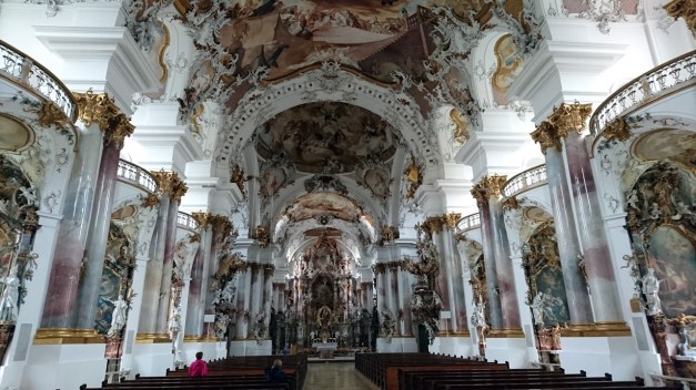
It was an old abbey and this was the church hall. It had German Baroque style interior that looked very expensive with gold (looked like gold!?) all around! I was totally speechless.
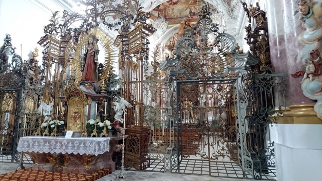
There was 4 side-altars on the both sides of the church-hall. Then there was the “second altar” (here in the picture) and behind the fence and 2 gates was the first altar. I was thinking to myself “After seeing this I can’t imagine what St. Peter’s Basilica looks like from the inside!! This abbey in the middle of south Germany was already something beyond my imagination!”
When we came out from this amazing abbey/ church it was raining. Finally after 3 hours of riding in the rain we arrived in the small city of Aystetten and we had a room in a small (and outmoded) Hotel that I cannot recommend (Hotel Sohnel).
adventure
This day we were riding in the Jura mountains in Switzerland and few km’s in France and few in Germany. The 266 km’s route was like this.
First it looked like the weather would be as hot as it had been many days before, but actually pretty soon it was cloudy and +25 celsius felt quite nice!
The views were still very impressive in Jura mountains! It would be nice to spend more time riding here too.
After couple hours of riding there was a raincloud following us.
And soon it was raining.
The most beautiful part of this days route it was raining so I didn’t take too many pictures. But that ride very near to Ch-Fr border (Cote-du-Doubs in the north side of La Chaux-de-Fonds) is a very nice road!
After 3 hours of rain it finally stopped and we switched to France to avoid the traffic in Basel. And after a short visit in France we switched to Germany and that was the last time in France in this trip for us!
We had an apartment in Lörrach to stay the night. So we made the dinner and breakfast ourselves! That was nice for a change…
Next morning Timo would go on his own way (straight to north and taking the ferry from Travemünde to Helsinki) and me and Maria would go on riding slowly home.
Is unfortunately closed.
In the morning we didn’t think about it. But later in the afternoon it was obvious -The Alps are now gone! Here’s the route for the day 15.
At first it was the big road (but not boring!) to north and Briancon-town and still after that the big road continues until Col du Galibier. We did ride this just few days earlier (Day 10) and I think it was a good idea to come here again! It is a great mountain Pass!
On the nort side of Valloire we took the highway A43 to the small city of La Chambre and from there the last mountain Pass in the Alps -Col de la Madeleine
We had a break in the top of Madeleine, Me and Timo ate some soup!
Riding up:
Riding down:
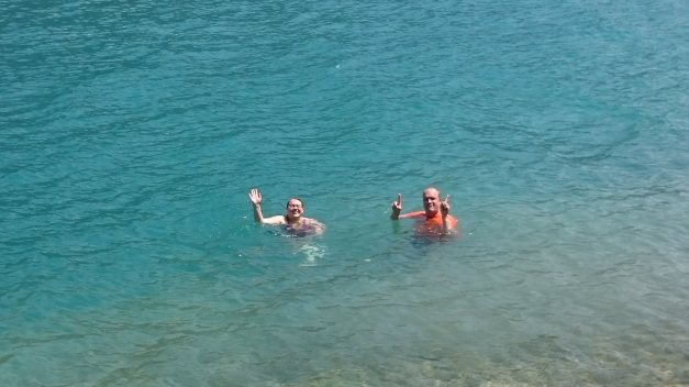
This was also a very hot day… So after mountain passes we had to ride through Albertville and on the north side of the Olympic City there was a valley and quite a lot of traffic when closing the city of Annecy… luckily the Lake Annecy was soon just beside the road and we took a swim in the beautiful clear turqoise water -nice refreshment in the middle of the day!
Then after city of Annecy I finally realized the the Alps are now behind!! We had some very nice mountain roads… but the views were quite boring comparing to the Alps. It was in the north side of Lake Geneva and it was the Jura mountains!
This road was very nice… It was mostly in the shadows of the trees and it didn’t feel too hot! Finally we arrived to our destination: The city of Les Rousses, and we ate dinner in very famous burger-restaurant, Chalet Regain!
Days 12 & 13 we did some riding between Menton – Monaco – Nizza. The Ducati got new chains and sprockets in Nizza and when we got the bike from Ducati Alpes Maritimes service it was only 10km’s when the rear brake caliper was loose!! They didn’t tighten the bolts at all! But ok, we could ride the Monster back to the Hotel and next day we started riding back north!
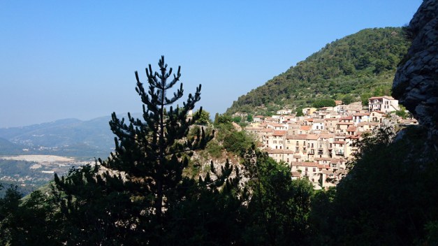
Day 14 started with very narrow mountain road from Menton towards the small village Peille. It is a beautiful old mountain village in the steep mountain wall!
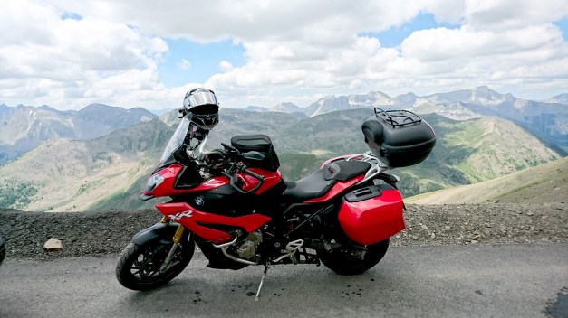
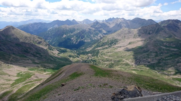
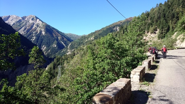
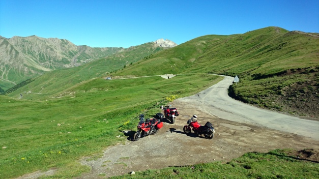
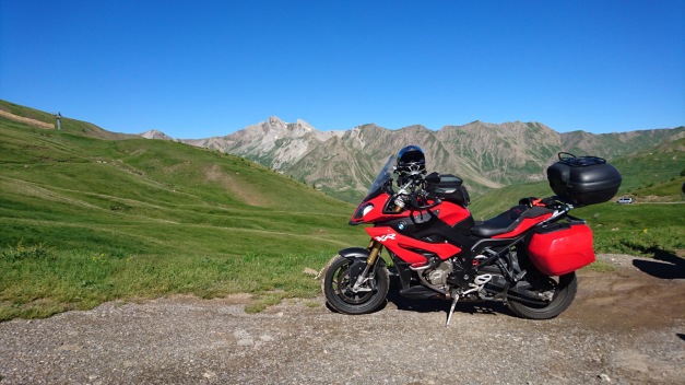
Then after few more nice mountain roads it was all about Col de la Bonette and Cime de la Bonette! Cime de la Bonette is the highest possible paved road (without dead end) in Europe! At first the road north from Saint-Sauveur-sur-Tinée is very nice and fast ride! It has mellow bends and fast corners until Saint-Étienne-de-Tinée. This video starts about 2 km’s before this village!
Few km’s more and the road is more narrow and the corners get tighter. In 11:10 is the first hairpin… And then starts the real climbing!! I deside to stop for awhile in the place called Camp des fourches

Here is few old and abandoned houses (I think they’re related to Napoleon?) But then the climbing continues…
This video goes all the way to the top of Europe (2802 meters!)
And then some photos!
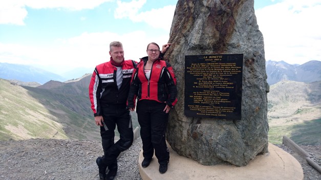
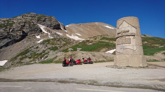
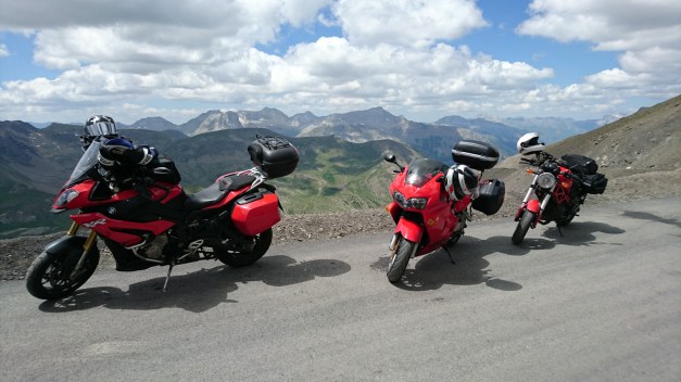
Timo & Maria, my fellowriders in this tour! (Timo with Honda and Maria with Ducati)
After spending some nice time in heights starts the ride down from Bonette. It is still an endless amount of hairpins and spectacular views. But there’s an interesting old abandoned fortress-looking building quite near… So I stop there.
We went in to see what was it all about?
There was some “drawings” in the mountain-wall too, made of stones!
“My God, it’s full of stars!”
Then we also climbed Col de Vars but at the moment I feel like I don’t remember it at all! It must be because Bonette was so beautiful, magnificent and spectacular so I remember it much better!
But here’s a video from Col de vars:
Right after Vars, we entered the village Eygliers where we had our next accomodation. The only problem was how to find it?? I try to call them but they didn’t speak any English. It was very hot day, Maria and Timo were a littele bit frustrated and they rode to the village to ask if somebody knew where it was. And I found a lady who did speak good English and I asked her… And she told me that the place right in front of me!!
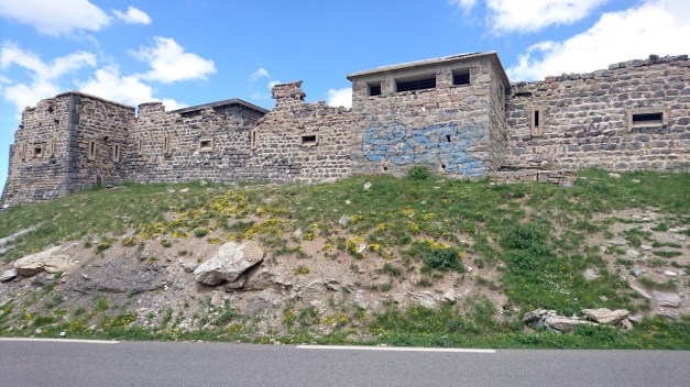
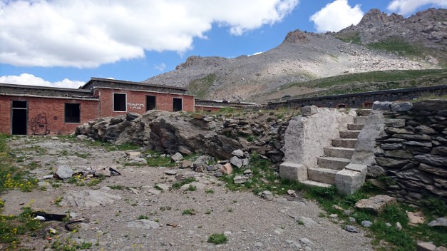
After the shower and changing the clothes Me and Maria desided to take a look of the fortress nearby. We didn’t know anything about it when we went there…
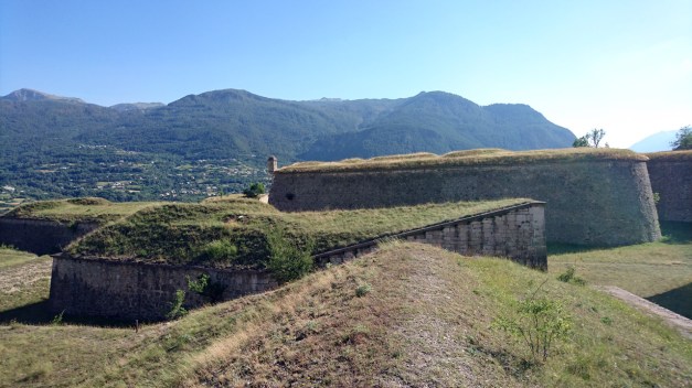
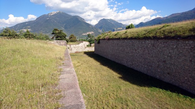
There was walls everywhere! It was almost like a labyrinth. It was also a very nice view to the other side of the valley!
The fortress is Mont-Dauphin, a small village with walls protecting it. It was built in late 17th century by the request of King Ludvig XIV. The fortress is 58 hectares and there’s about 150 people living in the village.
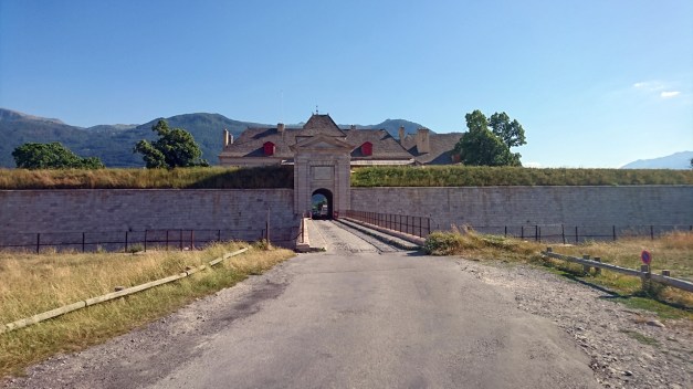
This is the gate to the village from the outside.

And from the inside.
Finally after spending some time in Mont-Dauphin it was 7pm! And usually you can’t get any food before 7pm!!! I think that’s totally crazy! We are hungry after riding all day!!
This was the route for the day 14!
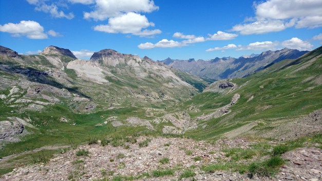
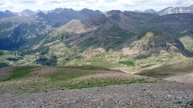
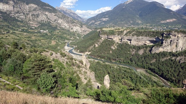
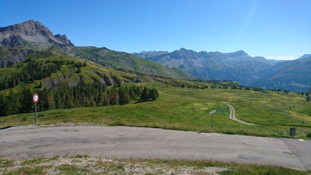
From Barcelonnette to south we chose D 908 instead of Col de la Cayolle (this would be actual part of the Route des Grandes Alpes). I think it is more interesting to ride Col d’Allos & Col des Champs (like we did)!
But before it starts to climb to the mountain Pass you need ride a long time endlessly twisting road following the valley. The river below you goes further and further while you’re climbing higher and higher.
Finally I had to stop and check if I can see the river anymore??!!
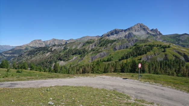
Then starts the actual climb to the Col d’Allos:
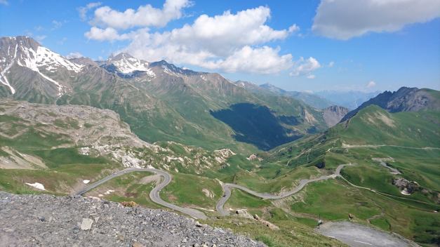
In the top of this beautiful mountain pass we saw absolutely stunning views and I took the best picture of the whole trip here!
Wanna see this picture in bigger size? Click here!
When riding down from Col d’Allos I had a very scary moment (03:55 in the video)!! A car came from the opposite direction just behind the blind corner… and the road is very narrow and there are no rails! I think my heart stopped for a second!!! But luckily I didn’t have too much speed.
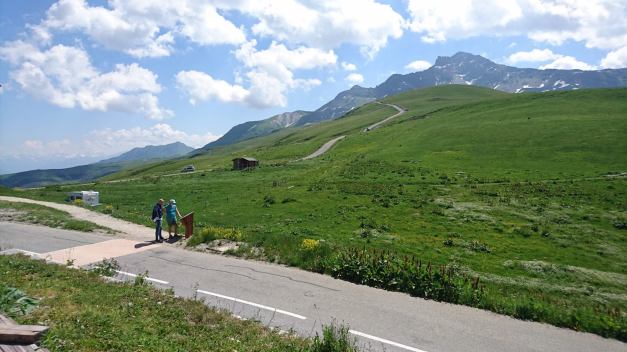
Then we rode Col des Champs! This was extremely narrow road in the middle of the forest. It felt like a jogging-path or a mountainbike-path! It had bumps and dikes… But luckily no traffic! Also in the top of Col des Champs was very quiet (and beautiful!)
The road down from Col des Champs (to east) is wider and easier to ride.
Then we rode to Valberg tourist- ans skiresort and from there we rode to Col de la Couillole.
(video here)
From there we were all waiting the final climb for this day -Col de Turini! But before we found the right mountain pass we took the wrong turn!! (Or actually we didn’t make the turn!) After missing the turn the GPS told us to climb to Ilonse… and we did!
It was 13 kilometers ride to the wrong direction!! But luckily it was very nice road and we didn’t feel bad to ride it back…
…So we could finally start the way to Col de Turini. It is simply amazing! There are so many tight corners and hairpins that I think I was feeling a little bit dizzy! And also it felt like it’s climbing a lot! Like at least 2500 meters! But actually the summit of the Turini is “only” 1607 meters high!! But gosh! What an amazing ride!!
That red spot is Timo with his Honda VFR!
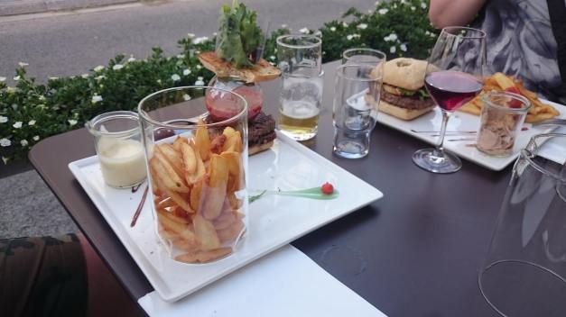
From the south-end of Turini we still had few nice corners to ride (from Sospel to Menton) -or actually our place to stay was Le Relais de Monti few kilometers noth from the city of Menton. We would spend the next 3 nights here! (Nice place, I recommend it!)
The route for the day 11 was like this!
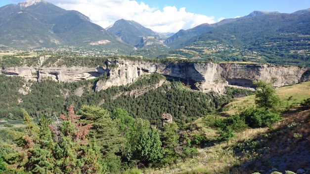
This was the day when we finally entered the Alps and the route that I planned this whole trip (Route des Grandes Alpes). But before we actually got to ride the endless hairpin corners… we visited the Les Gorges du Pont du Diable.
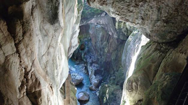
This is a place where the river has been “digging” the limestone for millions of years. It’s not a cave but almost… The hole is 40 meters deep. It costs 6,10€ to take a 40 minutes tour with a guide and it really is worth every penny!!
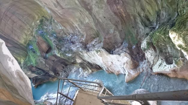
It is amazing place! And it’s only 20 minutes from Thonon Les Bains.
Then the first climb we took was Col de la Colombiere which is 1614 meters high mountain pass near Cluses. Then we climbed Col des Aravis, it’s still not very high but it offers one of the best views to Mt. Blanc!
You can see the highest mountain in Europe from many places if you’re driving south of Col des Aravis.
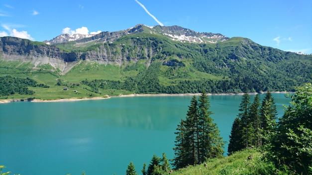
Then we had Cormet de Roselend, which is almost 2000 meters (1968 meters), this offered already very spectacular views from the top!! Especially the Lake Roselend with the clear turquoise water is really worth to make a break and admire the view!
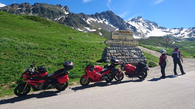
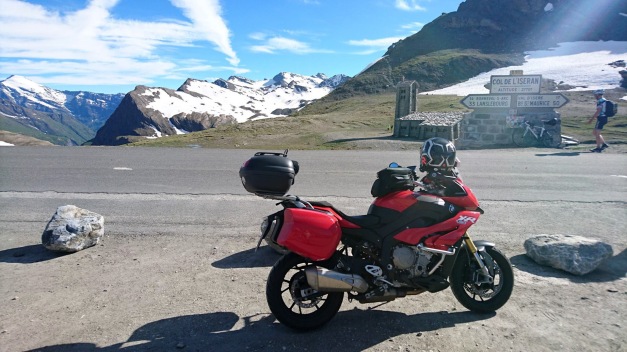
And finally we had the highest mountain pass in Europe in the afternoon: Col d’Iseran (2764 meters). The summit is still a lonely place! There’s no restaurant or no souvenir-shop just an old chapel made of stone… and I think they don’t even use that anymore!
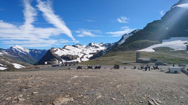
There’s still old meters in the sign… It has been checked few years ago that the real hight is few meters lower!
When we rode down to Val d’Isere it started to get cloudy. We had one more climb to make since we had our accommodation in Italy (Moncenisio). We did see a little bit of of the Lake Mt Cenis, but after we crossed the border we had no visibility anymore! We’re riding in the clouds! And the road to the amazing Chalet Sul Lago was extremely narrow with the branches of the trees coming very low… it felt like a scene from a horror movie!! And finally when we found the place… it had a very pleasant surprise for us!
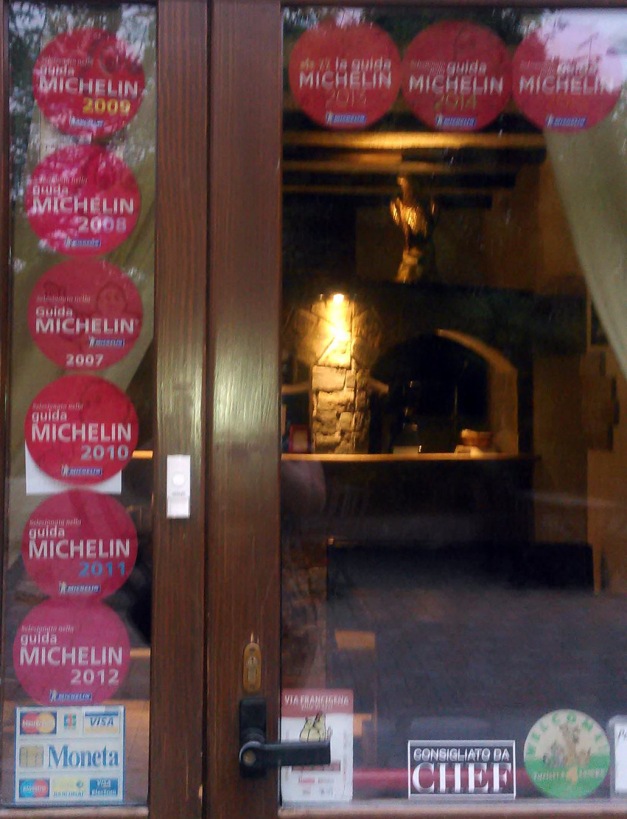
No, it is not a Michelin restaurant with any stars… But it is mentioned in the Michelin quite many times (as you can see!) -And yes the food was good!
Here is the route for the day 9.
After breakfast it was time to start riding again. My Tomtom Rider 410 showed us the way to the nearest gas station in Weil am Rhein… but what I didn’t remember in that point that in highway in Switzerland you’ll need the Vignette! And the nearest Shell was AFTER the border checkpoint in autobahn/ highway with only possible direction to Switzerland… Oops! (We decided that we are not going to buy the expensive Vignette -we would rather ride the small roads in Switzerland area).
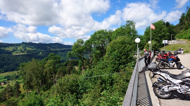
After a short discussion with customs officer we were able to make nice move to the other side of the customs area and ride back to Germany… and soon after that ride through the city of Basel. That took about 1 hour! In the southside of Basel we actually got our first real mountain hairpin corners when we climbed to Passwang Pass (elevation 1204 meters). And we had the first break in the “summit cafeteria” (http://www.alpenblick-passwang.ch/).
The view to valley was amazing.
Then we had Grenchenberg! What an amazing ride it was! The road is so narrow (climb from the north) that it is simply impossible to overtake a car. And I was so kind that I stopped and wait for the other 2 riders… and we had to drive behind a car for a long time.
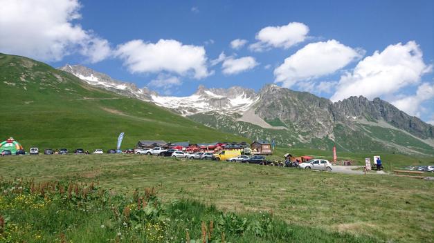
Just before the summit there was a place with lots of cars, tents and people… I don’t know if there was a some kind of special meeting or a camp(?) but it looked very strange! (In video 09:00). We had a nice break in the summit restaurant.
The southside road of Grenchenberg is not that narrow, there are even some busses driving… Then we entered Bern.
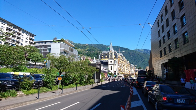
I was actually quite scared about riding through Bern! But it was Sunday early afternoon and there was not that much traffic. We did see the city center terminal of Bern and it was quite easy to ride through. From Bern we choose the road beside (and under) the highway to west as we headed to Lake Geneva. In the way we got some pretty nice views to the Lake of Gruyère (a reservoir).
Also the view to the Lake Geneva was amazing! I had planned the route to the beach Boulevard of Vevey, Clarens and Montreux… And that was a big mistake! There was annual Jazz Festival of Montreux going on… it took about 2 hours to ride that boulevard! (But we learned to do some nice splitting!) We did see the tents! And we heard some music! So I guess we can say that we were at the festival!
Finally after a long day we arrived in Thonon-Les-baines. It’s a city in French side of the Lake Geneva.
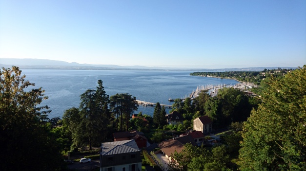
The route for this day was like this.
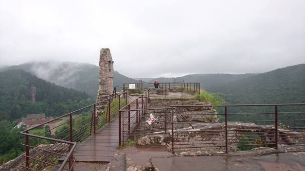
It had been raining during the night in Obersteinbach and the weather forecast promised us some more rain during the day. Right after the breakfast we visited Fleckenstein castle. It was actually good that it was raining since there were not too many people!
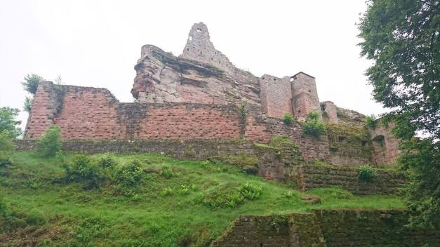
This castle is built on a steep and high rock and it was actually ruled by the same family Fleckenstein over 600 years!
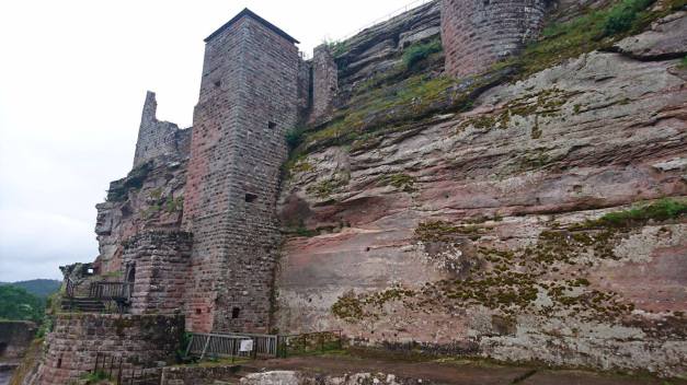
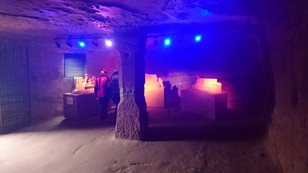
There’s also halls and tunnels inside the rock!
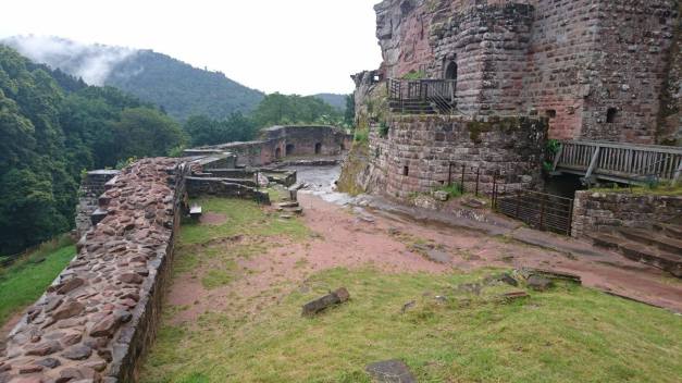
The view from the top of the castle is great… But we had that rain and clouds everywhere!
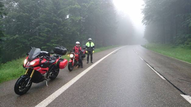
After the visit in the castle we had a nice road from Lembach to Wissembourg, but the road was wet so it was no fun. Then we went over the border back to Germany and after a nice break in Baden-Baden we started to ride the Schwarzwaldstrasse. But it was all in the clouds, the road was wet and from time to time it was raining!
The south-end of the Black Forest road was closed so we choosed alternative route: The road to Allerheiligen. That was very fun ride! The rain had stopped and the road was actually almost dry!
Here’s a short video I took after the roads were complitely dry:
At the end of this wet day we arrived in Weil am Rhein (in Germany), it’s actually a triple-city with Saint-Louis in France and Basel in Swtzerland. Our hotel was just beside the border and we could see people making a line to get to Switzerland!
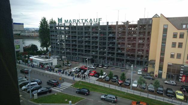
The reason for this is simple! After UK’s Brexit the € is so low that people from Basel come to Germany to make daily shopping!!
The route for the day 7 was like this!
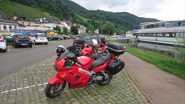
We got 1 more rider to make this tour with us! He’s Timo and he rides Honda VFR 800, and it’s red too!
This days route was called “Lets get the real good look at River Mosel!” -And yes we did!
The route was like this! And we’re following the River Mosel all the way from Koblenz to Trier and then to Luxemburg… It was more than 230 km’s of River Mosel and those grapevine or wine bushes on the both sides of the river! I think that’s enough… Luckily we did ride something else too! In the last part of the route we had nice ride in Eppenbrunn!
And then finally the GPS found a route that it is even hard to find from the map!!!
This must be the MAIN ROAD from Germany to France!
We had accommodation in Obersteinbach, France. It was nice and “bohemian” just in the right way!
