
Ride from the magnificent Chalet Sul Lago back to France was much nicer than the day before when we arrived.
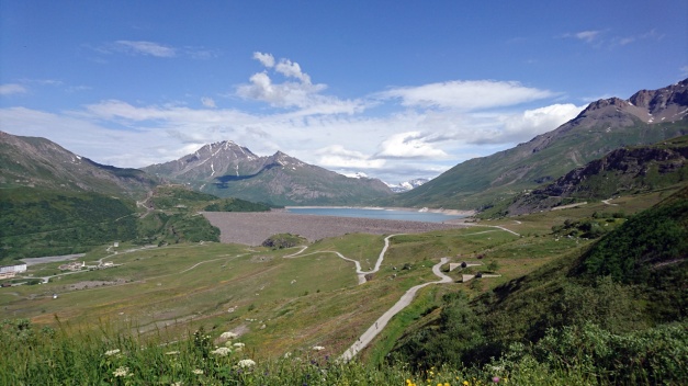
Mt Cenis
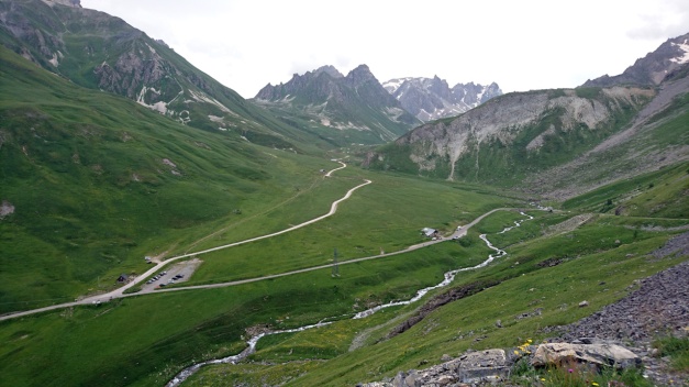
In France we started riding the endless amount of hairpin corners and mountain passes! First we had Col du Télégraphe then Col du Galibier, Col d’Izoard and finally Col de Vars.
Here’s video climbing up the Col du Télégraphe from the north:
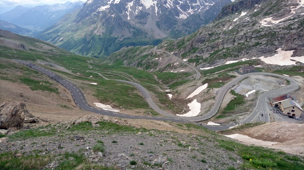
This climb ends in Valloire village and from the southside of Valloire starts the climb to Col du Galibier which is one of my favorites! It has a short tunnel on the top, but to reach even higher you have to take the alternative route and finally reach the 2645 meters.
Here’s video from the Col du Galibier
Col d’Izoard is more south and it starts from Cervières village (If you ride from north to south). The view on the summit is a little bit different than in many other mountain pass, the mountain walls are mostly gravel and stones! It is a barren sight!
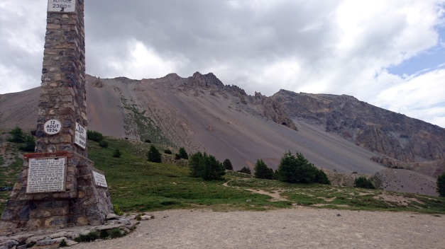
Col d’Izoard is 2360 meters high!
Finally we had Col de Vars (2109m) where we had some ice cream!
We had the accommodation in the middle of Barcelonnette city. Here’s the route for the day 10.
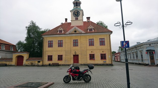
motorcycle
All posts tagged motorcycle
After breakfast it was time to start riding again. My Tomtom Rider 410 showed us the way to the nearest gas station in Weil am Rhein… but what I didn’t remember in that point that in highway in Switzerland you’ll need the Vignette! And the nearest Shell was AFTER the border checkpoint in autobahn/ highway with only possible direction to Switzerland… Oops! (We decided that we are not going to buy the expensive Vignette -we would rather ride the small roads in Switzerland area).
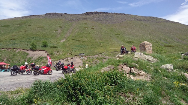
After a short discussion with customs officer we were able to make nice move to the other side of the customs area and ride back to Germany… and soon after that ride through the city of Basel. That took about 1 hour! In the southside of Basel we actually got our first real mountain hairpin corners when we climbed to Passwang Pass (elevation 1204 meters). And we had the first break in the “summit cafeteria” (http://www.alpenblick-passwang.ch/).
The view to valley was amazing.
Then we had Grenchenberg! What an amazing ride it was! The road is so narrow (climb from the north) that it is simply impossible to overtake a car. And I was so kind that I stopped and wait for the other 2 riders… and we had to drive behind a car for a long time.
Just before the summit there was a place with lots of cars, tents and people… I don’t know if there was a some kind of special meeting or a camp(?) but it looked very strange! (In video 09:00). We had a nice break in the summit restaurant.
The southside road of Grenchenberg is not that narrow, there are even some busses driving… Then we entered Bern.
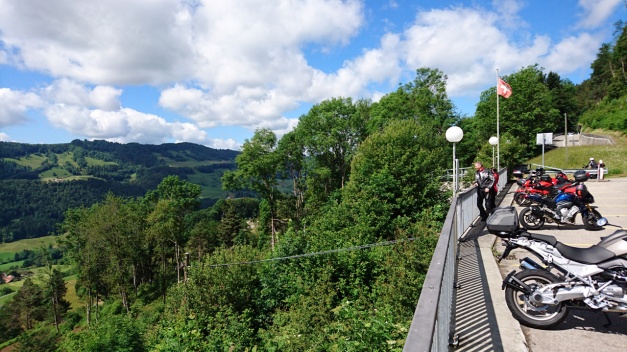
I was actually quite scared about riding through Bern! But it was Sunday early afternoon and there was not that much traffic. We did see the city center terminal of Bern and it was quite easy to ride through. From Bern we choose the road beside (and under) the highway to west as we headed to Lake Geneva. In the way we got some pretty nice views to the Lake of Gruyère (a reservoir).
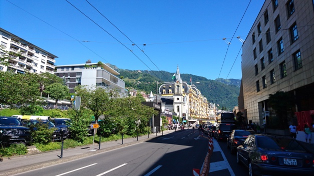
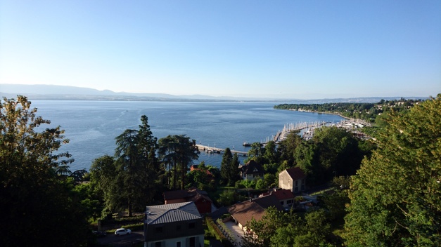
Also the view to the Lake Geneva was amazing! I had planned the route to the beach Boulevard of Vevey, Clarens and Montreux… And that was a big mistake! There was annual Jazz Festival of Montreux going on… it took about 2 hours to ride that boulevard! (But we learned to do some nice splitting!) We did see the tents! And we heard some music! So I guess we can say that we were at the festival!
Finally after a long day we arrived in Thonon-Les-baines. It’s a city in French side of the Lake Geneva.
The route for this day was like this.
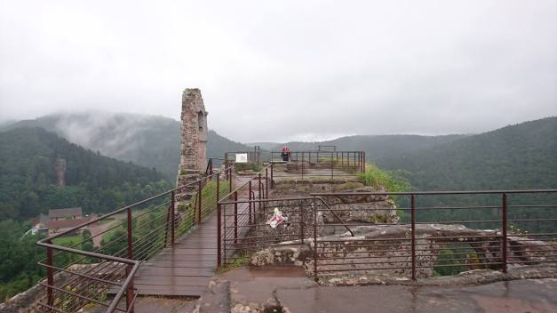
It had been raining during the night in Obersteinbach and the weather forecast promised us some more rain during the day. Right after the breakfast we visited Fleckenstein castle. It was actually good that it was raining since there were not too many people!
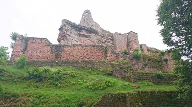
This castle is built on a steep and high rock and it was actually ruled by the same family Fleckenstein over 600 years!
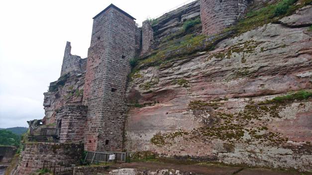
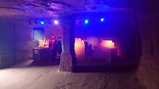
There’s also halls and tunnels inside the rock!
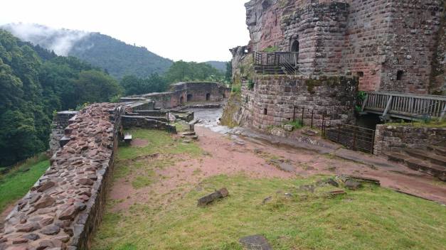
The view from the top of the castle is great… But we had that rain and clouds everywhere!
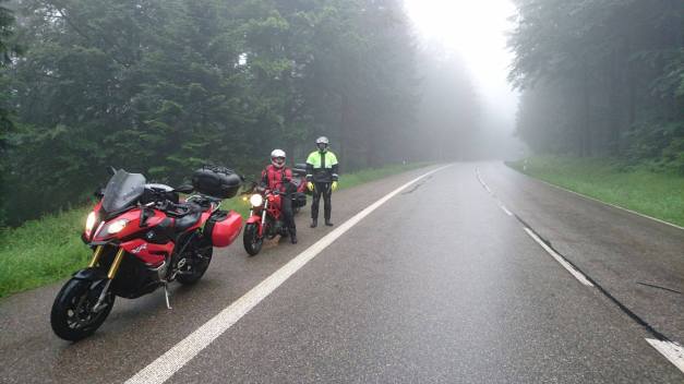
After the visit in the castle we had a nice road from Lembach to Wissembourg, but the road was wet so it was no fun. Then we went over the border back to Germany and after a nice break in Baden-Baden we started to ride the Schwarzwaldstrasse. But it was all in the clouds, the road was wet and from time to time it was raining!
The south-end of the Black Forest road was closed so we choosed alternative route: The road to Allerheiligen. That was very fun ride! The rain had stopped and the road was actually almost dry!
Here’s a short video I took after the roads were complitely dry:
At the end of this wet day we arrived in Weil am Rhein (in Germany), it’s actually a triple-city with Saint-Louis in France and Basel in Swtzerland. Our hotel was just beside the border and we could see people making a line to get to Switzerland!
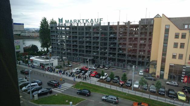
The reason for this is simple! After UK’s Brexit the € is so low that people from Basel come to Germany to make daily shopping!!
The route for the day 7 was like this!
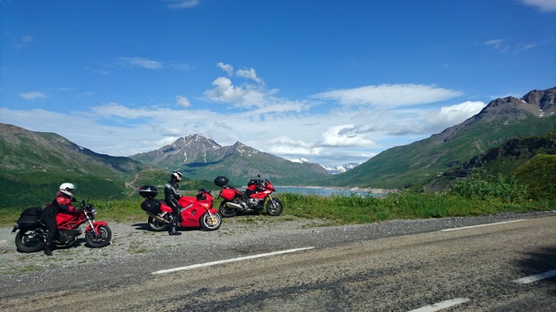
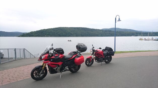
We got 1 more rider to make this tour with us! He’s Timo and he rides Honda VFR 800, and it’s red too!
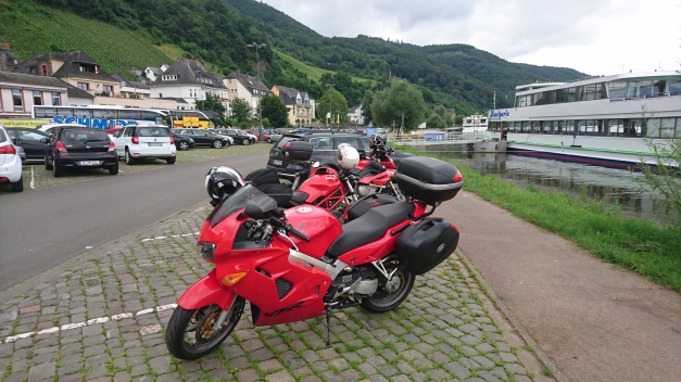
This days route was called “Lets get the real good look at River Mosel!” -And yes we did!
The route was like this! And we’re following the River Mosel all the way from Koblenz to Trier and then to Luxemburg… It was more than 230 km’s of River Mosel and those grapevine or wine bushes on the both sides of the river! I think that’s enough… Luckily we did ride something else too! In the last part of the route we had nice ride in Eppenbrunn!
And then finally the GPS found a route that it is even hard to find from the map!!!
This must be the MAIN ROAD from Germany to France!
We had accommodation in Obersteinbach, France. It was nice and “bohemian” just in the right way!
This was from Edersee to Bendorf (near Koblenz) like this. There was a risk of rain so we didn’t ride the whole tour Lake – Edersee. That area is very much recommended with nice roads all around!
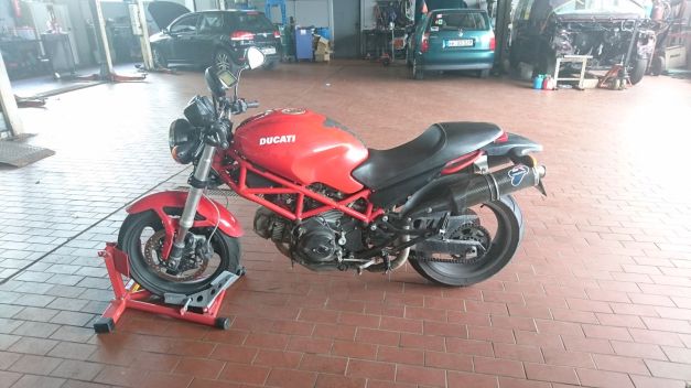
In the half-way of this day we noticed that the Ducati’s chains are very loose! Luckily we found a car and motorcycle garage where they tightened the chains right away!
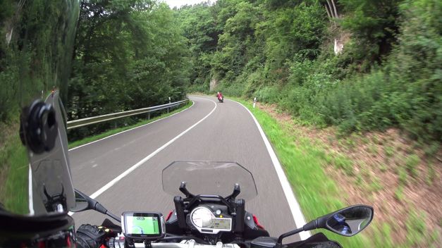
 As we got closer to Koblenz there was a very nice road with multiple tight corners!
I let the Ducati ride first.
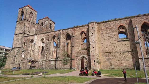
At first we rode through small roads to Beelitz-Heilstätten abandoned hospital. This is where A.Hitler had his testicles fixed (contoversal?) We checked few smaller buildings in the area. Little bit later we arrived in Zerbst/Anhalt -city and first we’re impressed by the middle-aged gate, but then we saw 2 high towers nearby. It was the ruins of old St. Nicolai church. It was such a beautiful place!
Soon after this city we crossed the river Elbe with Reaction ferry
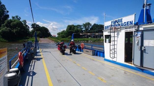
So there’s no engine in this Ferry but still it takes you to the other side!
When our route took us to Harz-mountains it had been raining a little. So we had to ride the nice corners with wet road. Luckily at the end of the day we had some nice corners near Edersee area and it was dry there!
Here’s the route we took.
The route was Kirkkonummi – Espoo – Helsinki – Tallinna – Pärnu – Riika – Saldus – Plinkses and about 500 kilometers like this! It was mostly big road and very boring day, the only merrier road was the Old Pärnu Road on the southside of Pärnu. There we also stopped ro take a swim in the Bay of Riga. The water was very warm!
Here is the parking area about 100m away from the sea. The day was HOT (about +30-32 celsius) so swimming was a very good idea!
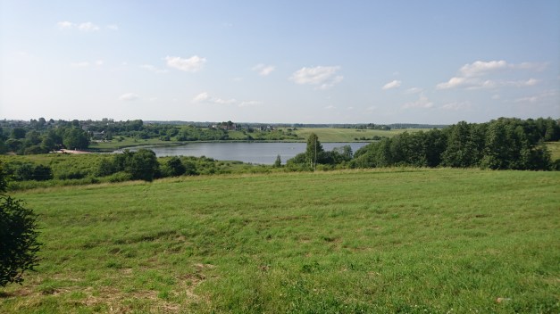
This is a view from the resting area just outside Saldus -city. It was a Beautiful place.
Here is a picture of our MOST BEAUTIFUL hotel!
You can follow this trip in facebook (https://www.facebook.com/PVTourinki/), mostly in Finnish.
In instagram (https://www.instagram.com/gozamite/) and in moottoripyora.org forum (http://www.moottoripyora.org/keskustelu/showthread.php/289047-Parlez-Vous-TouRinki), only in Finnish!
And as you can guess the trip is called “Parlez-Vous TouRinki”!
FInally I had a chance to take a weekend tour!! I started on Friday 27th of May and I choose the route and the direction where I had motocaching spots as many as possible to find!
This was my route on Friday. The first motocache I marked as “found it” was from Urjala to Huittinen, it’s a panoramic route in a typical Finnish countryside landscape.
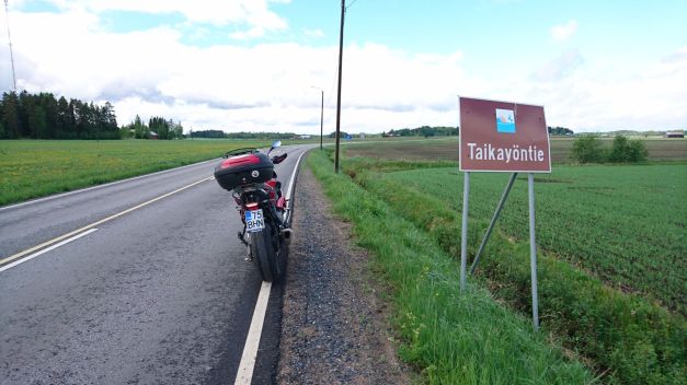
This is called “Road of the Magic Night”
Later I stopped in a cafeteria with a beautiful location beside the lake and a bridge.
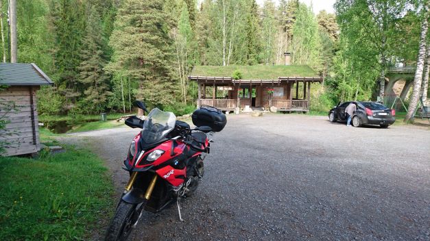
Sadly this Otamus Cafe wasn’t open so it was no snacks for me! Quite soon after this cafeteria it was one of the twisty roads that I had been waiting! But (WTF!?) it started raining! I had to put on my rainsuit to avoid getting wet and I didn’t really enjoy the corners… Ok, few kilometers in tho north part the road was dry again.

Friday I added 7 new caches to my list. Last one was the cafe beside the militarybase Niinisalo, It’s called a Sotilaskoti in Finnish and I think the English word is naafi(?)
These cafes are usually quite cheap comparing to ordinary ones.
The route for the second day (Saturday 28th) was like this. Again I was choosing roads and spots I could mark as found in motocaching.net. The first one was very old road from the middle ages called “Kyrönkankaantie” (Cache only in finnish). The first time it is mentioned was in 1556, but today it is only rarely used road in the middle of the forest. It would be great ride for a endurobike!!
At 02:00 I choose the wrong road and at 02:30 I stop to wonder why the GPS shows that I’m somewhere in the middle of nowhere??!! And I make the U-turn!
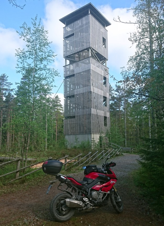
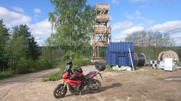
The second spot was a tower in the top of the mountain in the national park (Lauhanvuori national park). I have a physical fear of heights (not mental), if I go to a high place I haven’t been before I start to feel it on my stomach and in my feet. When I was younger I’ve even passed out few times. In this tower I had some trouble to stay on my feet but after a couple of minutes it was ok. I think the tower is over 20m high!
There was one road in the national park that I took. This was fun!! (And pitty I didn’t have my KTM!)
In the routemap it shows that I’m making U-turn at the end of this road, but since there are no traffic signs I just ride through to the bigger road (at 11:00 in the video)
Little bit later I took another tower, this was not as high and it was new. But when I climbed to the top I could feel the tower moving!! That didn’t feel ok at all!! They built it too light!
Then there was few rural roads, one of them had so big stones in it and I really didn’t like it at all!! (With my KTM Enduro it would’ve been ok!). Then I arrived in Karijoki, there’s a very old cave called “susiluola” (Wolf cave), it is the only place in northern Europe
where they’ve found some evidence of humans living before the ice-age! Although the evidence is not certified to be as old as they say (120 000 years old)! Here’s some info in english.
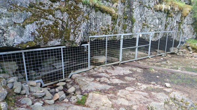
It was a disappointment that you coudn’t visit inside the cave!
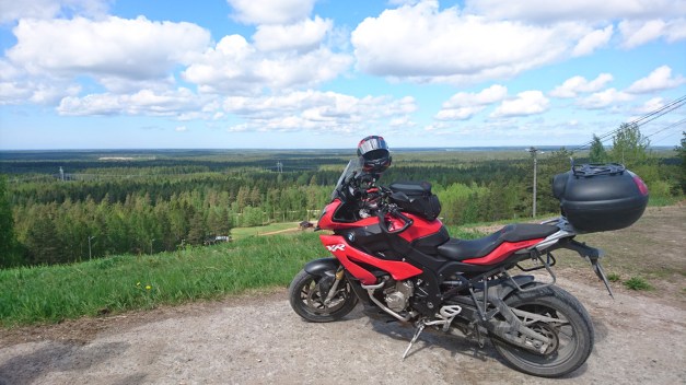
Just few kilometers from the cave there’s a skiing center where you can ride your bike to the top of the mountain -and there’s a great view!
Not far away from here is the city called Kristiinankaupunki, I’ve actually never been here before and there’s one strange alley… It’s very narrow and it is still a 2-way street! This is the most narrow 2-way street in Finland!
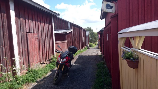
The name of the road is “Kissanpiiskaajankuja” (Catwhippersalley… Yes, a guy who’s whipping the cat!!)
From Kristiinankaupunki I was riding straight south following the coastline. The road to Siipyy, Merikarvia and Ahlainen is not extremely good… but it’s not boring either.
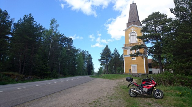
This is the belltower in Siipyy.
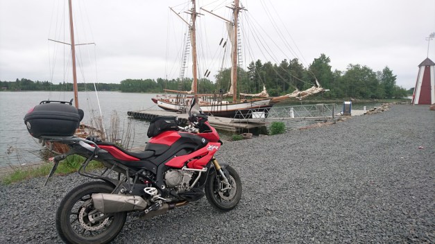
Late afternoon I was finally arriving Tahkoluoto and Reposaari. These are outer islands but possible to reach by road. I was lucky to have a beautiful sunny weather while riding the road to these islands. I found the beautiful restaurant on the south-end of Reposaari called “Merimesta”. I choose to eat the buffet even it was not cheap (27€) but it was all worth it!!
Finally spent the night in Pori and woke up next morning in cloudy west-coast city.
Sunday (Third day) route was like this, still choose the roads following the coastline. Visited the harbour in Luvia, I had never actually been there before. Usually there’s a new sailboat in the pier called “Ihana” (Wonderful) and I was so early in the morning it was not out in the sea and I was able to see it!
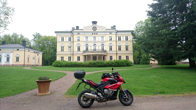
I rode to Vuojärvi Mansion -that is a very big and beautiful old mansion in the westcoast!
Stopped in Rauma to check the old town and it still is so beautiful and amazing area!
Then slowly I arrived to Turku and I checked few places before I chose the highway to Helsinki and the way home. It was pitty that Sunday was cloudy… I even had some drops of water in the morning but I didn’t get wet.
Here’s one picture from Turku… One of the most famous buildings in Finland:
Turku Castle!

This last day I had the longest route but it was the shortest day… And it’s because I choose the highway Turku-Helsinki, almost 170 kilometers of 120km/h speed. I was home at 4pm.
Now I’m waiting my next trip which is starting on 26th of June. That will be 3 weeks in Europe and maybe more than 7000 kilometers!!!
Day 3
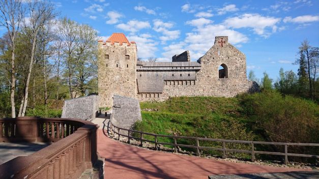
We started the day by going to visit the 2 nice castles of Sigulda.
(https://motocaching.net/en/cache/viewb/id6980)
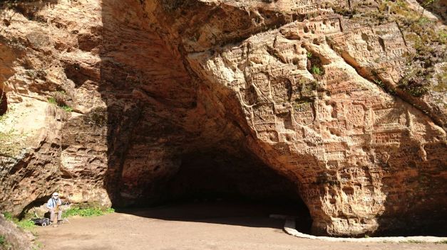
 And also the cave down beside the river, this cave has walls of sandstone with many signatures from long time ago. (https://motocaching.net/en/cache/viewb/id6955)
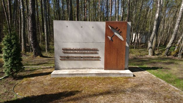
Then we started riding the route for saturday. First we took nice road from Turaida to Saulkrasti. This would be very nice… but the pavement is so bad condition that you have to concentrate to keep the bike in balance and you can’t really enjoy the long sweeping bends. (https://motocaching.net/en/cache/view/id6830). From Saulkrasti you can find a monument of finnish bomber Junkers JK-274 crash in 1943. It is quite interesting to find finnish language in the middle of Latvia! (https://motocaching.net/en/cache/view/id6124)
Then after many kilometers of boring Via Baltica we took the old road of Pärnu. It is more pleasant ride because of the many small villages, old wooden houses and small shops. This 35 kilometer long road gives you some alternative route to Via Baltica. (https://motocaching.net/en/cache/view/id4794)
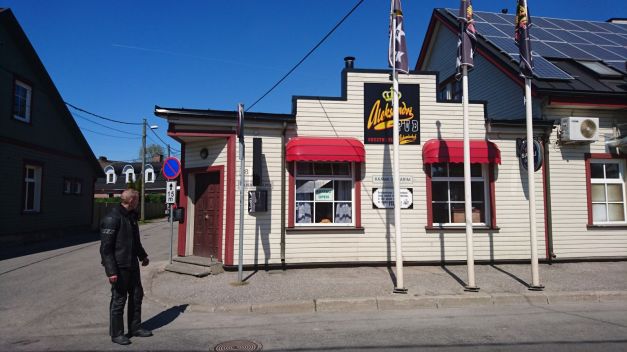
In Pärnu we took a short lunch-break in Aleksandri Pub (https://motocaching.net/en/cache/view/id6338)
And in the north side of Pärnu we took a short visit in Villa Andropoff, this has quite interesting history but it didn’t give me any shivers. Looked like old Spa or something…
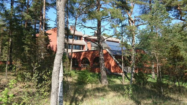
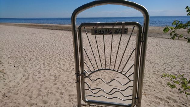
The Beach in this Villa was fantastic! Many kilometers of white sand everywhere.
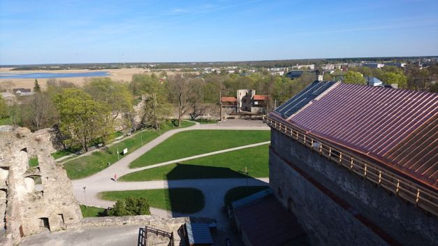
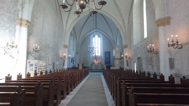
Finally after a long and quite hot riding-day we arrived to Haapsalu. We visited the Haapsalu Episcopal Castle. Last time I was here (20 years ago?) it was only the ruins of the castle but now there was a museum and many different parts of the castle where you can enter. The bell tower, the hospital, the cathedral, the dungeons… we’re almost running everyhting through and still it took more than 1 hour! The entrance fee to the museum is 5€ and I really recommend to visit there!

(https://motocaching.net/en/cache/view/id6310)
For saturday evening we choose to eat Pizza. There is 1 very nice pizzeria in Haapsalu, Pizza Grande!
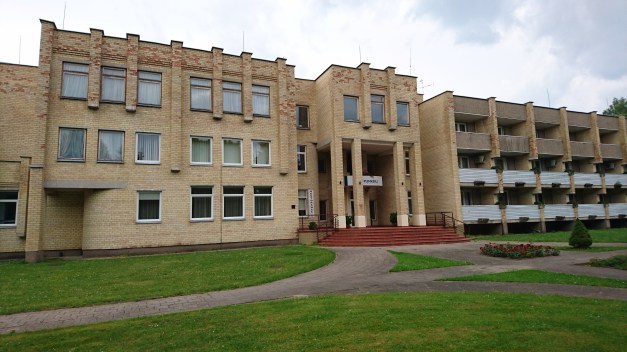
Our hotel was the Spa by the ocean so we also enjoyed some jacuzzi and sauna (in Spa Laine)
