YouTubers from UK decided to ride TET Finland! They have 30k followers in their channel. I started to follow them in the spring when Martha was about to get her licence for the big bikes. Then it was maybe in April when my Messenger had some questions from Mitch and about TET Finland. And It was actually quite close that we didn’t meet each other around Midsummer when I was riding in the north myself! I think it was Sunday when they were doing the Alta old post road and for me and my friends it was tuesday! This is actually the first time when someone is doing a full series (10 episodes) of YouTube videos about TransEuroTrail Finland and I think the movies are very good!! First episode here:
They have also very nice instagram channel: Jammy Gits
After some resting I was ofcourse riding again. So in July I took some interesting adventures and explorations around the area where I live! First ride was 15th of July. I was checking the most southern parts of the mainland in Raseborg.
This ride has interesting very narrow canal in the beginning. This canal almost everyone remembers because one boating accident that happened there 14 years ago. The second ride was 20th of July. I was checking some of the best trails near my home. It was also quite hot day.
Third ride was 21st of July. That was the group ride for “Pohjolan kurapyöräilijät” (Nordic dirt riders). We had super fun day!
Next ride was 23rd of July. I was finally checking the Kemiö island, the second biggest islanf in Finland.
Next ride was 27th of July. It is the seven sleepers day in Finland.
The last ride of July was on the last day of July. That I did with my friend Lauri in Hanko area.
I also shared a “remix” video of one of the best parts of that ride in Hanko area.
In August it will be the MotoAdventureDays again. I’m one of the team leaders (“Peura”) and I’m also doing some presentation about TET Finland. See you there!
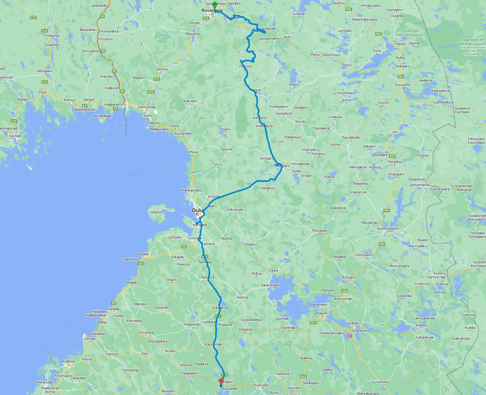
I spent the night in Rovaniemi in someones private home. I never met this guy before and he was still offering me this. Some great people still exist! In the morning I continued my route south from Rovaniemi (ok, first it was east, then south). This was still TransEuroTrail Finland section 7. I had about 130km route to check and first 40km were excellent! In the video it’s the first 5 minutes…
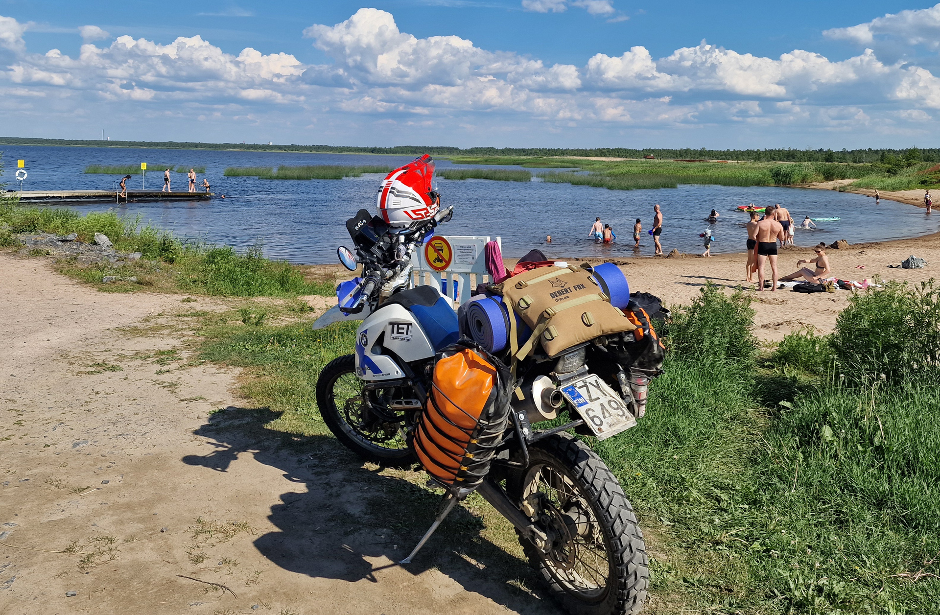
Finally I was in the crossroads with TET section 19. Now I had to make a decision about where to next?? But that decision was actually made for me because on the previous evening I noticed that my front fork was leaking badly and the rear shock was soft (again!). So when I cought some paved road I started to ride to south (I wasn’t thinking yet that I will ride as fast home as possible but that’s exactly what happened.) First I rode to Ranua… then to Pudasjärvi… and soon I was in Oulu and I took a swim in a nice beach of Vihiluoto.
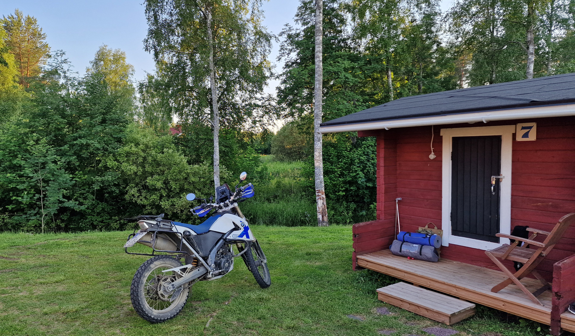
I couldn’t find accommodation that was cheap enough so I continued all the way to Pyhäsalmi and stayed in a small cabin in Emolahti camping area (40€).
The route for the day 6 looked like this:
North Adventure Day 7 was only the ride back home on the paved road. I got heavy rain from Jämsä to Padasjoki.
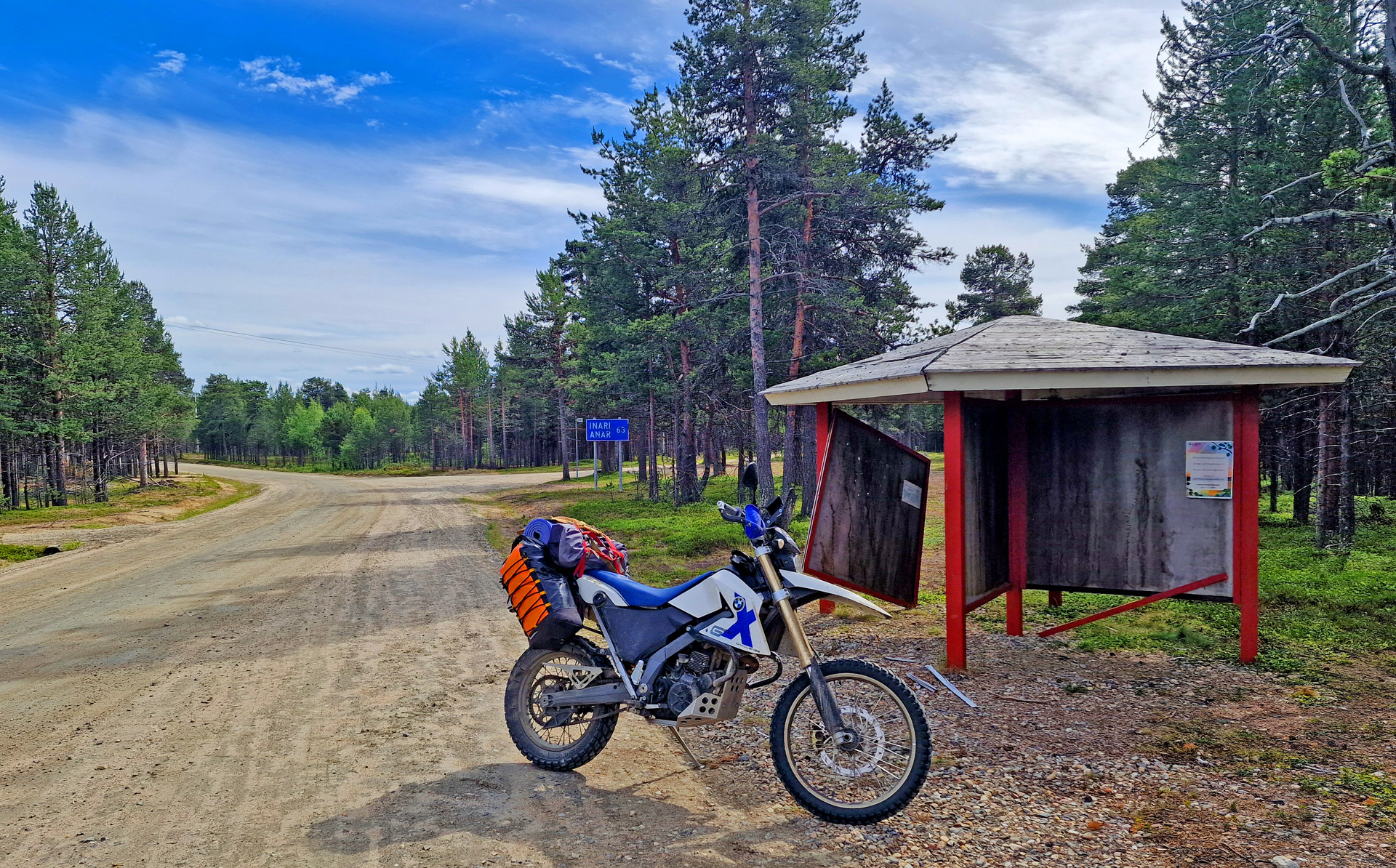
My friends Eero & Lauri decided to continue west towards Kilpisjärvi. I had other plans so I started riding east. I was riding a big road all day. First it was paved road until I was in Finland and then from Karigasniemi to Angeli and Inari it was big gravel road. In Vuottašjávri I took a short break and checked the place beside the lake. But there was too many mosquitos and black flies. So I continued riding.
The landscape and views are incredible in this area! So I can say that I did enjoy my ride. It was 370km all together!
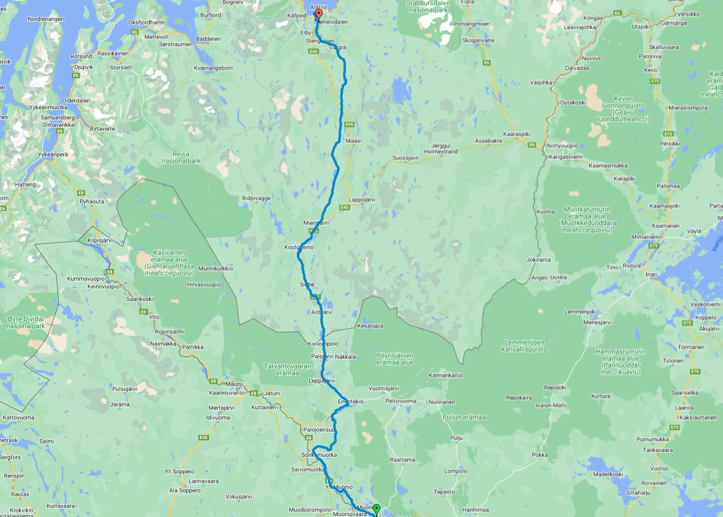
The village of Angeli I have never visited before. I had to search the result for a quite a long time about how many people lives in this village. It’s less than 100! The road from Karigasniemi south to Angeli and then east to Inari is also part of TransEuroTrail Finland section 7.
Here’s the video of this day. It’s the road up and away from Alta, so called Alta Canyon road.
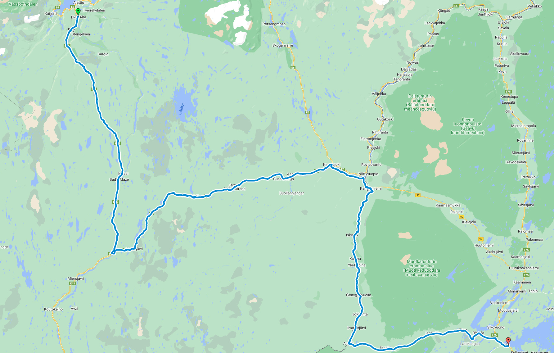
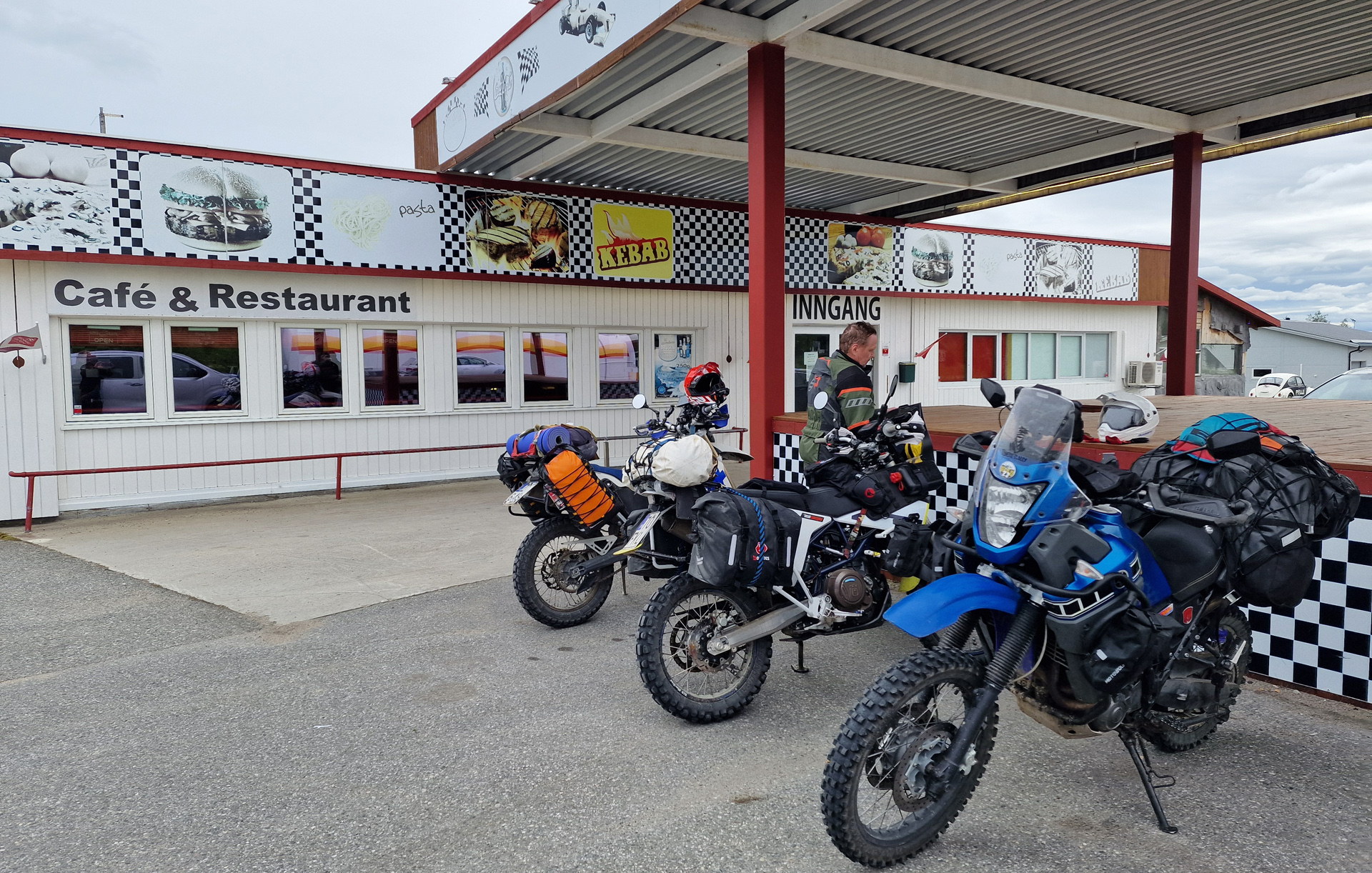
The weather forecast was saying that it will rain today but we desided to go anyway. And the plan was to ride north first to Enontekiö, then to Kautokeino (Norway) and from there we took the “Old Postroad” to Alta. In Hetta (Enontekiö) we filled the tanks and in Norway border we took few pictures. For my friend Lauri it was his first time out from Finland with the motorcycle! After 3 hours of riding we reached Kautokeino and we enjoyed lunch in Pit Stop Café & Restaurant. It was simple grillfood with very reasonable price. Here we got few drops of rain but other than that we had pretty nice weather all day!
Then 15km north from Kautokeino starts the challenge!
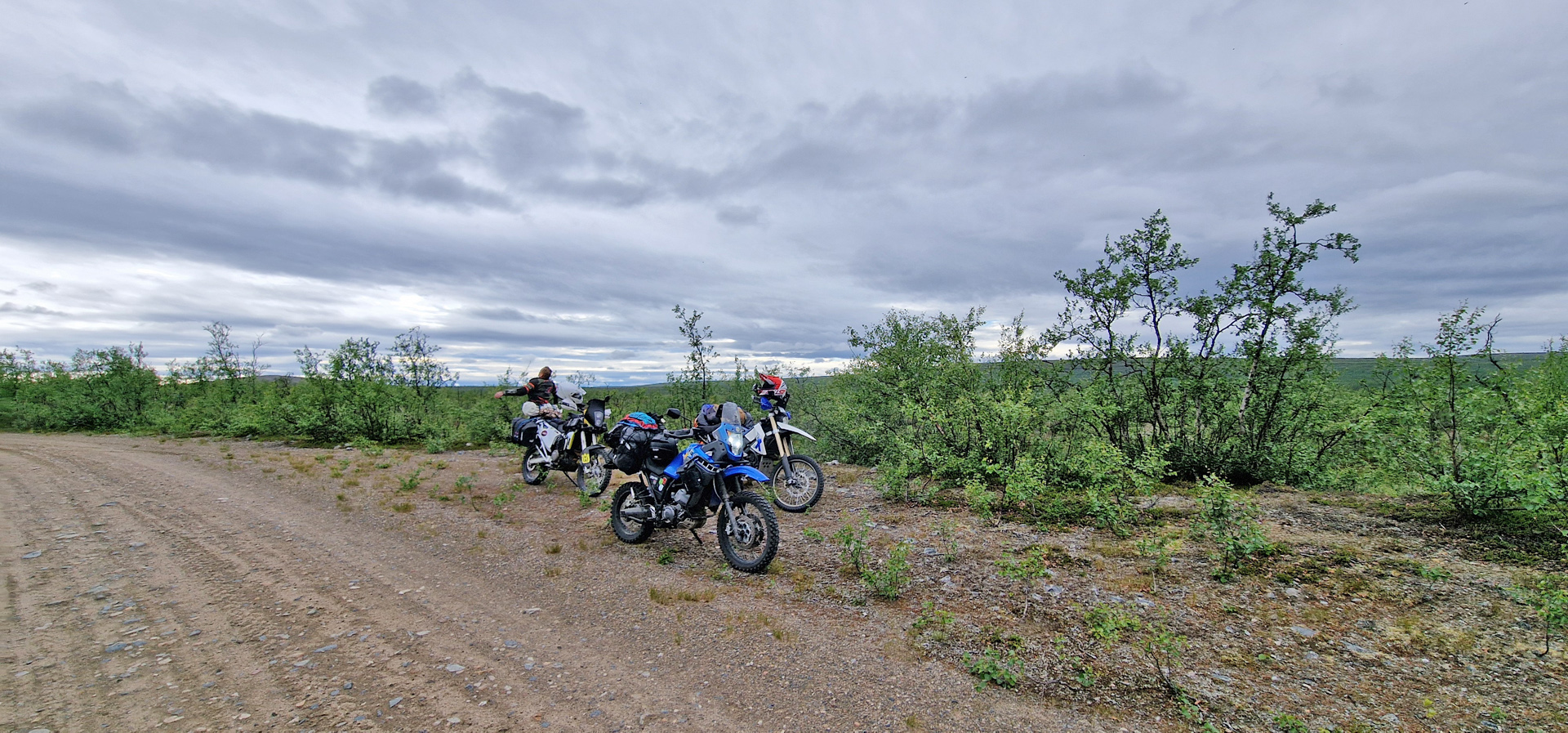
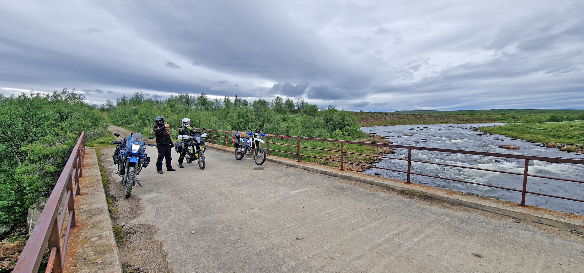
The Alta Old Post Road is very well known route for adventure riders! It had been my dream for many years and now I was here! The south part is about 60km and it is the more challenging one. There’s actually no really hard parts but after 10-15 km of riding started the puddles and more rocky parts. I started to count how many big puddles there was but after 30 (something) I got confused in the calculations.
The last picture is from Mázejohka old bridge and it’s definitely on of the best-preserved bridges on the route! But soon after this comes the place where one Norwegian couple crashed badly few years ago. The north part of the Old Post Road is almost like a normal road. You can drive there nicely with a normal car or with street motorcycle. And the scenery there is simply amazing!
The route for today was about 300km and it looked like this:
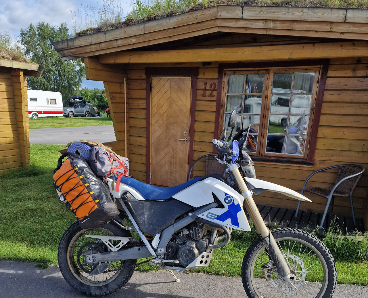
My friends Eero & Lauri took a different direction from Alta so after this day I was riding alone again. I found very nice cabin from Strand Camping with 51€.
The 30 minutes video of the day you can watch here:
Day 2 started with a light rain but it was over before I started packing my bike. Second time packing was already much faster and easier (& better). First I was riding back to Muonio and from there I called my friends Eero & Lauri who I knew were staying somewhere close in a cabin. I also had a place there for the next 1 or 2 nights.
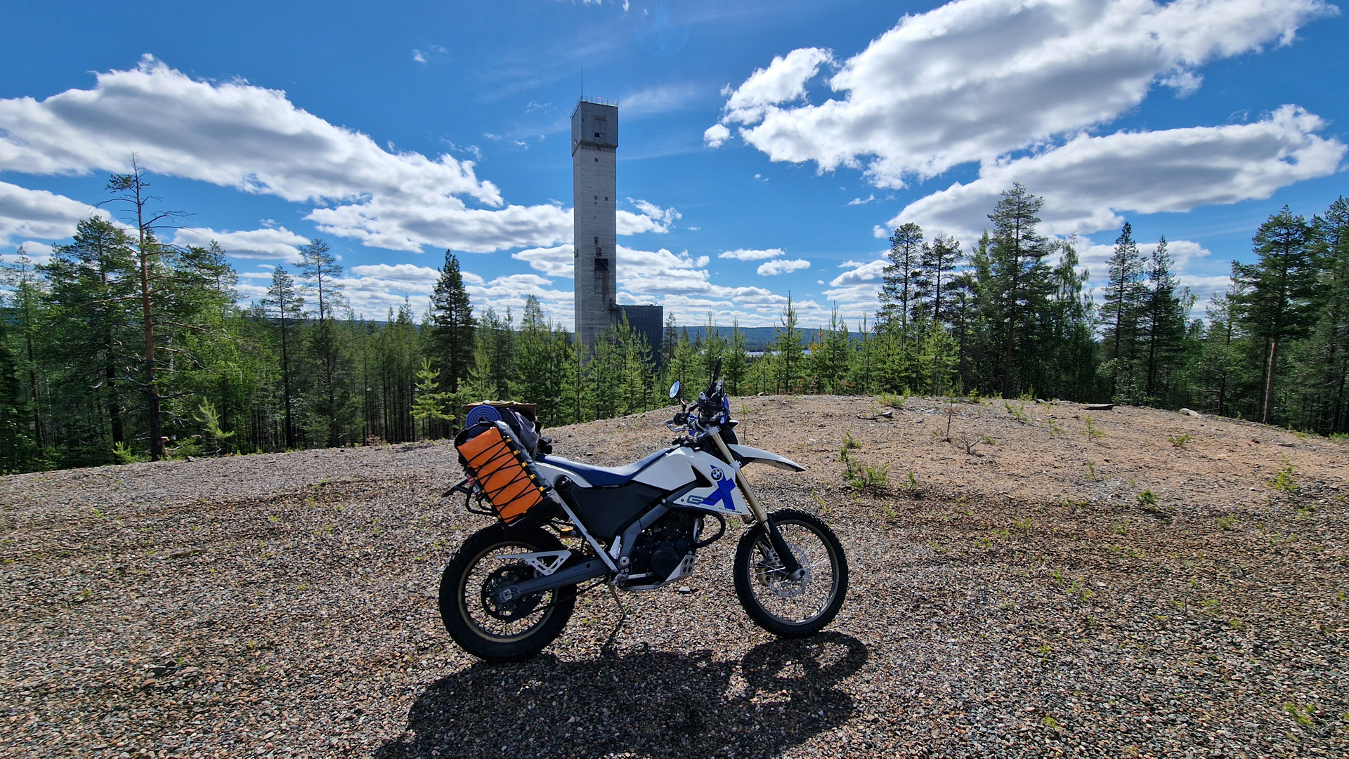
We wanted to explore the area and make a warm up for the next day. And it ended up being such an amazing riding day! First to Pakasaivo lake and then some smaller tracks/ roads to Äkäslompolo village where we filled the tanks and enjoyed some great lunch in Ravintola Rouhe. Then we continued to the Rautuvaara mining area and we spent maybe 2 hours exploring the tracks there. That was such an amazing area! After the mining area we still checked some smaller tracks in the forest of Kolari and Muonio. For me it was first 70km to the cabin and then 200km with my friends. The route was like this:
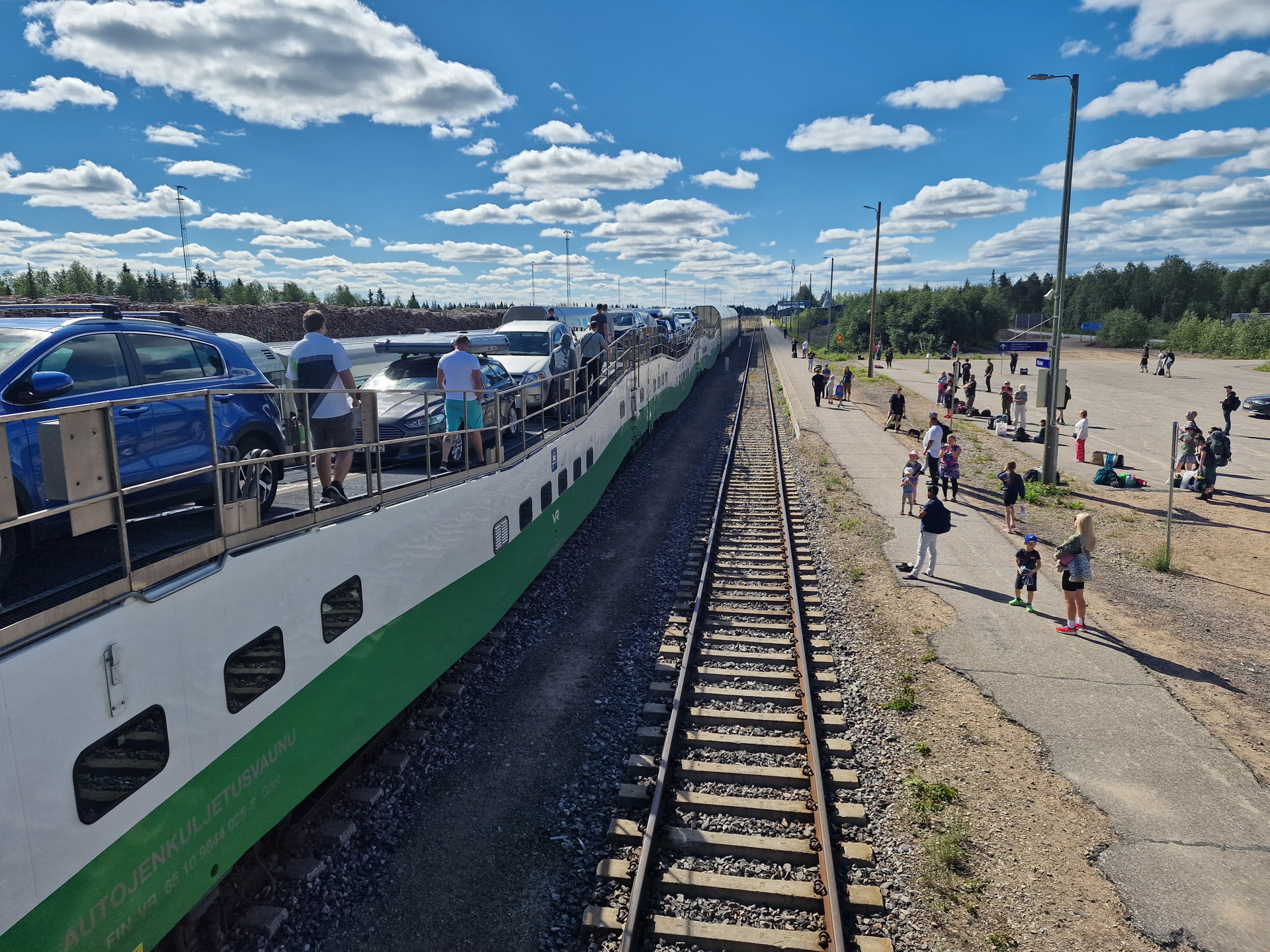
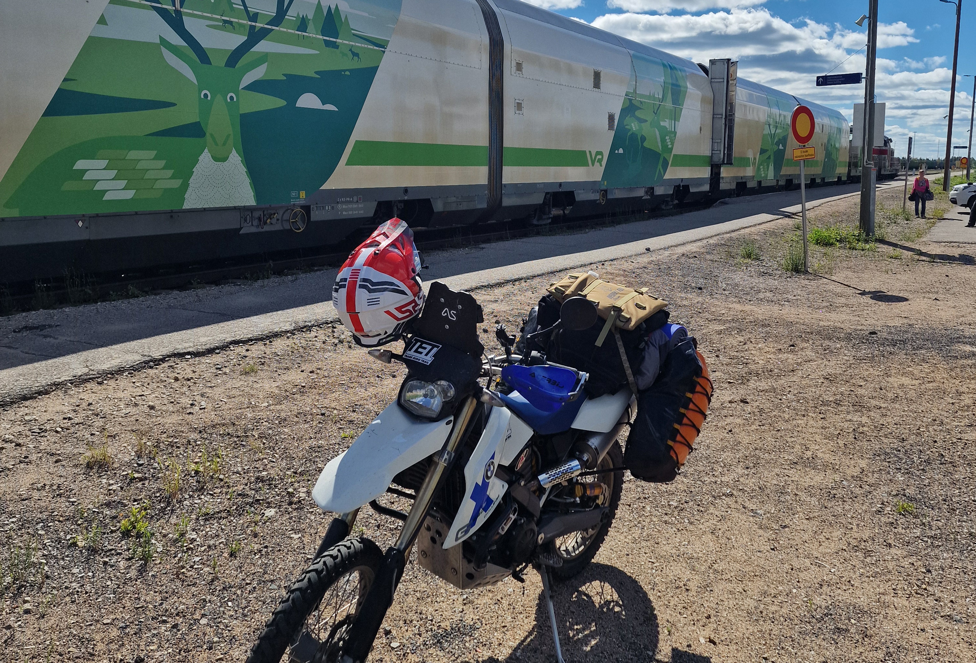
The train from Helsinki arrived to Kolari station around 11. About 1 hour later I got my bike out from the car-carrier train.
First thing I did I wanted to find a better place to change to my actual riding gear. That I did in the parking area of one restaurant that wasn’t open yet. There was also gas station just beside and I filled my tank. Then I started riding! Pretty soon I arrived to the gate of an old mine. It was Rautuvaara that stopped working as a mine in 1988!
Big disappointment was the possibilities for eating in Muonio on Sunday afternoon! SEO Muonio right beside the main road has Rolls hamburger restaurant. But I didn’t want anything from there. Other than that there was no option! Harriniva resort has restaurant but the kitchen opens only at 5pm! SO I decided to ride straight to my accommodation and they promised to make some food for me! (What a great service!) Here is the route I did on the first day:
From Kolari to Muonio I was riding TransEuroTrail Finland Section 3. Here’s the video I made of that day:
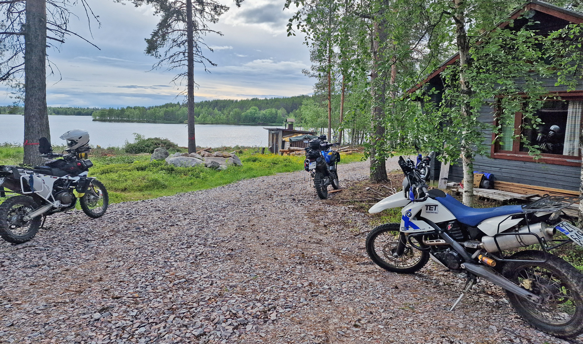
Big recommendation for the place I stayed for the night!! It was Old School of Kihlanki village and I found the place from booking.com. Check from the end of the video… I was amazed especially how helpful and friendly the hosts were!
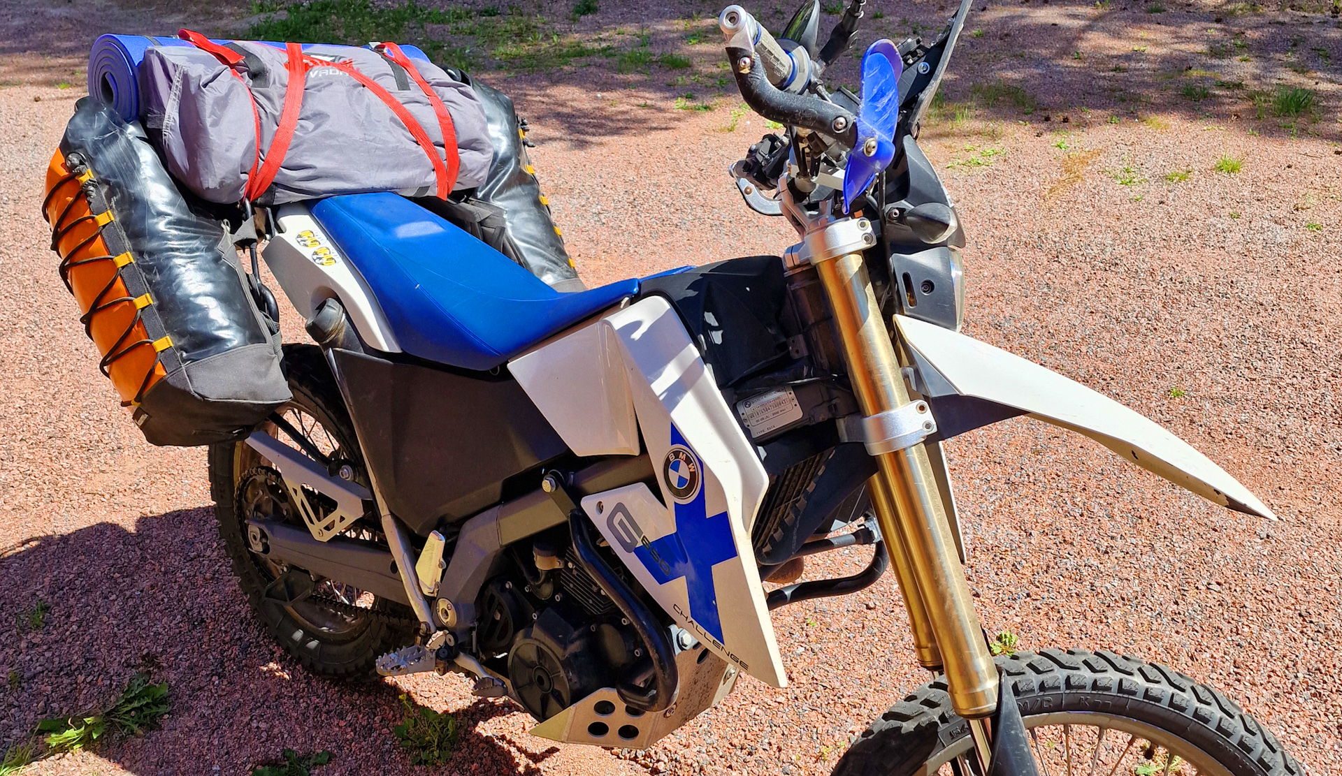
On the last days befere my “big adventure” I changed the tires to my bike. Metzeler MC 360 Mid Hard was already pretty much gone from the front. Rear had still about 5-6mm of knobby. New tires were Heidenau K60 and they were quite perfect for me in this situation! Then started packing:
I was very happy about the size of all the luggage! Even I decided to take my tent and camping mattress with me (and I didn’t need them!) I was ready for my biggest adventure so far.
First leg was to ride to Helsinki and put my bike to the train (Helsinki – Kolari). And after 15 hours in the train I was far north in Lapland!
Empty shopping mall Zsar This shopping mall was opened in November 2018. Already in december 2020 it was in debt restructuring and in october 2022 the company went bankrupt. Now this amazing building is standing empty just beside the TET Track in the beginning of the section 4. The POI is called “Zsar shopping Mall (empty)”
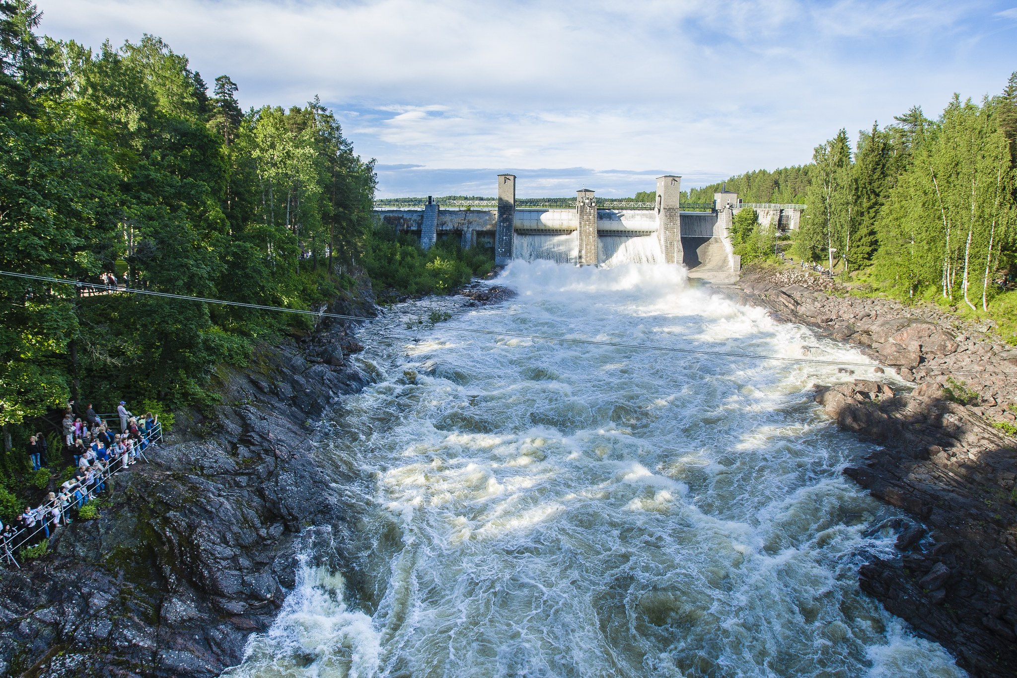
Kruununpuisto landscape Finland’s first nature reserve Kruununpuisto-park in Imatra is established in 1842. In the same island are the best views of the dam and the old banks of the river/ rapids. The POI in the TET gpx is called “Oldest nature preserve in Finland” or “Imatra Dam”. This park is just beside the TET track.
Parikkala Sculpture park Freak statues! Some even think they are scary… Entrance fee is 7€. The POI in TET gpx is called “Parikkala sculpture park” and it’s just beside the TET track.
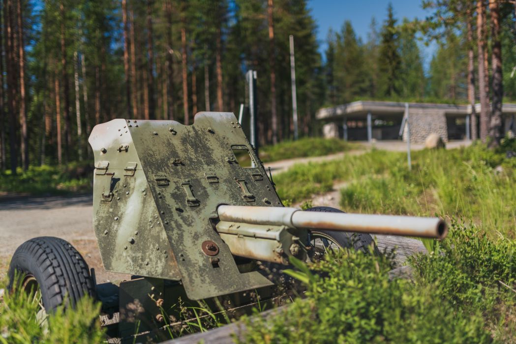
Öykköistenvaara Battle Zone This is a perfect place to learn a little about the battles of the Second World War on the Finnish front line. You are free to walk around the area that was built by local volunteers. The POI in TET gpx is called “Öykköistenvaara Battle Zone”.
Most Eastern point of continental EU This would be the most eastern point of the Continental EU. You are now 60km east from St. Petersburg. If you want to go further east in EU you need to visit Cyprus. The POI in TET gpx is called “Most Eastern point of EU”. The TET track takes you as far as you can ride. Then there is still a short hiking trail to the shore of the lake from where you can see the actual point.
Neitikoski/ Ruunaa rapids Ruunaa is a huge area for hiking, fishing or rafting. In the TET gpx file there is one suspension bridge POI but the main place to visit would be the Ruunaa outdoor center and the Neitikoski rapids close to this place. You need to ride 4,5km east from the track and the POI is called “Ruunaa rapids”. You can leave your bike to the parking area beside the outdoor center or somewhere close. The trail to the Neitikoski is very near and easy to find.
Tyrvää medieval church About 100km’s after the section 2 start you will ride through Sastamala city. This church is 3km after the city. POI in TET gpx-file has the same name. You need to ride about 1km away from the track to enter the place. The church is located on an island and it’s very beautiful place! Maybe churches is not your thing? But I recommend this place anyway -especially in the evening/ sunset it can be extremely beautiful.
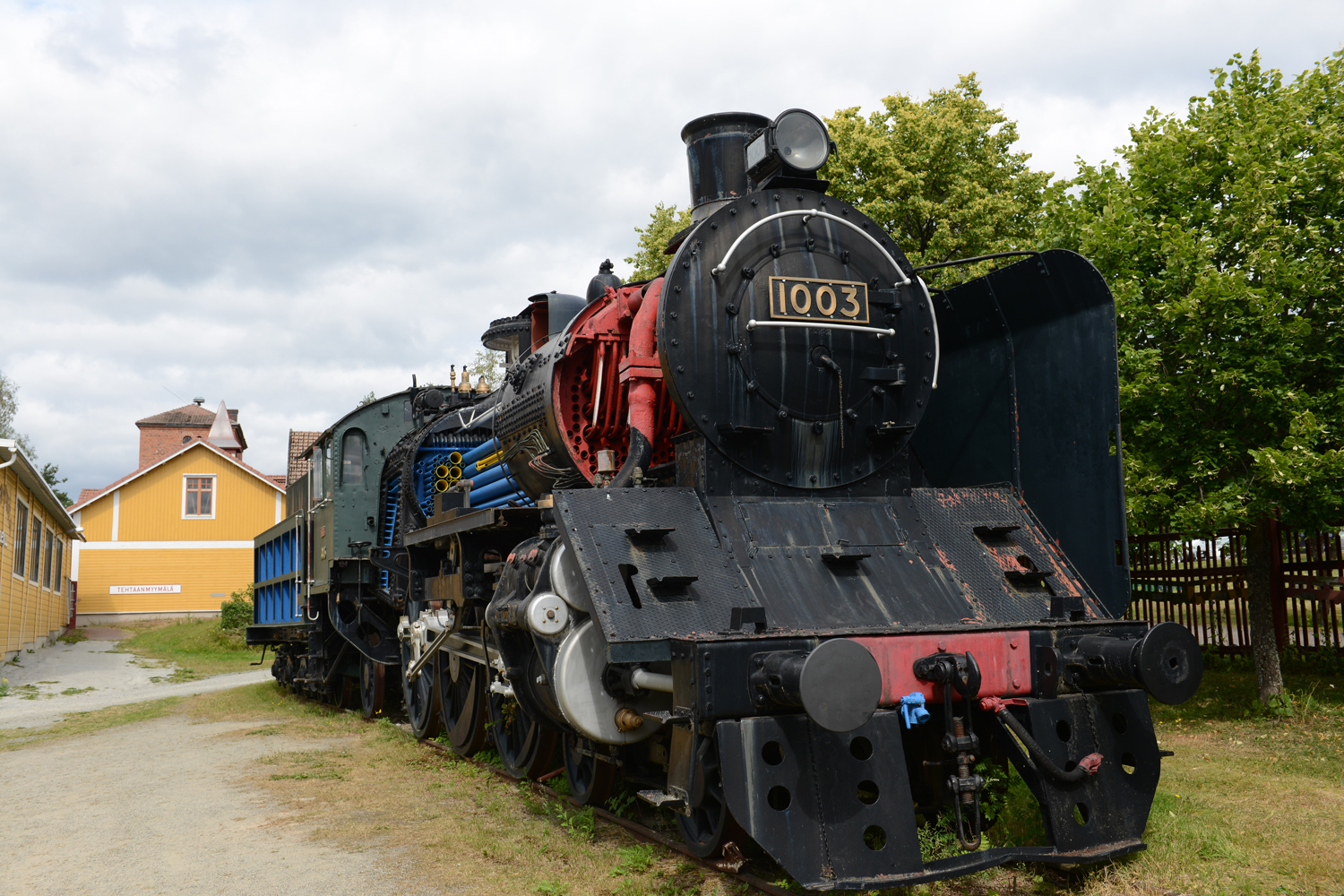
Haapamäki Steam Locomotive Park About 335km from the start of Section 2 You will enter Haapamäki city where this place is located. The POI is called “Steamtrain park”. It claims to be the biggest Steam locomotive park in the world!
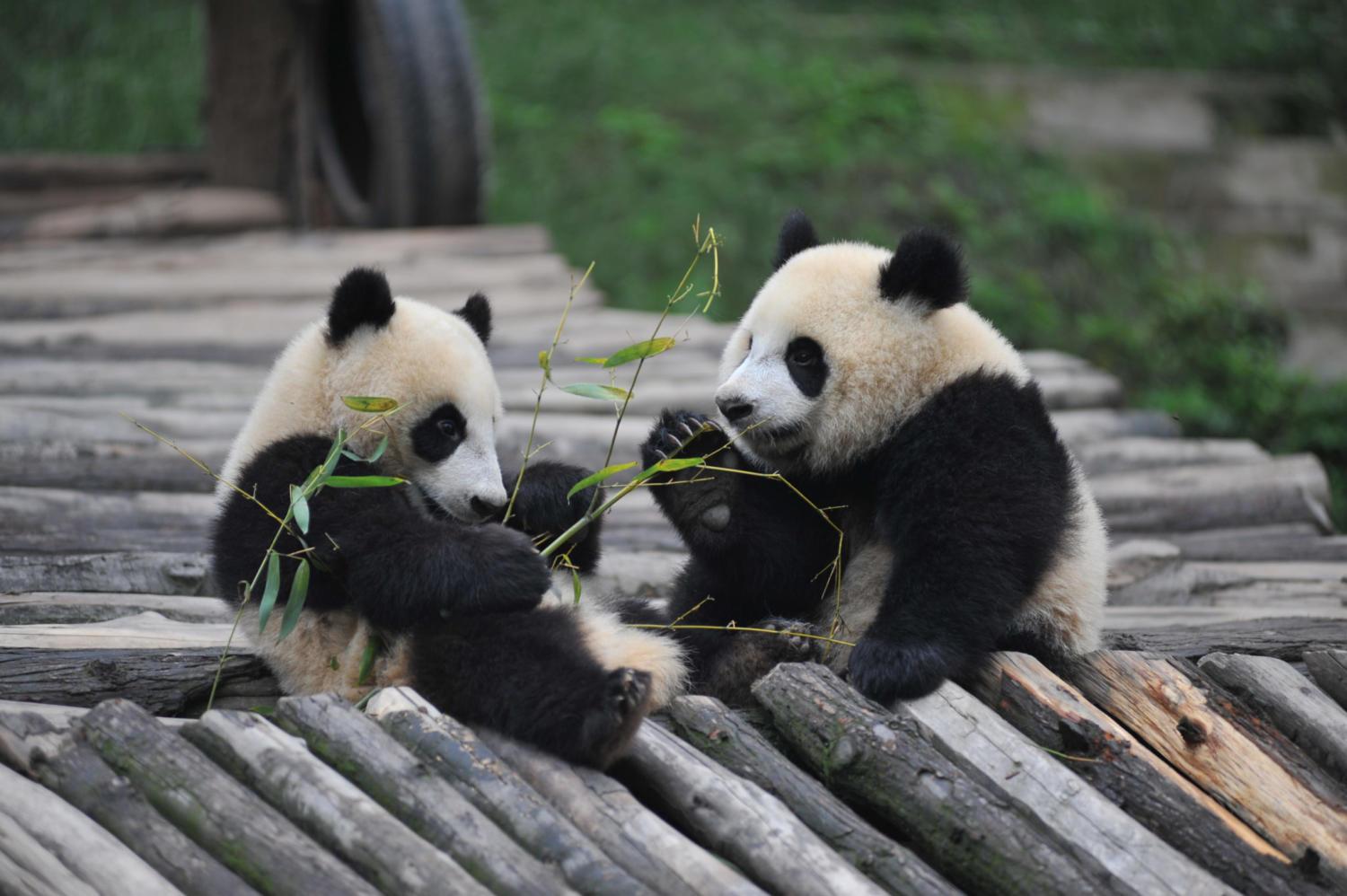
Ähtäri Zoo They don’t have Pandas anymore!! POI has the same name. If you want to visit I think it will be at least 3 hours. Ticket to the Zoo is for 1 day (21-23€).
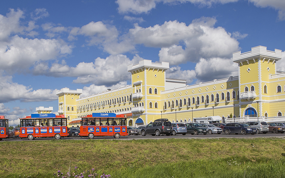
Tuuri Shopping Mall 28km west from Ähtäri Zoo there is the biggest shopping mall of Finland. The story begins in 1976 when the small grocery store started in Tuuri village.
Hepoköngös Waterfall This waterfall is in Puolanka about 15km west from the TET track. It’s one of the most famous waterfalls in Finland!