
We’re in the paradise island. What should we do? Go to the beach? Go to have some summer activities? Jet Ski maybe? No… Lets go ride a motorcycle!
I made a route almost 300km’s long and we started riding that. First south from Galeria: These parts are so nice ride with magnificant views to the sea almost all the time. And finally the Col de Palmarella with sensational views to the both sides of the island! Southside from Golfe de Porto we found the the rock-formations of Les Calanques de Piana. But as excepted this area is quite full of people!
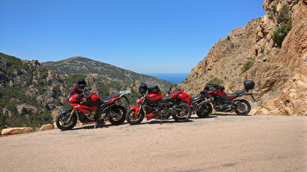
We only stopped for awhile to take some pictures and we continued more south towards Col de Vergio. This is the highest mountain pass in Corsica island (With altitude of 1477m).
It was very funny to ride these areas of Corsica! The road was sweeping nicely through Pinetree-forest and the forest was full of pigs! For some reason you don’t see the pigs in my video because they stay at the shadows but here is one pic…

The eastside of Vergio is actually a very beautiful (and dangerous) Canyonroad with very narrow places and tight/ steep corners!
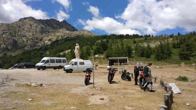
In Ponte Leccia we tried to find a place to eat…. But not a very good success! We found only Panini and waitress dropped one of them to my lapp and then she pushed her fingers to Maria’s (or Salla’s) Cola! Not a very good day for her I guess? Here’s the route for day 7:
Mountain Road
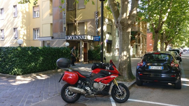
Unfortunately we didn’t have time to get to know the city of Ravenna -I bet it would’ve been beautiful!
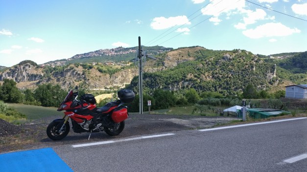
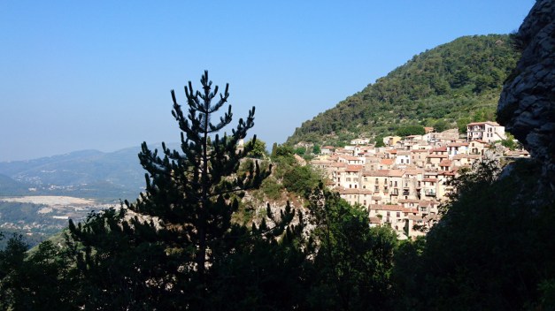
We took the big road to south and San Marino. The streets of San Marino are full with very expensive cars! We stopped on the “Other side of the mountain” when we saw some possible places to park the bikes. But there was no cafe or even a grocery store!
The roads on the westside of San Marino… OMG! They are nice! There’s a corner after corner, twist after twist and some very nice views all the time!
Ducati Monster went straight to Ducati service in Ravenna. They couldn’t fix the starter but they did fix the rear brake! (Not the brakedisc though…)
From motocaching we marked “as found” these:
San Marino from southwest, Passo dei Mandrioli and SR70 Consuma
But the whole route from San Marino to Livorno is excellent riding!! There’s not much traffic, the scenery and views are great and you will certainly enjoy riding! I really recommend these roads!

The pink decorations are there because it was the 100th Giro d’Italia this may.
Video compilation of the day 5:
This was the route for the day 5:
This day we were riding in the Jura mountains in Switzerland and few km’s in France and few in Germany. The 266 km’s route was like this.
First it looked like the weather would be as hot as it had been many days before, but actually pretty soon it was cloudy and +25 celsius felt quite nice!
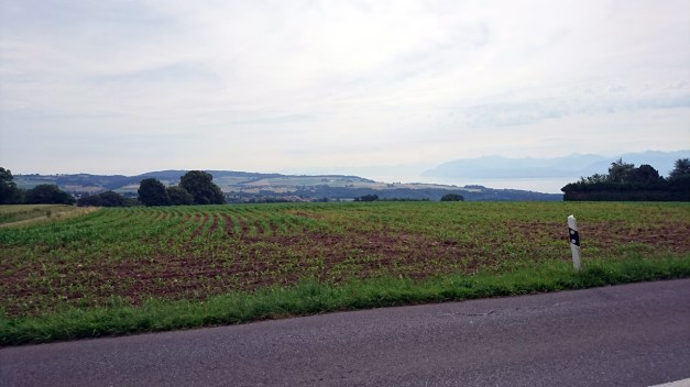
The views were still very impressive in Jura mountains! It would be nice to spend more time riding here too.
After couple hours of riding there was a raincloud following us.
And soon it was raining.
The most beautiful part of this days route it was raining so I didn’t take too many pictures. But that ride very near to Ch-Fr border (Cote-du-Doubs in the north side of La Chaux-de-Fonds) is a very nice road!
After 3 hours of rain it finally stopped and we switched to France to avoid the traffic in Basel. And after a short visit in France we switched to Germany and that was the last time in France in this trip for us!
We had an apartment in Lörrach to stay the night. So we made the dinner and breakfast ourselves! That was nice for a change…
Next morning Timo would go on his own way (straight to north and taking the ferry from Travemünde to Helsinki) and me and Maria would go on riding slowly home.
Days 12 & 13 we did some riding between Menton – Monaco – Nizza. The Ducati got new chains and sprockets in Nizza and when we got the bike from Ducati Alpes Maritimes service it was only 10km’s when the rear brake caliper was loose!! They didn’t tighten the bolts at all! But ok, we could ride the Monster back to the Hotel and next day we started riding back north!
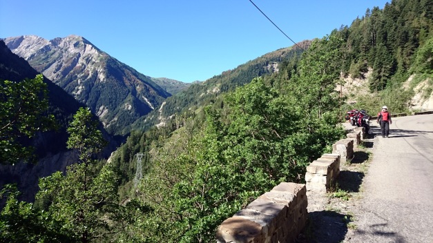
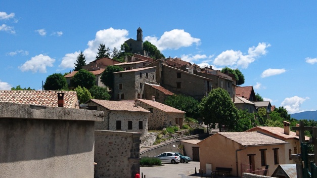
Day 14 started with very narrow mountain road from Menton towards the small village Peille. It is a beautiful old mountain village in the steep mountain wall!
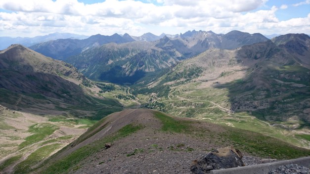
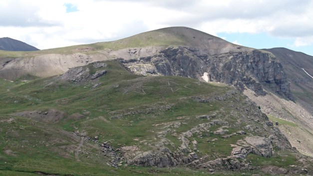
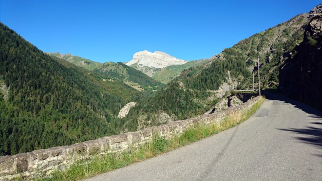
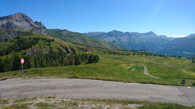
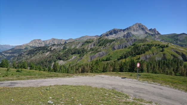
Then after few more nice mountain roads it was all about Col de la Bonette and Cime de la Bonette! Cime de la Bonette is the highest possible paved road (without dead end) in Europe! At first the road north from Saint-Sauveur-sur-Tinée is very nice and fast ride! It has mellow bends and fast corners until Saint-Étienne-de-Tinée. This video starts about 2 km’s before this village!
Few km’s more and the road is more narrow and the corners get tighter. In 11:10 is the first hairpin… And then starts the real climbing!! I deside to stop for awhile in the place called Camp des fourches

Here is few old and abandoned houses (I think they’re related to Napoleon?) But then the climbing continues…
This video goes all the way to the top of Europe (2802 meters!)
And then some photos!
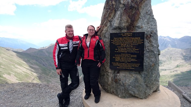
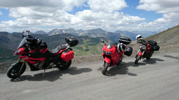
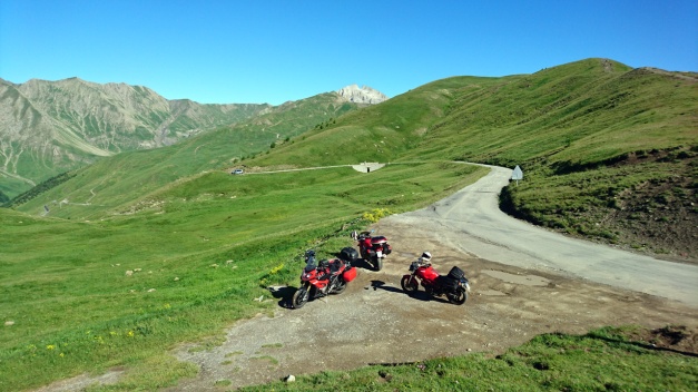
Timo & Maria, my fellowriders in this tour! (Timo with Honda and Maria with Ducati)
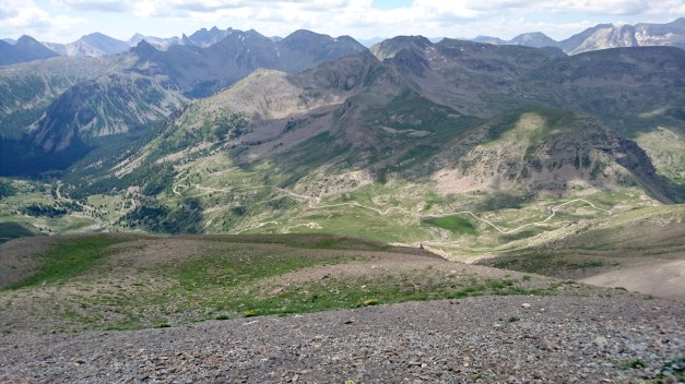
After spending some nice time in heights starts the ride down from Bonette. It is still an endless amount of hairpins and spectacular views. But there’s an interesting old abandoned fortress-looking building quite near… So I stop there.
We went in to see what was it all about?
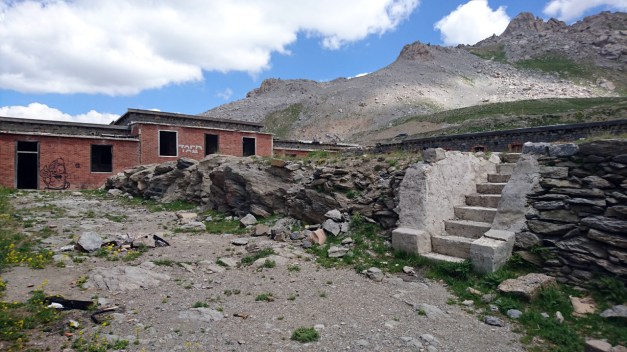
There was some “drawings” in the mountain-wall too, made of stones!
“My God, it’s full of stars!”
Then we also climbed Col de Vars but at the moment I feel like I don’t remember it at all! It must be because Bonette was so beautiful, magnificent and spectacular so I remember it much better!
But here’s a video from Col de vars:
Right after Vars, we entered the village Eygliers where we had our next accomodation. The only problem was how to find it?? I try to call them but they didn’t speak any English. It was very hot day, Maria and Timo were a littele bit frustrated and they rode to the village to ask if somebody knew where it was. And I found a lady who did speak good English and I asked her… And she told me that the place right in front of me!!
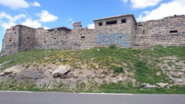
After the shower and changing the clothes Me and Maria desided to take a look of the fortress nearby. We didn’t know anything about it when we went there…
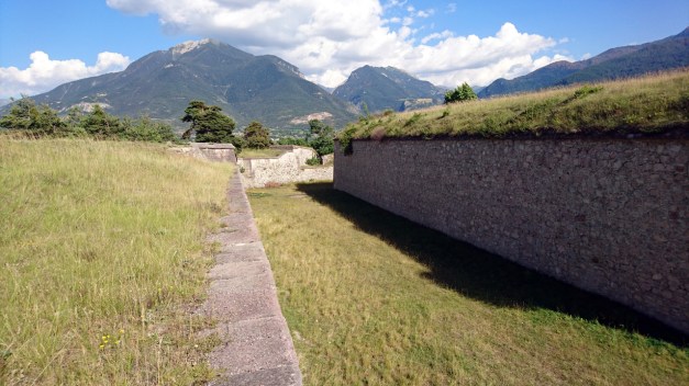
There was walls everywhere! It was almost like a labyrinth. It was also a very nice view to the other side of the valley!
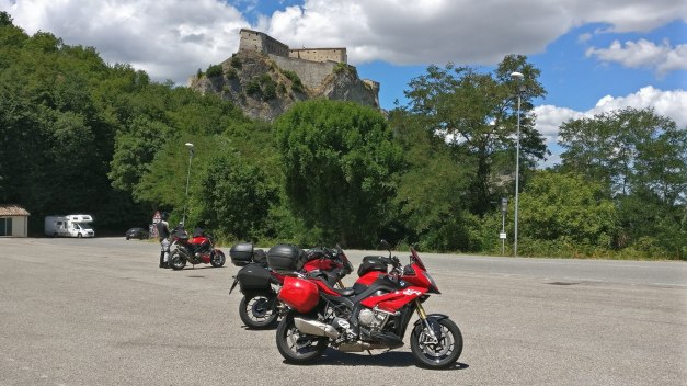
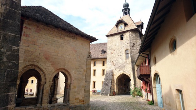
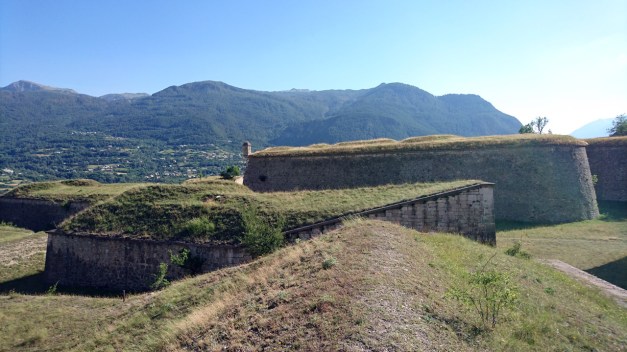
The fortress is Mont-Dauphin, a small village with walls protecting it. It was built in late 17th century by the request of King Ludvig XIV. The fortress is 58 hectares and there’s about 150 people living in the village.
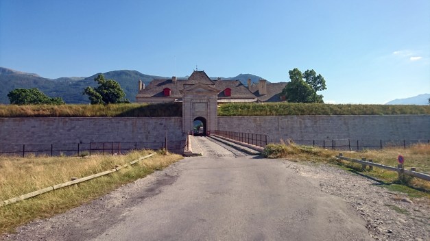
This is the gate to the village from the outside.

And from the inside.
Finally after spending some time in Mont-Dauphin it was 7pm! And usually you can’t get any food before 7pm!!! I think that’s totally crazy! We are hungry after riding all day!!
This was the route for the day 14!
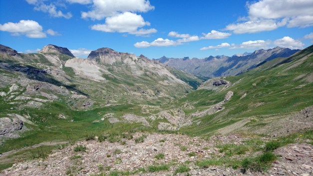
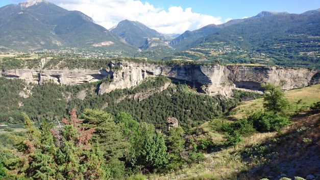
From Barcelonnette to south we chose D 908 instead of Col de la Cayolle (this would be actual part of the Route des Grandes Alpes). I think it is more interesting to ride Col d’Allos & Col des Champs (like we did)!
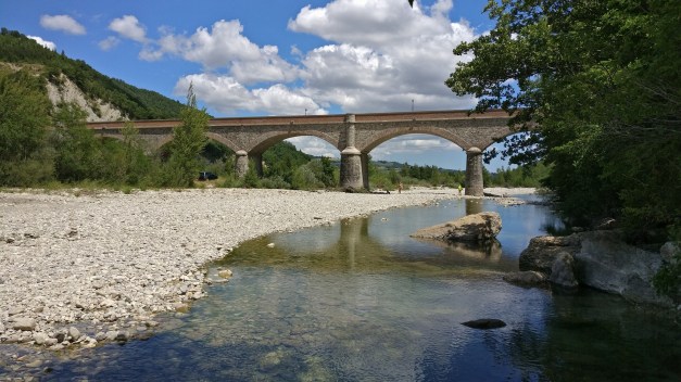
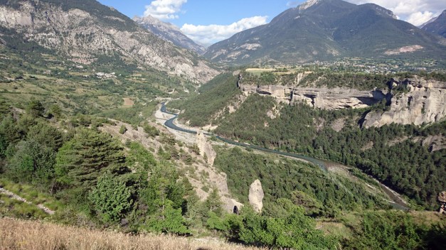
But before it starts to climb to the mountain Pass you need ride a long time endlessly twisting road following the valley. The river below you goes further and further while you’re climbing higher and higher.
Finally I had to stop and check if I can see the river anymore??!!
Then starts the actual climb to the Col d’Allos:
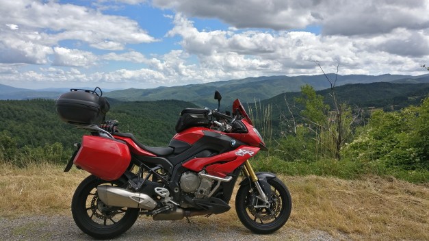
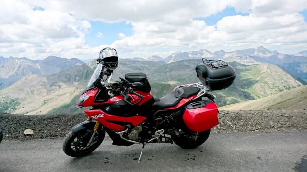
In the top of this beautiful mountain pass we saw absolutely stunning views and I took the best picture of the whole trip here!
Wanna see this picture in bigger size? Click here!
When riding down from Col d’Allos I had a very scary moment (03:55 in the video)!! A car came from the opposite direction just behind the blind corner… and the road is very narrow and there are no rails! I think my heart stopped for a second!!! But luckily I didn’t have too much speed.
Then we rode Col des Champs! This was extremely narrow road in the middle of the forest. It felt like a jogging-path or a mountainbike-path! It had bumps and dikes… But luckily no traffic! Also in the top of Col des Champs was very quiet (and beautiful!)
The road down from Col des Champs (to east) is wider and easier to ride.
Then we rode to Valberg tourist- ans skiresort and from there we rode to Col de la Couillole.
(video here)
From there we were all waiting the final climb for this day -Col de Turini! But before we found the right mountain pass we took the wrong turn!! (Or actually we didn’t make the turn!) After missing the turn the GPS told us to climb to Ilonse… and we did!
It was 13 kilometers ride to the wrong direction!! But luckily it was very nice road and we didn’t feel bad to ride it back…
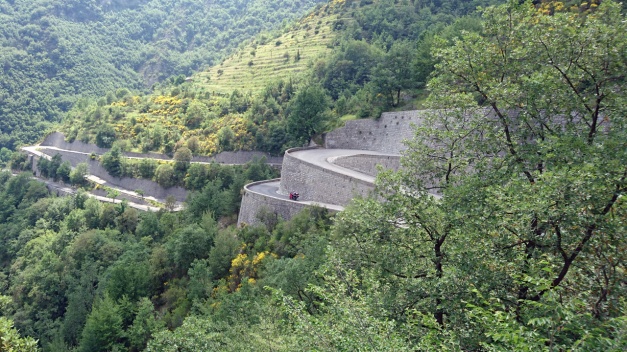
…So we could finally start the way to Col de Turini. It is simply amazing! There are so many tight corners and hairpins that I think I was feeling a little bit dizzy! And also it felt like it’s climbing a lot! Like at least 2500 meters! But actually the summit of the Turini is “only” 1607 meters high!! But gosh! What an amazing ride!!
That red spot is Timo with his Honda VFR!
From the south-end of Turini we still had few nice corners to ride (from Sospel to Menton) -or actually our place to stay was Le Relais de Monti few kilometers noth from the city of Menton. We would spend the next 3 nights here! (Nice place, I recommend it!)
The route for the day 11 was like this!
