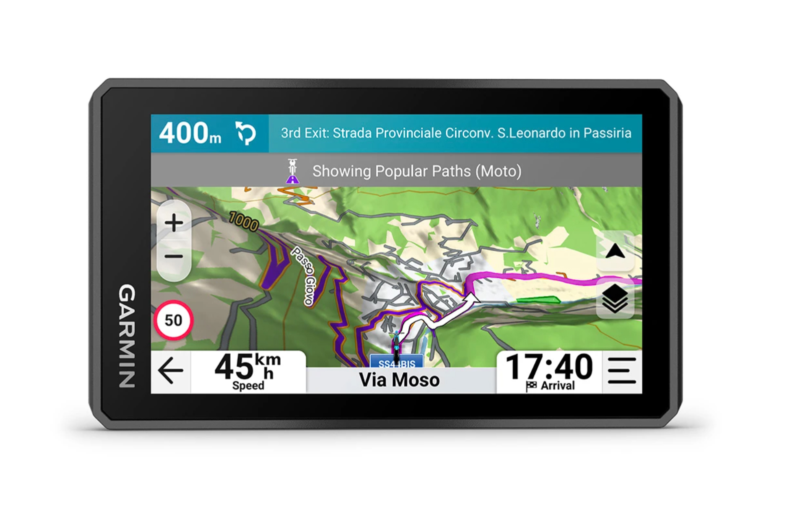
The newest version of Garmin motorcycle GPS-device is out. You can buy it here! There should be 2 different versions of this available: 4,7″ screen wights around 190g and 6″ screen weights around 340g. It seems like it is now more like everything else than only a device to find your best route. It will measure your leaning angle, G-forces and even take the time of your laps on the race tracks. For me it sounds like a device I will not order because XT2 is already quite tricky to use. I’m actually using more of my Montana 600 or 700 to follow the tracks or the TET route. But of course, it’s always interesting to see some kind of progress…
I didn’t have a proper GPS device to do the navigation when OffRoading with this bike. I was trying to manage with TomTom… But that just didn’t work! So the first proper GPS was Garmin GPSMap 64 Pros: Easy to use, works with AA batteries, No bugs Cons: Difficult to use (no touch screen), Very small screen and not very bright
Then the second device was Garmin Montana 600 Pros: Very easy to use (Touchscreen) Cons: Problems with charging, not very bright screen
Third was Samsung Active Tab 2 with Osmand App Pros: Super big screen, Osmand is very good App Cons: Problems with charging, didn’t like the Osmand maps
And then I got Garmin Zumo XT2 I made a comparison video between Montana 700 and Zumo XT2 Pros: Very bright screen, Very big screen, Very versatile and diverse to use Cons: Maybe too complex menu, Too big screen resolution (thin lines on the ToPo map are not easy to see!)
The Motorcycle In this case I will talk about the most common (or the best?) possible bikes with couple of examples. There is always many many other possibilities to choose. You should choose the bike that is best for you! A good one would be Yamaha Tenere 700 or Honda CRF300 Rally. The bike should be able to do gravelroads, forestroads and some offroad parts easily. It should be able to do 300km (or more?) of riding without filling the tank. It should carry the rider and all his stuff easily in the motorcycle bags. It should have at least 50/ 50 tyres (Mitas E07, Heidenau K60) but even more offroad oriented are a very good choice!
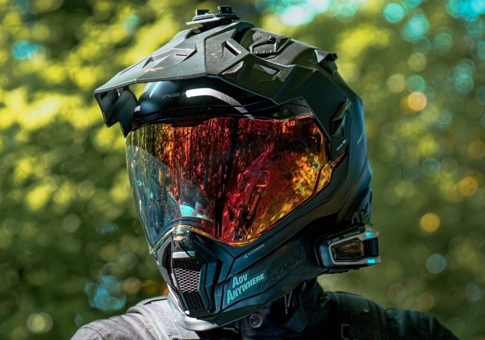
Motorcycle riding gear Helmet is a must! Enduro or adventure helmet has more airspace in front of the mouth so you will not feel like totally out of breath when you have to do some lifting of the bike.
Other than a helmet I really recommend to have adventure boots (or enduro boots), motorcycle pants with knee and hip protection -the more protection pads the better the pants! Same goes with the jacket! Quite many riders nowadays are rather using a whole protection west/ shirt that you keep closer to your body and the outer jacket/ shirt itself can be very light. I have LS2 MX436 helmet, Forma Terra Evo Low boots, Adventure Spec Supershirt, Rukka motorcycle pants (and few other pants) and Adventure Spec Linesman Jacket.
The GPS device A GPS device to ride TransEuroTrail has to have one certain function. You have to be able to see gpx-track on your map view and your own location. The ordinary car gps or Tomtom doesn’t do this. Here it is explained in TransEuroTrail web page what it could be or should be. You have these options: 1. Cheap android phone with OsmAnd or Locus app (or some other). This phone you will connect to your bike somehow so you can see the screen while you are riding. Problem might be that the brightness of the screen is not enough. This way you can keep your own phone in your pocket and take pictures with it whenever you need. 2. Your own mobile phone attached to the bike with some app to follow the TET track. Nowadays the phones are very expensive and very easily breakable. I’m not recommending this. 3. A tablet with some app to follow GPX track. For example Samsung Tab Active3. 4. Garmin gps device you can buy a cheap used gps for example here in Finland this morning there was one Garmin gpsmap device with 120€ in tori webpage. The screen is very small in all gpsmap devices so I would recommend Garmin Montana. I was using Garmin Montana 700 for one year. Now I’m using Garmin Zumo XT2.
The Latest TET Finland GPX file This file you can download ONLY from TransEuroTrail webpage! File has 21 sections at the moment. (Check my post about different sections here!) But the tracks and the file is updating all the time so you must check that you have the latest update.
Now you have everything that you actually need to start riding. But ofcourse then we will start to talk about how long you are going to ride the TET route? What kind of weather it will be? Will you be sleeping in a tent? In the Lean-To? Or in some accommodation? Lets talk about these little bit: Accommodation: I prefer booking.com but airbnb.com or hotels.com are also ok. Lean-To: from the webpage laavu.org you can download the gpx file where you will see pretty much all lean-to shelters and free cabins to stay for the night! (Choose from the menu “Lataa (gpx) – kaikki”) and you will have all these in your gps device. Wild Camping: You can put your tent up pretty much everywhere! Except to someone’s private yard or nearby, to nature preserve or National Park area. National parks usually have only few places where it is ok to do wild camping. Also planted fields or parks are out of question. If you do wild camping it means you will do no harm to the nature, you will leave no trace or marks in the place where you were camping and you will make fire only if you have the permit from the landowner (if there is an actual fireplace then you can do it). And you will not make fire at all if there is a warning about grass or forest fires. Here you can read more about “Everyman’s rights” in Finland: Visit Finland
I bought myself a new GPS device. The main reason was that my Montana couldn’t get the power anymore from the original motorcycle holder. I already removed the wires and I was thinking that I will charge it only with USB wire but that ofcourse brings more problems. And when I realised that I had the opportunity to buy Garmin Zumo XT2 I decided to take it. I hear the XT2 has same kind of problems with the power connection so now I’m waiting to have the same peoblems soon. Hopefully not in this summer yet!
Every now and then there is a question which navigation system is the best for Adventure riding? I don’t have the correct answer but here are some features to check. Especially if you want to ride TransEuroTrail (Finland). I’ve been using Garmin GPSmap 62, Garmin Montana 600, Last summer Samsung Active Tab 2 & Osmand App and now I have Garmin Montana 700. I did a testride with both of these navigation systems attached to my motorcycle. I also had my camera (DJI Osmo Action) attached to my helmet -this I didn’t have in a very long time. And Rode Wireless Go II microphone was connected to my camera and the microphone itself was inside my helmet. Here is the video:
I’m not saying which one is better. They both have some cons and pros. Samsung Tab can be a little bit tricky to keep the batter fully loaded. It is very delicate part of the tablet this USB gate where you should connect the charging wire. I was using the magnetic type of wire where there is an extra connection just after the plug that you should push to the USB gate. The power that comes from my motorcycles alternator is not quite enough to keep the battery 100% loaded all day. But in novemeber when we were riding 9 hours it took only about 30% of battery power… So I could easily ride 2-3 days without recharging the tablet. It has also a small problem about the maps. You can get along with them but they are not as accurate than the maps in Garmin Montana. Every now and then I was little bit confused with Osmand maps. Why this track or that road is not on the map? Garmin Montana 700 biggest drawback (so far) is that you can’t change the thickness of the saved track’s line on the map! This makes it little bit tricky to see the line on the map that you should try to follow. The strangest thing is that it was possible in Garmin Montana 600!! (And also in Osmand App!) There are a lot of other devices and other apps to use. Especially this whole Apple -thing! I know nothing about them. But for android this Osmand is very good choice because it’s free or it’s not expensive to buy (full licence) where you can have unlimited amount of downloads (maps). I hope this helps you to choose a good system that serves you the best!