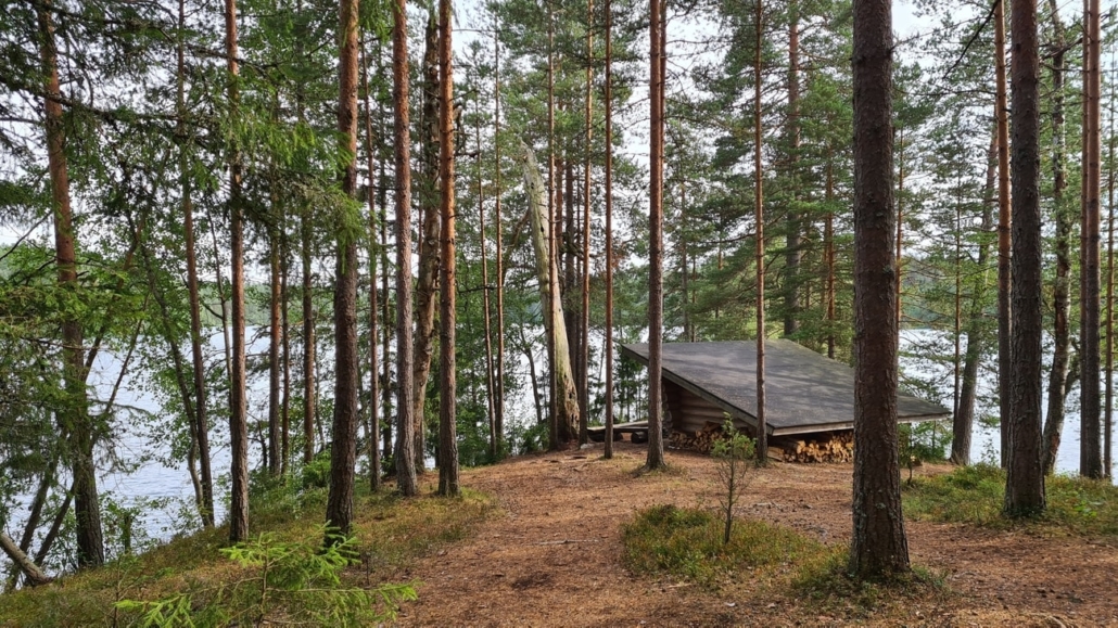
Iso Valkee
You started from Helsinki 159km ago and you have been enjoying “Kiikala” area already 30km’s and now you have POI in your TET gpx called “Iso Valkee very nice place”. This is a small beach, camping area and Lean-To shelter by a very beautiful lake! The lake has very clear water and sand bottom so it’s a nice place for a swim. Or grilling some sousages and have a break.
It’s ok to put your tent here and do wild camping. Remember: Don’t make fire if there is forest fire warning!
Aulanko in Hämeenlinna
You need to leave TET route just when you enter the main road 57 in Hattula/ Hämeenlinna. You need to ride 8km to south-east to reach the Aulanko area and there turn to left to Aulanko lookout tower.
(Route here). Even if the tower itself is not open the place has amazing views to the lake and the tower itself looks quite unique. It’s 117 years old tower and the place is one of the national landscapes of Finland. The POI in TET gpx is called “Aulanko National view”.

Niemisjärvi lake in Evo area
You have been riding in Evo area already few km’s and the TET route makes a turn to the right to go around this lake. I recommend to ride straight to the place and have a short break there. With lean-to shelters, grilling places and a beautiful small beach it’s quite special place. You’re not allowed to ride over the bridge but you can park your bike before the bridge.
POI is called “Niemisjärvi camping area”.
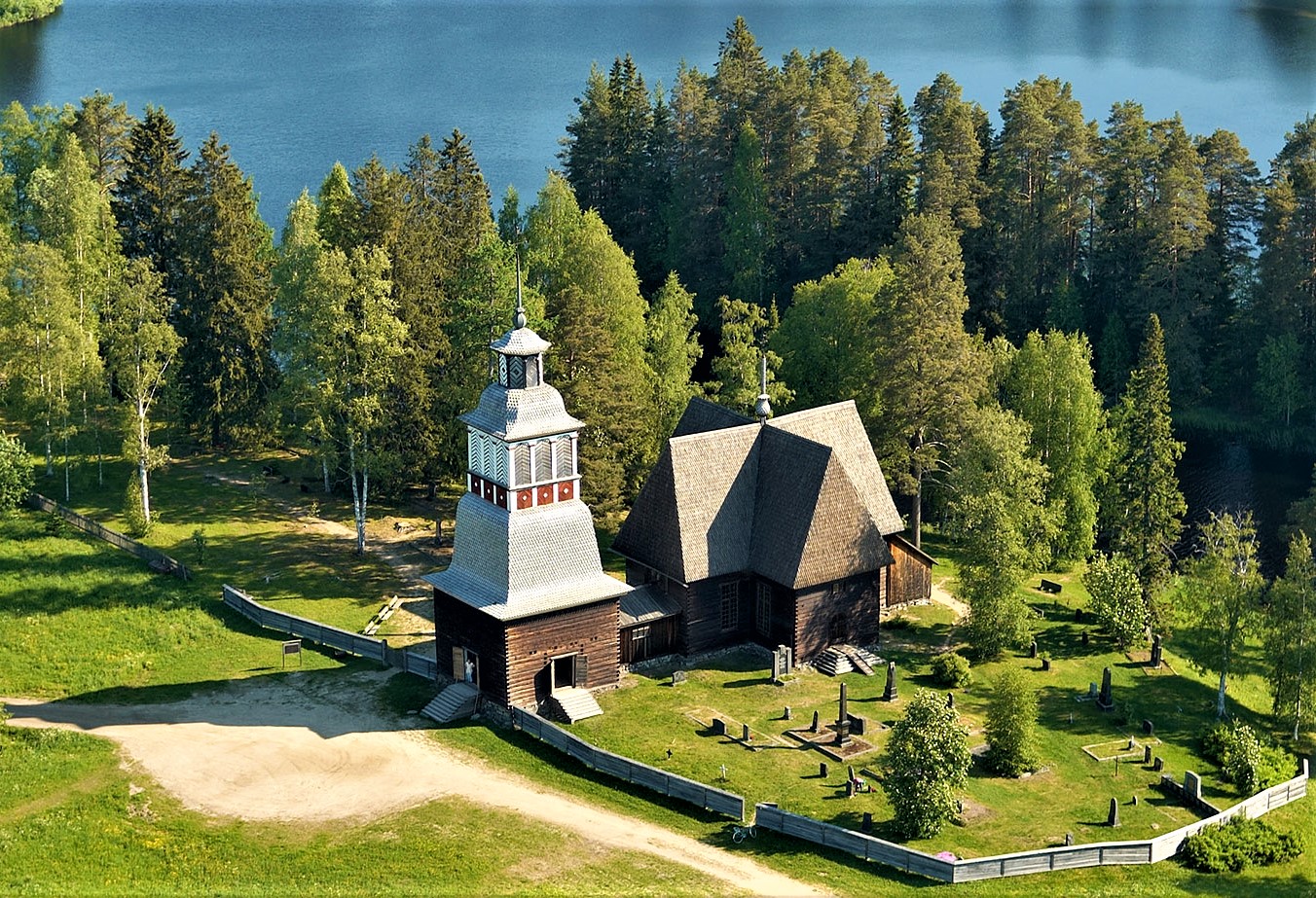
Old church of Petäjävesi
You can see this wooden church from The TET route but we really recommend you to go and check this 250 years old wooden church. You can see the POI in TET gpx, it’s called “Old Church of Petäjävesi”.
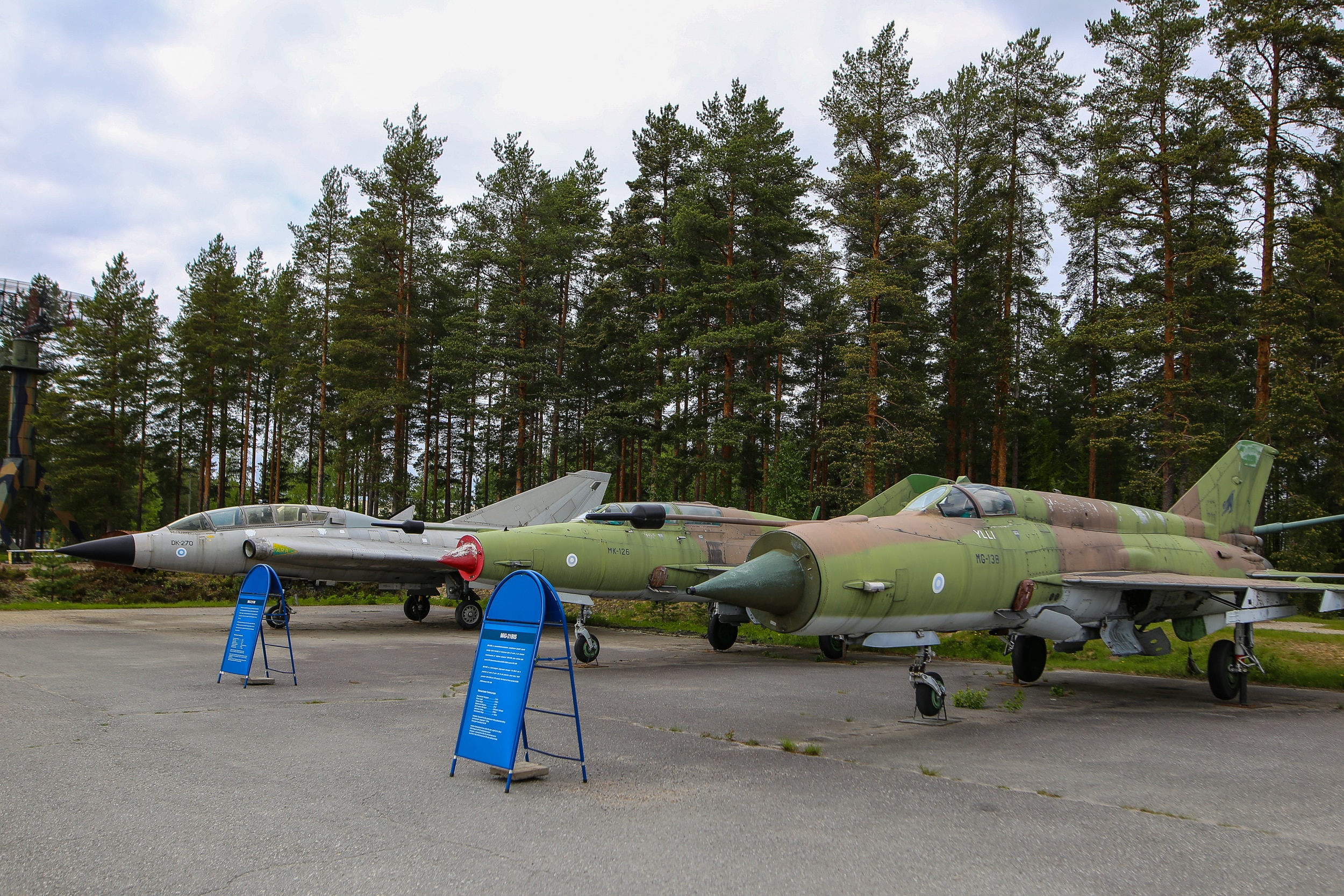
Finnish Air Force Museum
You can see the planes and the museum from the route but if you are interested about this kind of stuff it is ofcourse recommended to go in!
Google maps location
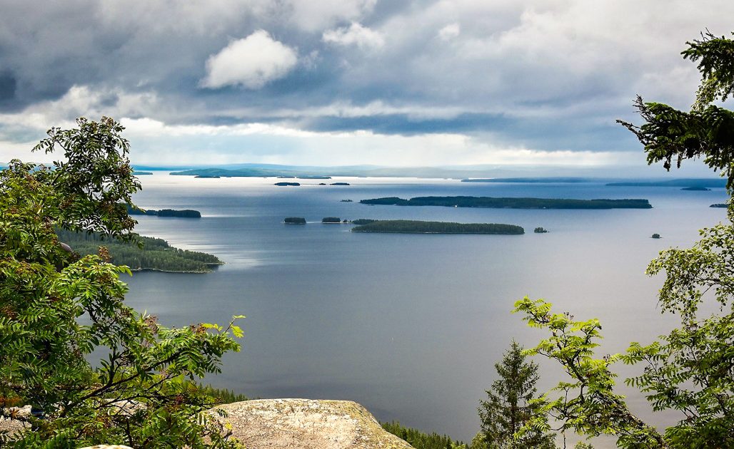
Koli National landscape
If you want to visit Koli National park and the “famous view from the top of Koli” You need to ride about 20km away from the route near Juuka. And in Koli you need to leave your bike to the parking area and take the railcar to the top. From there it is about 1km hike to the lookout spot.
POI is called “Koli hill top”.
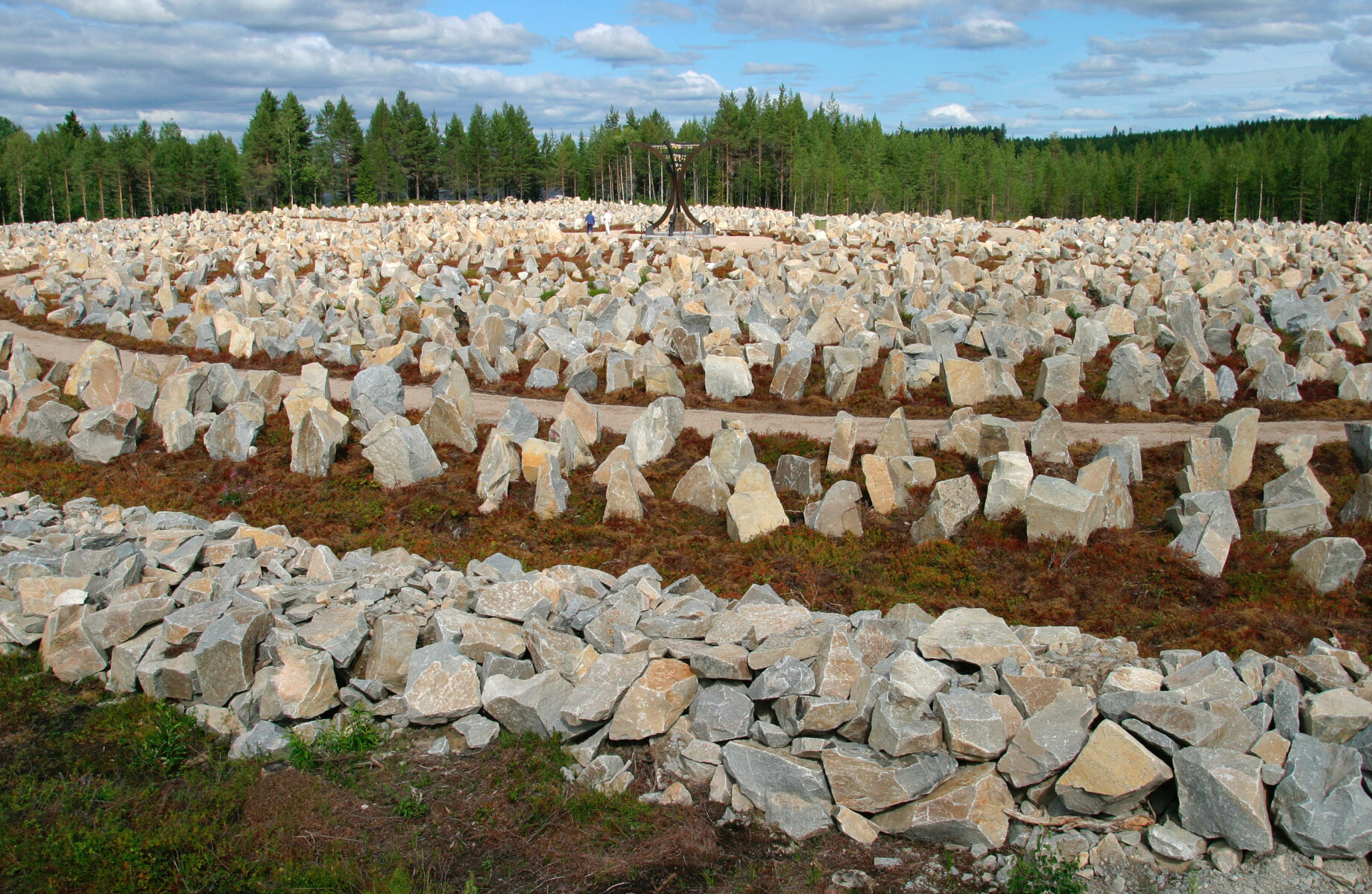
Raate road
The route goes across Raate road in Suomussalmi. You will probably see some tanks or something about the war while riding but it’s very much recommended to ride to the beginning of Raate Road. That is about 15km’s from the actual TET route to the museum area. Maybe visit the Raatteen portti museum or at least read about the Battle of Raate Road and check the Winter War Monument.
POI’s are called “Raatteen portti” and “Winter War Monument”.
Kiutaköngäs rapids
The POI in TET gpx is called “Kiutaköngäs Rapids/ Waterfall”. If you ride 3 km north from the track you will find Oulanka National park (One of the gates to the park) and if you leave your bike to the parking area you will have about 1km hike to the famous rapids in the National park.

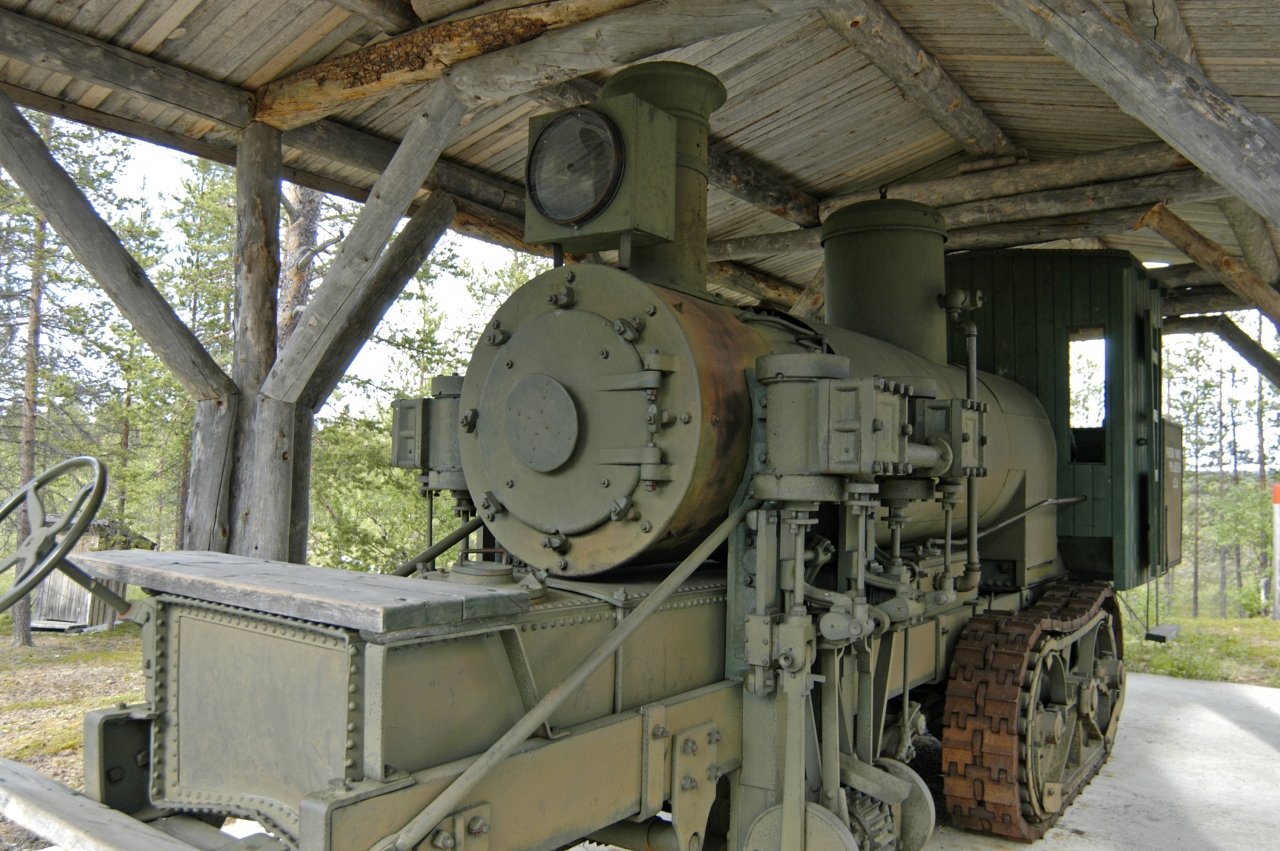
Samperi’s locomotive
About 4km east from the track you can find POI called “Tulppion majat” and just on the north side of that area there is a strange machine standing in the shelter. It’s a steam locomotive to be used in transporting logs from the forest closer to the road.